Cdt - New Mexico Section
- 0.4 mi
- round trip
- 156 ft
- climb
- 11,037 ft
- high point
- Out and back
- route
Is Cdt - New Mexico Section open right now?
Alert in the area
The Forest Service lists 2 alerts for Carson National Forest.
Current Prescribed Fire Activity and Plans
Agency alert covering Carson National Forest · USFS · Carson National Forest
Current Fire Restrictions and Related Prohibitions
Agency alert covering Carson National Forest · USFS · Carson National Forest
As of · Source: USFS · Carson National Forest. Agencies don't list every closure — check before you go.
The CDT - New Mexico Section is a short, easy hike in the Tres Piedras Ranger District of Carson National Forest in northern New Mexico, managed by the Forest Service. The route is an out-and-back of about 0.9 miles, with a one-way climb of about 156 feet from a low point of 10,866 feet to a high of 11,037 feet. The Continental Divide Trail passes within about 2.3 miles, and Dixie Creek Access is about 2.1 miles away. For an overnight stay, Trujillo Meadows Campground is about 5.7 miles off, and the Rio Chama offers canoeing about 6.6 miles away.
Local outfitters
- Pagosa Riverside Campground37 mi away
- Pagosa Pines RV Park39 mi away
Not on Roamze yet. Their page has how to reach them.
- Dixie Creek AccessHiking2.1 mi
- Continental Divide TrailHiking2.3 mi
- CdtHiking3.8 mi
- Trujillo Meadows CampgroundCamping5.7 mi
- Trujillo Meadows Boating SiteLake fishing6.1 mi
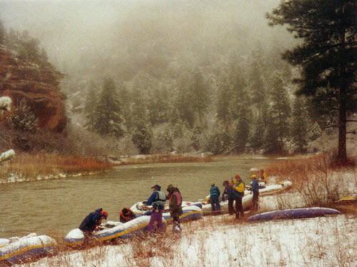 Rio ChamaCanoeingPhoto: Public domain (via Wikimedia Commons)6.6 mi
- Dispersed CampingCamping8.1 mi
- LagunitasCamping8.5 mi
Source: Roamze catalog (indexable pages within 10 miles, PostGIS distance)
 NotchHiking · ~21 min drivePhoto: Michael C. Rael, CC BY 2.0 (via Flickr)
 Hidden Lake TrailHiking · ~21 min drivePhoto: Michael C. Rael, CC BY 2.0 (via Flickr)
- Cdt - New Mexico SectionHiking · ~2 min drive
- Archuleta TrailHiking · ~14 min drive
 Duck LakeHiking · ~19 min drivePhoto: Michael C. Rael, CC BY 2.0 (via Flickr)
 No Name LakeHiking · ~27 min drivePhoto: Michael C. Rael, CC BY 2.0 (via Flickr)
- Dixie Creek AccessHiking · ~4 min drive
- Roaring Gulch East TrailHiking · ~29 min drive
- CdtHiking · ~6 min drive
 Valdez TrailHiking · ~33 min drivePhoto: JustTooLazy, CC BY 2.0 (via Flickr)

Map and trail data © OpenStreetMap contributors
