Rio Chama
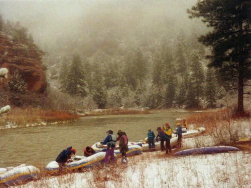 Photo: Public domain (via Wikimedia Commons)
- 12.5 mi
- distance
- 9,309 ft
- high point
- May–Jul, Sep
- best months
Get a permit
Rio Chama · river launch
Reserve on Recreation.govRio Chama is a canoeing destination in northern New Mexico, about 2.6 miles from the community of Lobato. The river offers paddling on its waters, with the surrounding area rich in trails, camping and other outdoor options within a short drive. Summer is the most comfortable time to paddle. Typical averages from the nearby Chama weather station, at about 7,850 feet, show July highs around 80°F and lows near 46°F, though that station sits roughly 1,450 feet below the river, so temperatures on the water run cooler. June and September are also mild, with highs in the upper 70s and low 70s. Several trails lie close by. The Archuleta Trail and the Chama River route are both about 2.9 miles away. Dispersed camping is about 3.2 miles off. For a longer outing, the West Fork Rio Chama trail is about 5 miles away.
Local outfitters
- Wilderness Journeys Pagosa34 mi away
Not on Roamze yet. Their page has how to reach them.
- Archuleta TrailHiking2.9 mi
- Chama RiverHiking2.9 mi
- Dispersed CampingCamping3.2 mi
- West Fork Rio ChamaHiking5 mi
- Elk Interpretive TrailHiking5.1 mi
 Chama ChileCross-country skiingPhoto: Jeffrey Beall, CC BY 4.0 (via Wikimedia Commons)5.1 mi
- Trujillo Meadows Boating SiteLake fishing6.7 mi
- Trujillo Meadows CampgroundCamping6.9 mi
Source: Roamze catalog (indexable pages within 10 miles, PostGIS distance)
 Navajo RiverCanoeing · ~22 min drivePhoto: Dicklyon, CC BY-SA 4.0 (via Wikimedia Commons)
- Trujillo Meadows Boating SiteBoat launch · ~12 min drive
 Rio BlancoCanoeing · ~37 min drivePhoto: Dicklyon, CC BY-SA 4.0 (via Wikimedia Commons)
- Platoro Reservoir Boating SiteBoat launch · ~43 min drive
 Conejos RiverCanoeing · ~52 min drivePhoto: JustTooLazy, CC BY 2.0 (via Wikimedia Commons)
- Big Meadows Reservoir Boating SiteBoat launch · ~1h 9m drive
 East Fork San Juan RiverCanoeing · ~54 min drivePhoto: Dicklyon, CC BY-SA 4.0 (via Wikimedia Commons)
- Shaw Lake Boating SiteBoat launch · ~1h 11m drive
 San Juan RiverCanoeing · ~56 min drivePhoto: Kkaufman11 at English Wikipedia, Public domain (via Wikimedia Commons)
- Chavez Canyon Boating SiteBoat launch · ~1h 15m drive
Best time to visit Rio Chama
Best months: May–July and September. Best months have typical highs of 55–85 °F, lows of 30 °F or warmer (32 °F where the station doesn't record snow), at most one snowy day and no more than 12 wet days.
Jan
37° / 7°
8 wet
Feb
41° / 11°
8 wet
Mar
48° / 18°
7 wet
Apr
56° / 24°
7 wet
May
65° / 32°
7 wet
Jun
77° / 38°
6 wet
Jul
80° / 46°
11 wet
Aug
78° / 46°
13 wet
Sep
72° / 38°
9 wet
Oct
61° / 27°
7 wet
Nov
48° / 17°
6 wet
Dec
38° / 8°
7 wet
Typical high / low (°F) and days with rain or snow, 1991–2020. Measured at Chama, NM, 5.2 mi away at 7,850 ft. The station sits about 1,500 ft lower than this place, so expect it a little cooler here. This station doesn't record snowfall. Source: NOAA NCEI U.S. Climate Normals 1991–2020.

