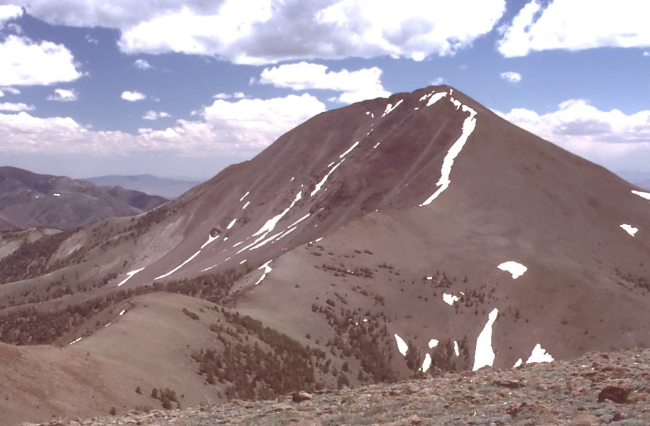
Red Rocks
- 5.2 mi
- round trip
- 776 ft
- climb
- 9,183 ft
- high point
- Out and back
- route
Is Red Rocks open right now?
Closure in the area
There's a closure order in Humboldt-Toiyabe National Forest. It doesn't name Red Rocks, so check the source for the area it covers.
Elephant Fire Closure
Agency closure covering Humboldt-Toiyabe National Forest · Order 04-17-26-01-04 · USFS · Humboldt-Toiyabe National Forest
Area, Road, and Trail Closures (Spring Mountains National Recreation Area)
Agency alert covering Humboldt-Toiyabe National Forest · Order 04-17-25-04 · USFS · Humboldt-Toiyabe National Forest
Year-Round Fire Restrictions (Spring Mountains National Recreation Area)
Agency alert covering Humboldt-Toiyabe National Forest · Order 04-17-24-01 · USFS · Humboldt-Toiyabe National Forest
Vehicle Snow Chain Requirements during Inclement Weather (Spring Mountains National Recreation Area)
Agency alert covering Humboldt-Toiyabe National Forest · Order 04-17-23-01 · USFS · Humboldt-Toiyabe National Forest
Rainbow Canyon Flood Diversion Structure Closure (Spring Mountains National Recreation Area)
Agency alert covering Humboldt-Toiyabe National Forest · Order 04-17-15-01 · USFS · Humboldt-Toiyabe National Forest
As of · Source: USFS · Humboldt-Toiyabe National Forest. Agencies don't list every closure — check before you go.
Red Rocks is a moderate out-and-back hike of about 5 miles in Nevada's Humboldt-Toiyabe National Forest, on the Austin-Tonopah Ranger District. The trail rises from a low point of about 8,385 feet to a high point of about 9,183 feet, with a total elevation gain of 776 feet. The Forest Service manages the surrounding land, and the route is on natural surface. The hike is open year-round. Horses are allowed, so it works for riders as well as hikers. Pasco Canyon lies about 1.6 miles away, and Mount Jefferson is about 2.5 miles off. Bucks Canyon and Pine Creek are both within about 4.5 miles. For an overnight stay, Pine Creek Campground is roughly 4.9 miles away.
- Pasco CanyonHiking1.6 mi
- Mount JeffersonHiking2.5 mi
- Bucks CanyonHiking4.1 mi
- Pine CreekHiking4.3 mi
- North Summit Mt JeffersonHiking4.5 mi
- Pine Creek CampgroundCamping4.9 mi
- Middle Summit Mt JeffersonHiking5.9 mi
- Adt - Nevada - S - Seg 4Hiking6.3 mi
Source: Roamze catalog (indexable pages within 10 miles, PostGIS distance)
 Fishers Hayfarm RoadHiking · ~25 min drivePhoto: Ken Lund from Las Vegas, Nevada, USA, CC BY-SA 2.0 (via Wikimedia Commons)
- Mount JeffersonHiking · ~15 min drive
- Adt - Nevada - S - Seg 4Hiking · ~11 min drive
- Adt - Nevada - S - Seg 5Hiking · ~20 min drive
- Adt - Nevada - S - Seg 5Hiking · ~26 min drivePhoto: Ken Lund from Las Vegas, Nevada, USA, CC BY-SA 2.0 (via Wikimedia Commons)
- Pasco CanyonHiking · ~3 min drive
- Little Table Mountain SpringHiking · ~21 min drive
- Mount JeffersonHiking · ~4 min drive
- North Summit Mt JeffersonHiking · ~8 min drive
- TipoverHiking · ~30 min drive