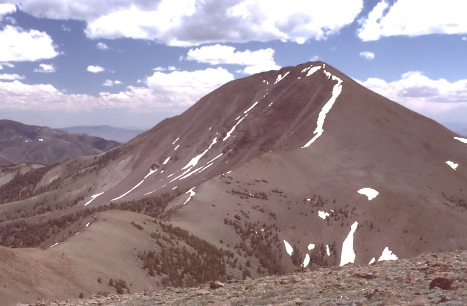
Little Table Mountain Spring
- 3.0 mi
- round trip
- 445 ft
- climb
- 8,157 ft
- high point
- Out and back
- route
- May–Sep
- best months
Is Little Table Mountain Spring open right now?
Closure in the area
There's a closure order in Humboldt-Toiyabe National Forest. It doesn't name Little Table Mountain Spring, so check the source for the area it covers.
Elephant Fire Closure
Agency closure covering Humboldt-Toiyabe National Forest · Order 04-17-26-01-04 · USFS · Humboldt-Toiyabe National Forest
Area, Road, and Trail Closures (Spring Mountains National Recreation Area)
Agency alert covering Humboldt-Toiyabe National Forest · Order 04-17-25-04 · USFS · Humboldt-Toiyabe National Forest
Year-Round Fire Restrictions (Spring Mountains National Recreation Area)
Agency alert covering Humboldt-Toiyabe National Forest · Order 04-17-24-01 · USFS · Humboldt-Toiyabe National Forest
Vehicle Snow Chain Requirements during Inclement Weather (Spring Mountains National Recreation Area)
Agency alert covering Humboldt-Toiyabe National Forest · Order 04-17-23-01 · USFS · Humboldt-Toiyabe National Forest
Rainbow Canyon Flood Diversion Structure Closure (Spring Mountains National Recreation Area)
Agency alert covering Humboldt-Toiyabe National Forest · Order 04-17-15-01 · USFS · Humboldt-Toiyabe National Forest
As of · Source: USFS · Humboldt-Toiyabe National Forest. Agencies don't list every closure — check before you go.
Little Table Mountain Spring is a 3-mile out-and-back hike in the Austin-Tonopah Ranger District of Humboldt-Toiyabe National Forest in Nevada. The trail starts at about 7,733 feet and climbs to a high point of 8,157 feet, a moderate ascent of 445 feet, and is managed by the Forest Service. The trail is natural-surfaced and allows both horses and bikes. It is open year-round, and trips should plan for about three miles of footing, with the climb spread evenly along the route. Summer is the most comfortable time to go. Typical averages from a nearby weather station run to highs around 83°F in July and lows near 48°F, while temperatures at the high point run a little cooler than those figures. Winter is cold, with typical highs around 42°F and lows near 15°F in December and January. Several other trails lie close by. Round Meadow is about half a mile away, and Lone Pine Springs and Windy Pass are each roughly 2.4 miles off. For an overnight stay, Belmot Camground is about 5.7 miles away.
Best time to go · May–Sep
Best time to visit Little Table Mountain Spring
Best months: May–September. Best months have typical highs of 55–85 °F, lows of 30 °F or warmer (32 °F where the station doesn't record snow), at most one snowy day and no more than 12 wet days.
Jan
42° / 15°
6 wet
Feb
43° / 17°
6 wet
Mar
51° / 23°
6 wet
Apr
57° / 27°
6 wet
May
66° / 35°
6 wet
Jun
76° / 41°
4 wet
Jul
83° / 48°
4 wet
Aug
82° / 47°
4 wet
Sep
74° / 40°
4 wet
Oct
63° / 31°
3 wet
Nov
50° / 21°
4 wet
Dec
42° / 15°
4 wet
Typical high / low (°F) and days with rain or snow, 1991–2020. Measured at Snowball Rch, NV, 45.2 mi away at 7,160 ft. The station sits about 1,000 ft lower than this place, so expect it a little cooler here. This station doesn't record snowfall. Source: NOAA NCEI U.S. Climate Normals 1991–2020.
Keep exploring — more trails worth the drive
HIKE
Mount Jefferson
~7 min drive
23.03-mile out-and-back trail in Nevada with 1,743 ft elevation gain.
 Photo: Ken Lund from Las Vegas, Nevada, USA, CC BY-SA 2.0 (via Wikimedia Commons)
Adt - Nevada - S - Seg 5
~26 min drive
0.37-mile out-and-back trail in Nevada with 15 ft of elevation gain.
HIKE
Round Meadow
~1 min drive
2.92-mile out-and-back trail in Nevada with 479 ft gain.
HIKE
Adt - Nevada - S - Seg 4
~16 min drive
24.39-mile out-and-back trail in Nevada with 4,392 ft gain and 3,563 ft loss.
HIKE
Windy Pass Trail
~8 min drive
3.40-mile out-and-back trail in Nevada with 1,794 ft elevation gain.
Photo: Ken Lund from Las Vegas, Nevada, USA, CC BY-SA 2.0 (via Wikimedia Commons)Fishers Hayfarm Road
~25 min drive
1.94-mile out-and-back trail in Nevada with 144 ft elevation gain.
HIKE
Adt - Nevada - S - Seg 5
~16 min drive
3.90-mile out-and-back trail in Nevada with 2 ft gain and 662 ft loss.
HIKE
Trail Canyon Creek
~8 min drive
7.60-mile out-and-back trail in Nevada with 358 ft gain and 1,595 ft loss.
HIKE
Lone Pine Springs
~4 min drive
1.90-mile out-and-back trail to Lone Pine Springs in Nevada with 344 ft elevation gain.
HIKE
Red Rocks
~21 min drive
5.21-mile out-and-back trail in Nevada with 776 ft elevation gain.