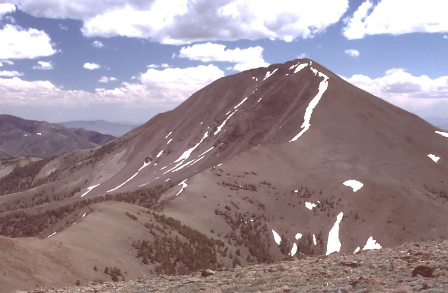
Middle Summit Mt Jefferson
- 4.0 mi
- round trip
- 1,637 ft
- climb
- 11,531 ft
- high point
- Out and back
- route
Caution at last check
Agency alerts are in effect for this area; weather is marginal · USFS, OpenWeather · checked 20 h ago
Is Middle Summit Mt Jefferson open right now?
Closure in the area
There's a closure order in Humboldt-Toiyabe National Forest. It doesn't name Middle Summit Mt Jefferson, so check the source for the area it covers.
Elephant Fire Closure
Agency closure covering Humboldt-Toiyabe National Forest · Order 04-17-26-01-04 · USFS · Humboldt-Toiyabe National Forest
Area, Road, and Trail Closures (Spring Mountains National Recreation Area)
Agency alert covering Humboldt-Toiyabe National Forest · Order 04-17-25-04 · USFS · Humboldt-Toiyabe National Forest
Year-Round Fire Restrictions (Spring Mountains National Recreation Area)
Agency alert covering Humboldt-Toiyabe National Forest · Order 04-17-24-01 · USFS · Humboldt-Toiyabe National Forest
Vehicle Snow Chain Requirements during Inclement Weather (Spring Mountains National Recreation Area)
Agency alert covering Humboldt-Toiyabe National Forest · Order 04-17-23-01 · USFS · Humboldt-Toiyabe National Forest
Rainbow Canyon Flood Diversion Structure Closure (Spring Mountains National Recreation Area)
Agency alert covering Humboldt-Toiyabe National Forest · Order 04-17-15-01 · USFS · Humboldt-Toiyabe National Forest
As of · Source: USFS · Humboldt-Toiyabe National Forest. Agencies don't list every closure — check before you go.
Middle Summit Mt Jefferson is a 4-mile out-and-back hike in Nevada's Alta Toquima Wilderness, part of the Austin-Tonopah Ranger District of the Humboldt-Toiyabe National Forest. The trail climbs from a low point of 9,844 feet to a high of 11,531 feet, a gain of 1,637 feet, and is rated hard. The Forest Service manages the land. The route is on natural surface, and horses are allowed. Bikes are not. The trail is open from about June 15 through October 30. North Summit Mt Jefferson lies about 2.4 miles away, and Windy Pass Trail is about 1.8 miles off. Pine Creek Campground, roughly 3.8 miles away, offers a place to stay. Lone Pine Springs is about 4 miles from the summit.
Keep exploring — more trails worth the drive
 Photo: Ken Lund from Las Vegas, Nevada, USA, CC BY-SA 2.0 (via Wikimedia Commons)
Adt - Nevada - S - Seg 5
~22 min drive
0.37-mile out-and-back trail in Nevada with 15 ft of elevation gain.
HIKE
Mount Jefferson
~5 min drive
23.03-mile out-and-back trail in Nevada with 1,743 ft elevation gain.
HIKE
Windy Pass
~7 min drive
8.76-mile out-and-back trail in Nevada with 1,681 ft gain.
HIKE
Adt - Nevada - S - Seg 4
~11 min drive
24.39-mile out-and-back trail in Nevada with 4,392 ft gain and 3,563 ft loss.
Photo: Ken Lund from Las Vegas, Nevada, USA, CC BY-SA 2.0 (via Wikimedia Commons)Fishers Hayfarm Road
~21 min drive
1.94-mile out-and-back trail in Nevada with 144 ft elevation gain.
HIKE
Bucks Canyon
~5 min drive
7-mile out-and-back trail in Bucks Canyon, Nevada with 1,516 ft elevation gain.
HIKE
Red Rocks
~10 min drive
5.21-mile out-and-back trail in Nevada with 776 ft elevation gain.
HIKE
Lone Pine Springs
~7 min drive
1.90-mile out-and-back trail to Lone Pine Springs in Nevada with 344 ft elevation gain.
HIKE
Andrews Basin
~8 min drive
4.20-mile out-and-back trail in Nevada with 599 ft gain.
HIKE
Round Meadow
~10 min drive
2.92-mile out-and-back trail in Nevada with 479 ft gain.