

North American RV Park & Yurt Village
Hiking business nearby (~11 mi away) — hasn't claimed their Roamze page yet
Free — you'll pick up right here.
Watch this trail
Sign up to watch it — saving subscribes you to gate, closure and report changes.
Montana
4.2 mi
Distance
1,953 ft
Gain
2h 23m
Time
We won't guess. Here is exactly what we do and don't know.
What we do know
Inside Flathead National Forest
2 managing-area boundaries mapped — agency alerts for them feed this page automatically.
Boundary data
What's missing
No access route mapped
We don't yet know which road reaches this trailhead, so we can't tell you if it's gated.
Nobody's filed a report here yet — be the first.
Why you'll love it
Rescue Creek
AI-suggested draft · review before you go
No permit or access details on file for this trail — check with the local land manager before you go.
Rescue Creek is a moderately challenging 4.2-mile trail that climbs nearly 2,000 feet through Montana backcountry, offering hikers a rewarding alpine experience. The trail follows Rescue Creek drainage, ascending through mixed forest and open meadows with views expanding as you gain elevation. This route is ideal for hikers seeking a solid workout with manageable distance and classic Montana mountain terrain.
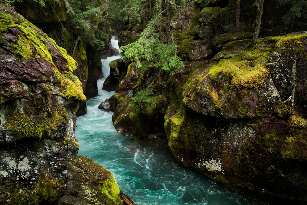
Avalanche Creek
~30 min drive
Home to two of the Glacier's iconic trails, the Avalanche Creek area is one of the most popular and crowded spots in the park. The old growth cedars and hemlock trees are unlike anywhere else in the Glacier. Enjoy the picnic area, a short boardwalk trail, or a moderate hike t…
Skiumah Creek
~2 min drive
Moderate creek-side hike with 1,150 ft gain near Skiumah Creek.
Cascadilla Creek
~3 min drive
Scenic creek-side hike with cascades and forest views near Cascadilla Creek.
Stanton Lake
~7 min drive
Moderate 7.76-mile hike to a scenic alpine lake with gentle elevation gain.
Camas Road Gate Parking
~20 min drive
Parking at the Camas Road Gate is only allowed during the winter months. From here, skiers and snowshoers can access a variety of trails. Trails that can be reached from this parking area are: Lower McDonald Creek, 2-3 miles roundtrip. The trail begins just south of the McDo…
Great Bear Creek
~2 min drive
Steady creek-side hike through Montana forest with 882 ft elevation gain.
Emery Hill Sm
~12 min drive
Moderate 4.9-mile hike with 1,099 ft gain near Emery Hill, Montana.
Grant Ridge
~7 min drive
Moderate 9.69-mile ridge climb with 2,872 ft gain and expansive views.
Apgar Lookout Trailhead
~20 min drive
This trail leads to the Apgar Fire Lookout, offering an expansive view of Lake McDonald and the surrounding valley. This particular view is shared online via a live webcam. The webcam view is available at www.nps.gov/glac. Apgar Fire Lookout Distance: 3.6 mi (5.8 km), one wa…
P-Line Trail
~14 min drive
Short, steep Montana foothill hike with 480 ft elevation gain.
Local operatorsoffering guided trips. You book directly with them — Roamze doesn’t take a cut.
North American RV Park & Yurt Village
Hiking business nearby (~11 mi away) — hasn't claimed their Roamze page yet
Rocky Mountain Outfitter
Hiking business nearby (~29 mi away) — hasn't claimed their Roamze page yet