Ruffneck Peak
- 9,418 ft
- summit
- 1
- way up
Is Ruffneck Peak open right now?
Alert in the area
The Forest Service lists an alert for Salmon-Challis National Forest.
Stoddard Bridge Construction Closure
Agency alert covering Salmon-Challis National Forest · Order 0413-07-17 · USFS · Salmon-Challis National Forest
As of · Source: USFS · Salmon-Challis National Forest. Agencies don't list every closure — check before you go.
Ruffneck Peak is a summit in the Frank Church-River of No Return Wilderness, within the Middle Fork Ranger District of Salmon-Challis National Forest in Idaho. The nearest town is Stanley, about 22 miles away. Close by are the Langer Lake Spur 1 trail, under a mile away, and the Roughneck trail, about 1.8 miles off. Paddlers can look to Beaver Creek, about 5 miles away. Dagger Falls Campground, about 7 miles out, is the nearest place to camp.
Conditions and forecast
Daily highs and lows, wind and the chance of precipitation at the summit and route start for the next 7 days, from the Open-Meteo model.
- Summit elevation
- 9,418 ft
Elevation from USGS 3D Elevation Program terrain data (about 10 m resolution).
Map © Mapbox © OpenStreetMap contributors Questions about Ruffneck Peak
How tall is Ruffneck Peak?
9,418 ft (2,871 m).
How many routes go to the summit of Ruffneck Peak?
One: Roughneck.
When is the best time to climb Ruffneck Peak?
Year-round.
- Blue Bunch Mountain8,746 ft · Idaho1 route6.0 mi away
- Big Soldier Mountain8,984 ft · Idaho1 route8.0 mi away
- Greyhound Mountain8,992 ft · Idaho1 route8.1 mi away
- Morehead Mountain8,504 ft · Idaho1 route12 mi away
- Little Soldier Mountain8,812 ft · Idaho1 route16 mi away
- Red Mountain8,723 ft · Idaho1 route20 mi away
- LANGER LAKE SPUR 1Hiking0.7 mi
- RoughneckHiking1.8 mi
- Fall CreekHiking2.4 mi
- Beaver CreekCanoeing4.8 mi
- Dagger Falls CampgroundCamping7.2 mi
- Marsh CreekCanoeing7.4 mi
- Boundary Creek Campground ComplexCamping7.5 mi
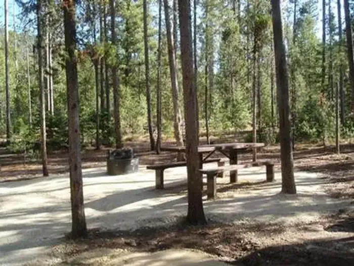 Boundary Creek CampgroundCampingPhoto: Recreation.gov (RIDB) / public domain7.6 mi
Source: Roamze catalog (indexable pages within 10 miles, PostGIS distance)
 McGowan PeakSummit · ~32 min drivePhoto: Fredlyfish4, CC BY-SA 4.0 (via Wikimedia Commons)
 Alpine PeakSummit · ~38 min drivePhoto: Fredlyfish4, CC BY-SA 3.0 (via Wikimedia Commons)
 Mount ReganSummit · ~39 min drivePhoto: Fredlyfish4, CC BY-SA 4.0 (via Wikimedia Commons)
 Thompson PeakSummit · ~42 min drivePhoto: Fredlyfish4, CC BY-SA 3.0 (via Wikimedia Commons)
 Baron PeakSummit · ~43 min drivePhoto: Fredlyfish4, CC BY-SA 3.0 (via Wikimedia Commons)
 Decker PeakSummit · ~54 min drivePhoto: Fredlyfish4, CC BY-SA 4.0 (via Wikimedia Commons)
 Elk PeakSummit · ~55 min drivePhoto: Fredlyfish4, CC BY-SA 3.0 (via Wikimedia Commons)
 Watson PeakSummit · ~58 min drivePhoto: Fredlyfish4, CC BY-SA 3.0 (via Wikimedia Commons)
- Payette PeakSummit · ~60 min drivePhoto: Fredlyfish4, CC BY-SA 3.0 (via Wikimedia Commons)
 Lee PeakSummit · ~1h 3m drivePhoto: Leaflet, CC BY-SA 4.0 (via Wikimedia Commons)
