Big Soldier Mountain
- 8,984 ft
- summit
- 1
- way up
Is Big Soldier Mountain open right now?
Alert in the area
The Forest Service lists an alert for Salmon-Challis National Forest.
Stoddard Bridge Construction Closure
Agency alert covering Salmon-Challis National Forest · Order 0413-07-17 · USFS · Salmon-Challis National Forest
As of · Source: USFS · Salmon-Challis National Forest. Agencies don't list every closure — check before you go.
Big Soldier Mountain is a summit in Idaho's Frank Church-River of No Return Wilderness, within the Middle Fork Ranger District of the Salmon-Challis National Forest. The nearest town is Landmark, about 15 miles away. Two are relevant here: one for the Frank Church-River of No Return Wilderness and one for the Middle Fork of the Salmon Wild and Scenic River. The Big Soldier Trail passes less than half a mile from the summit, and Muskeg Creek is under a mile away. The Middle Fork Salmon River runs about 2 miles off. Boundary Creek Campground and Dagger Falls Campground sit roughly 3 miles away and are the closest places to camp.
Conditions and forecast
Daily highs and lows, wind and the chance of precipitation at the summit and route start for the next 7 days, from the Open-Meteo model.
- Summit elevation
- 8,984 ft
Elevation from USGS 3D Elevation Program terrain data (about 10 m resolution).
Map © Mapbox © OpenStreetMap contributors Questions about Big Soldier Mountain
How tall is Big Soldier Mountain?
8,984 ft (2,738 m).
How many routes go to the summit of Big Soldier Mountain?
One: Big Soldier Trail.
- Morehead Mountain8,504 ft · Idaho1 route4.9 mi away
- Blue Bunch Mountain8,746 ft · Idaho1 route6.3 mi away
- Greyhound Mountain8,992 ft · Idaho1 route7.2 mi away
- Ruffneck Peak9,418 ft · Idaho1 route8.0 mi away
- Little Soldier Mountain8,812 ft · Idaho1 route13 mi away
- Big Baldy9,707 ft · Idaho1 route15 mi away
- Big Soldier TrailHiking0.4 mi
- Muskeg CreekHiking0.8 mi
 Middle Fork Salmon RiverCanoeingPhoto: Rex Parker, CC BY 2.0 (via Wikimedia Commons)2.3 mi
- Morehead MtnHiking3 mi
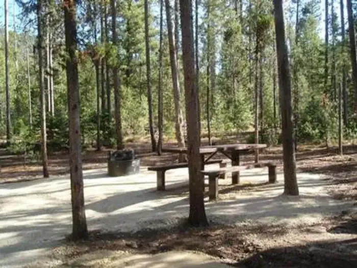 Boundary Creek CampgroundCampingPhoto: Recreation.gov (RIDB) / public domain3.1 mi
- Dagger Falls CampgroundCamping3.1 mi
- Boundary Creek Campground ComplexCamping3.2 mi
- Elkhorn CreekCanoeing3.8 mi
Source: Roamze catalog (indexable pages within 10 miles, PostGIS distance)
 McGowan PeakSummit · ~45 min drivePhoto: Fredlyfish4, CC BY-SA 4.0 (via Wikimedia Commons)
 Alpine PeakSummit · ~50 min drivePhoto: Fredlyfish4, CC BY-SA 3.0 (via Wikimedia Commons)
 Mount ReganSummit · ~51 min drivePhoto: Fredlyfish4, CC BY-SA 4.0 (via Wikimedia Commons)
 Baron PeakSummit · ~56 min drivePhoto: Fredlyfish4, CC BY-SA 3.0 (via Wikimedia Commons)
 Horstmann PeakSummit · ~58 min drivePhoto: Fredlyfish4, CC BY-SA 4.0 (via Wikimedia Commons)
 Decker PeakSummit · ~1h 7m drivePhoto: Fredlyfish4, CC BY-SA 4.0 (via Wikimedia Commons)
 Twin PeaksSummit · ~1h 7m drivePhoto: BLMIdaho, Public domain (via Wikimedia Commons)
 Elk PeakSummit · ~1h 7m drivePhoto: Fredlyfish4, CC BY-SA 3.0 (via Wikimedia Commons)
 Sevy PeakSummit · ~1h 9m drivePhoto: Fredlyfish4, CC BY-SA 3.0 (via Wikimedia Commons)
 Watson PeakSummit · ~1h 11m drivePhoto: Fredlyfish4, CC BY-SA 3.0 (via Wikimedia Commons)
