Soda Creek
 Photo: Paul Mono, CC BY-SA 3.0 (via Wikimedia Commons)
- 5.0 mi
- round trip
- 500 ft
- climb
- 8,362 ft
- high point
- Out and back
- route
- Jun–Oct
- best months
Caution today
Agency alerts are in effect for this area; weather is good · USFS, OpenWeather · checked 6 h ago
Is Soda Creek open right now?
Alert in the area
The Forest Service lists 3 alerts for Inyo National Forest.
Help Halt Golden Mussel Invasion
Agency alert covering Inyo National Forest · USFS · Inyo National Forest
Ansel Adams and John Muir Wilderness Campfire Restrictions
Agency alert covering Inyo National Forest · Order 05-04-50-25-04 · USFS · Inyo National Forest
Golden Trout and Hoover Wilderness Campfire Restrictions
Agency alert covering Inyo National Forest · Order 05-04-50-25-05 · USFS · Inyo National Forest
As of · Source: USFS · Inyo National Forest. Agencies don't list every closure — check before you go.
Soda Creek is a 5-mile out-and-back hike in California's Inyo National Forest, within the Mt. Whitney Ranger District. The Forest Service manages the land, and the trail rises from about 7,870 feet to about 8,362 feet, a total elevation gain of 500 feet. Summer and early fall are the most comfortable times to go. Typical averages from a nearby weather station at Lodgepole, which sits about 1,600 feet lower, show July and August highs around 76°F with only two or three wet days a month. That station's snow days drop to zero from June through September. The trail is rated hard. It is open year-round and carries natural surface, and it allows horses and bikes. It is not an accessible trail. Old Jordan Dennison is less than a mile away, and the Bigdry Mdw-Litldry Mdw Cutoff and Long Canyon are both about 1.4 miles off for mountain bikers. River Springs Cutoff #2 is about 1.6 miles away.
Local outfitters
- Big Willi Mountaineering Company28 mi away
Not on Roamze yet. Their page has how to reach them.
- Old Jordan DennisonHiking0.7 mi
- Bigdry Mdw-Litldry Mdw CutoffMountain biking1.3 mi
- Long CanyonMountain biking1.4 mi
- BakeovenMountain biking1.4 mi
- River Springs Cutoff #2Hiking1.6 mi
- CASA VIEJA CUTOFFHiking1.7 mi
 River Springs Cutoff #1Mountain bikingPhoto: David Bakken, CC BY-SA 2.0 (via Wikimedia Commons)1.9 mi
- River Springs Cutoff #1 TrailHiking1.9 mi
Source: Roamze catalog (indexable pages within 10 miles, PostGIS distance)
 Blackrock Mountain TrailHiking · ~7 min drivePhoto: Moo.The.Cow, CC BY 2.0 (via Flickr)
- Fish CreekHiking · ~10 min drivePhoto: Moo.The.Cow, CC BY 2.0 (via Flickr)
 Jackass Peak TrailHiking · ~10 min drivePhoto: Moo.The.Cow, CC BY 2.0 (via Flickr)
- Old Jordan DennisonHiking · ~2 min drive
- BLACKROCK MOUNTAINHiking · ~9 min drive
- Albanita TrailHiking · ~10 min drivePhoto: Moo.The.Cow, CC BY 2.0 (via Flickr)
- Old Jordan DennisonHiking · ~1 min drive
- BIGDRY MDW-LITLDRY MDW CUTOFFHiking · ~3 min drive
- Pacific Crest TrailHiking · ~10 min drive
- Long CanyonHiking · ~4 min drive
Also worth it near here
- River Springs Cutoff #1Mountain biking · ~3 min drivePhoto: David Bakken, CC BY-SA 2.0 (via Wikimedia Commons)
 Jordan Hot SpringsHot spring · ~8 min drivePhoto: David Bakken, CC BY-SA 2.0 (via Wikimedia Commons)
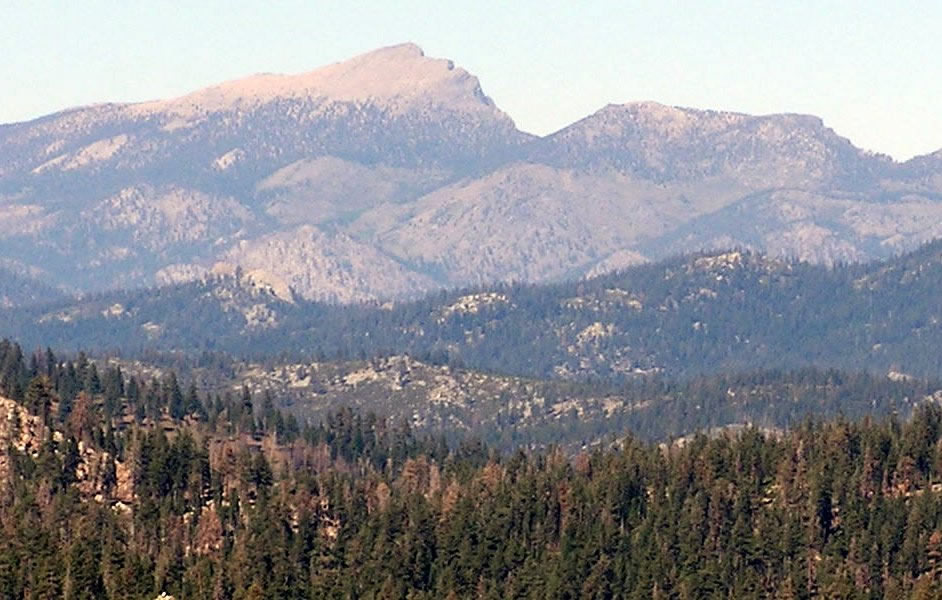 Olancha PeakSummit · ~11 min drivePhoto: Justin, CC BY 2.0 (via Wikimedia Commons)
- Fish Creek RockRock climbing · ~18 min drive
Best time to visit Soda Creek
Best months: June–October. Best months have typical highs of 55–85 °F, lows of 30 °F or warmer (32 °F where the station doesn't record snow), at most one snowy day and no more than 12 wet days.
Jan
39° / 17°
9 wet · 8 snow
Feb
41° / 18°
10 wet · 8 snow
Mar
45° / 22°
10 wet · 8 snow
Apr
50° / 26°
8 wet · 5 snow
May
58° / 33°
5 wet · 2 snow
Jun
68° / 40°
3 wet
Jul
76° / 46°
2 wet
Aug
76° / 44°
2 wet
Sep
70° / 39°
2 wet
Oct
59° / 31°
4 wet · 1 snow
Nov
47° / 23°
6 wet · 4 snow
Dec
37° / 17°
8 wet · 6 snow
Typical high / low (°F) and days with rain or snow, 1991–2020. Measured at Lodgepole, CA, 38.9 mi away at 6,735 ft. The station sits about 1,600 ft lower than this place, so expect it a little cooler here. Source: NOAA NCEI U.S. Climate Normals 1991–2020.
