Olancha Peak
 Photo: Justin, CC BY 2.0 (via Wikimedia Commons)
- 12,122 ft
- summit
- Forest Service
- managed by
Is Olancha Peak open right now?
Alert in the area
The Forest Service lists 3 alerts for Inyo National Forest.
Help Halt Golden Mussel Invasion
Agency alert covering Inyo National Forest · USFS · Inyo National Forest
Ansel Adams and John Muir Wilderness Campfire Restrictions
Agency alert covering Inyo National Forest · Order 05-04-50-25-04 · USFS · Inyo National Forest
Golden Trout and Hoover Wilderness Campfire Restrictions
Agency alert covering Inyo National Forest · Order 05-04-50-25-05 · USFS · Inyo National Forest
As of · Source: USFS · Inyo National Forest. Agencies don't list every closure — check before you go.
Olancha Peak is a summit of about 12,122 feet in Tulare County, California, inside the Golden Trout Wilderness. The peak lies within the Mt. Whitney Ranger District of Inyo National Forest, which the Forest Service manages, and the nearest town is Cartago, about 6 miles away. Several trails lie close by. Bear Trap Meadow is about 2 miles away, the Pacific Crest Trail about 2.6 miles, and Olancha Pass about 3 miles. The Strawberry Mdw to Monache route is roughly 4 miles off.
Conditions and forecast
Daily highs and lows, wind and the chance of precipitation at the summit for the next 7 days, from the Open-Meteo model.
- Summit elevation
- 12,122 ft
- Land manager
- Forest Service
Elevation from USGS 3D Elevation Program terrain data (about 10 m resolution).
We don't know of a mapped trail or route to the summit of Olancha Peak. Plan the approach with local maps, a guidebook or a local guide, and check conditions before you go.
Questions about Olancha Peak
How tall is Olancha Peak?
12,122 ft (3,695 m).
Is there a trail to the top of Olancha Peak?
We don't know of a mapped trail or route to the summit. Plan the approach with local maps, a guidebook or a local guide.
- Indian Head8,974 ft · California1 route9.3 mi away
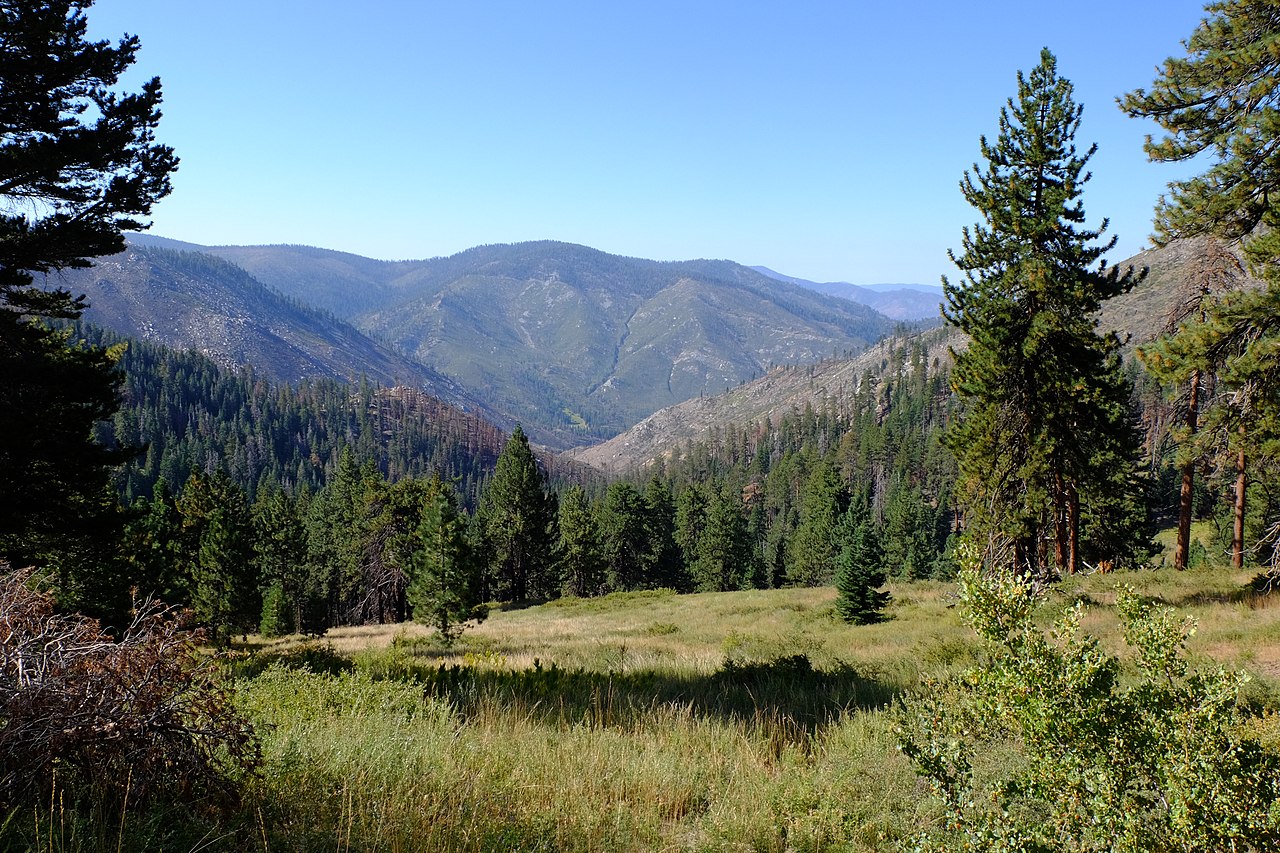 Kern Peak11,503 ft · California1 route9.9 mi awayPhoto: David Bakken, CC BY-SA 2.0 (via Wikimedia Commons)
- Manzanita Knob9,124 ft · California1 route11 mi away
- Bald Mountain9,383 ft · California1 route19 mi away
 Mount Langley14,028 ft · California1 route19 mi awayPhoto: Timwryan (talk · contribs), CC BY-SA 4.0 (via Wikimedia Commons)
- Mount Pickering13,464 ft · California1 route20 mi away
- Bear Trap MeadowHiking1.9 mi
- Pacific Crest TrailHiking2.6 mi
- Olancha PassHiking3 mi
- Olancha Pass - PCT SouthHiking3.1 mi
- PCT - PACIFIC CREST TRAILHiking3.1 mi
- Olancha StockHiking3.6 mi
- Strawberry Mdw to MonacheHiking3.8 mi
- Honey BeeHiking3.8 mi
Source: Roamze catalog (indexable pages within 10 miles, PostGIS distance)
- Kern PeakSummit · ~17 min drivePhoto: David Bakken, CC BY-SA 2.0 (via Wikimedia Commons)
- Mount LangleySummit · ~33 min drivePhoto: Timwryan (talk · contribs), CC BY-SA 4.0 (via Wikimedia Commons)
 Lone Pine PeakSummit · ~37 min drivePhoto: UFGS Region 5, CC BY 2.0 (via Wikimedia Commons)
 Mount McAdieSummit · ~37 min drivePhoto: glenngould, CC BY 2.0 (via Wikimedia Commons)
 Mount MuirSummit · ~39 min drivePhoto: Poppy, CC BY-SA 3.0 (via Wikimedia Commons)
 Mount WhitneySummit · ~41 min drivePhoto: Geographer (talk · contribs), CC BY 1.0 (via Wikimedia Commons)
 Mount RussellSummit · ~42 min drivePhoto: Will Beback at en.wikipedia, CC BY-SA 3.0 (via Wikimedia Commons)
 Silver PeakSummit · ~42 min drivePhoto: sdold, CC BY-SA 3.0 (via Wikimedia Commons)
 Mount FlorenceSummit · ~45 min drivePhoto: MiguelVieira, CC BY 2.0 (via Wikimedia Commons)
 Needham MountainSummit · ~46 min drivePhoto: Mitch Barrie, CC BY-SA 2.0 (via Wikimedia Commons)
Also worth it near here
 Soda CreekHiking · ~11 min drivePhoto: Paul Mono, CC BY-SA 3.0 (via Wikimedia Commons)
- Lake Olancha RV Park & CampgroundCamping · ~11 min drive
 River Springs Cutoff #1Mountain biking · ~13 min drivePhoto: David Bakken, CC BY-SA 2.0 (via Wikimedia Commons)
 Jordan Hot SpringsHot spring · ~18 min drivePhoto: David Bakken, CC BY-SA 2.0 (via Wikimedia Commons)
- Owens LakeLake fishing · ~19 min drive
