Transept Trail Intersection with Bridle Path by AZ SR67
 Photo: Yssso, CC BY-SA 2.0 (via Flickr)
- Loop
- route
- May–Oct
- best months
Clear at last check
Weather is good · OpenWeather · checked 15 h ago
Is Transept Trail Intersection with Bridle Path by AZ SR67 open right now?
Closure in the area
There's a closure order in Grand Canyon National Park. It doesn't name Transept Trail Intersection with Bridle Path by AZ SR67, so check the source for the area it covers.
INNER CANYON TRAIL CLOSURES
Park closure covering Grand Canyon National Park · NPS · Grand Canyon National Park
Overnight Lodging Suspended and Parkwide Stage 4 Water Restrictions
Park alert covering Grand Canyon National Park · NPS · Grand Canyon National Park
INNER CANYON WATER SHUTOFFS
Park alert covering Grand Canyon National Park · NPS · Grand Canyon National Park
Critical Backcountry Updates/Closures
Park alert covering Grand Canyon National Park · NPS · Grand Canyon National Park
As of · Source: NPS · Grand Canyon National Park. Agencies don't list every closure — check before you go.
With the exception of where it passes along the rim within the North Rim Campground, the Transept Trail is CLOSED - due to extensive fire damage. North Rim Visitors should plan ahead and be prepared for a more remote experience this year, with limited services available as the park continues recovery and restoration work. The 2026 season will focus mainly on day use and limited backcountry access, with some scenic drives, viewpoints, and trails open to visitors. Please keep in mind that potable water will not be available on the North Rim, so be sure to bring plenty of water and food for your visit. North Rim - Current Status and Closures Beginning near the intersection of the Bridle Path and Arizona State Route 67, the narrow Transept Trail heads southwest, passing the Backcountry Information Center, the North Rim Campground, and ultimately reaching Grand Canyon Lodge. The trail traces the edge of the Transept, a dramatic side canyon of Grand Canyon, offering striking views of the canyon’s layered geology. It's a popular hike for both campers and lodge guests. Although not particularly strenuous, some sections of the trail feature steep, winding paths through wooded areas, along with exposed viewpoints, so hikers should be prepared for moderate terrain. Be on the lookout for Mule deer and other wildlife! The Transept Trail intersects with the Bridle Path, on both north and south ends, allowing for extended loop hikes providing views of both Transept and Roaring Springs canyons. The photo shows the intersection on the north end of the Transept Trail ―with the Bridle Path continuing across the paved road towards the North Kaibab Trailhead, Transept Trail Information One-Way Distance: 2.0 miles (3.2 km) Average Hiking Time: 1-2 hours, one-way Elevation change: ~100 feet (~30 m) Difficulty: Moderate Bicycles and Leashed Pets are Not Permitted on the Transept Trail
Local outfitters
- Buck Wild Hummer Tours17 mi away
- Wander Camp33 mi away
Not on Roamze yet. Their page has how to reach them.
 Bridle Path (North End)HikingPhoto: Yssso, CC BY-SA 2.0 (via Flickr)0.2 mi
- Ken Patrick TrailHiking0.3 mi
- North Rim Campground (AZ)Camping0.4 mi
 Arizona TrailHikingPhoto: Grand Canyon National Park, CC BY 2.0 (via Wikimedia Commons)0.4 mi
- Widforss TrailHikingPhoto: Grand Canyon National Park, CC BY 2.0 (via Wikimedia Commons)0.6 mi
 Grand Canyon National ParkRock climbingPhoto: brewbooks from near Seattle, USA, CC BY-SA 2.0 (via Wikimedia Commons)4.3 mi
 UnconventionalsRock climbingPhoto: brewbooks from near Seattle, USA, CC BY-SA 2.0 (via Wikimedia Commons)6.1 mi
- TemplesRock climbing6.8 mi
Source: Roamze catalog (indexable pages within 10 miles, PostGIS distance)
- Bridle Path (North End)Hiking · Next doorPhoto: Yssso, CC BY-SA 2.0 (via Flickr)
- Arizona TrailHiking · Next doorPhoto: Grand Canyon National Park, CC BY 2.0 (via Wikimedia Commons)
- Widforss TrailHiking · ~1 min drivePhoto: Grand Canyon National Park, CC BY 2.0 (via Wikimedia Commons)
 Walhalla Glades TrailHiking · ~9 min drivePhoto: RuggyBearLA, CC BY 2.0 (via Flickr)
 Old Bright Angel TrailHiking · ~5 min drivePhoto: Robert Anders, CC BY 2.0 (via Flickr)
- Bridle Path (South End)Hiking · ~2 min drive
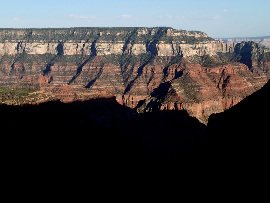 Uncle Jim TrailHiking · ~2 min drivePhoto: cogdogblog, CC BY 2.0 (via Flickr)
- Widforss PointHiking · ~1 min drivePhoto: Grand Canyon National Park, CC BY 2.0 (via Wikimedia Commons)
 Saddle MountainHiking · ~12 min drivePhoto: deborah.soltesz, Public Domain Dedication (CC0) (via Flickr)
 Ken Patrick Trail - East (Point Imperial)Hiking · ~11 min drivePhoto: rob stoeltje, CC BY 2.0 (via Flickr)
Also worth it near here
- Ribbon FallsWaterfall · ~7 min drive
- Grand Canyon National ParkRock climbing · ~7 min drivePhoto: brewbooks from near Seattle, USA, CC BY-SA 2.0 (via Wikimedia Commons)
 Brahma TempleSummit · ~10 min drivePhoto: Miguel Hermoso Cuesta, CC BY-SA 3.0 (via Wikimedia Commons)
- Kolb ArchNatural arch · ~12 min drive
Best time to visit Transept Trail Intersection with Bridle Path by AZ SR67
Best months: May–October. Best months have typical highs of 55–85 °F, lows of 30 °F or warmer (32 °F where the station doesn't record snow), at most one snowy day and no more than 12 wet days.
Jan
36° / 18°
7 wet
Feb
37° / 19°
7 wet
Mar
44° / 23°
6 wet
Apr
52° / 28°
4 wet
May
62° / 36°
4 wet
Jun
73° / 43°
3 wet
Jul
77° / 49°
8 wet
Aug
74° / 48°
11 wet
Sep
67° / 42°
7 wet
Oct
56° / 33°
5 wet
Nov
45° / 24°
5 wet
Dec
36° / 17°
6 wet
Typical high / low (°F) and days with rain or snow, 1991–2020. Measured at Bright Angel Rs, AZ, 0.1 mi away at 8,000 ft. This station doesn't record snowfall. Source: NOAA NCEI U.S. Climate Normals 1991–2020.
