

Patagonia RV Park
Hiking business nearby (~49 mi away) — hasn't claimed their Roamze page yet
Free — you'll pick up right here.
Watch this trail
Sign up to watch it — saving subscribes you to gate, closure and report changes.
Arizona
1.9 mi
Distance
216 ft
Gain
45 min
Time
We won't guess. Here is exactly what we do and don't know.
What we do know
Inside Coronado National Forest
2 managing-area boundaries mapped — agency alerts for them feed this page automatically.
Boundary data
What's missing
No access route mapped
We don't yet know which road reaches this trailhead, so we can't tell you if it's gated.
Nobody's filed a report here yet — be the first.
Why you'll love it
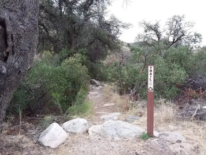
South Tanque Verde Rim
AI-suggested draft · review before you go
No permit or access details on file for this trail — check with the local land manager before you go.
South Tanque Verde Rim is a 1.9-mile out-and-back trail located in Arizona. The route features 216 feet of elevation gain, making it a moderate hike suitable for a range of fitness levels. The trail provides access to scenic rim views characteristic of the Arizona landscape. Being an out-and-back trail, hikers will retrace their route to return to the trailhead, with the same elevation change on the descent. The relatively short distance and moderate elevation gain make this trail accessible for a half-day hiking adventure. South Tanque Verde Rim offers an opportunity to experience the natural terrain and vistas of the region without requiring an extensive time commitment or advanced hiking experience.
Lower Tanque Verde Falls
~0 min drive
0.8 mi · Easy
Agua Caliente Hill
~5 min drive
8.9 mi · Hard
Wildhorse Trail
~6 min drive
Easy 0.30-mile out-and-back desert hike in Arizona.
Carrillo Trail
~6 min drive
6.4 mi · Moderate
Upper Tanque Verde Falls
~1 min drive
0.8 mi · Easy
Milagrosa
~7 min drive
7.5 mi · Hard
Tanque Verde Ridge Trail
~8 min drive
Challenging ridge climb with sweeping desert and mountain views near Tucson.
Italian Spring Trail #95
~10 min drive
9.3 mi · Moderate
Douglas Spring Trail
~3 min drive
4.9 mi · Easy
Bellota Trail #15
~11 min drive
21 mi · Hard
Local operatorsoffering guided trips. You book directly with them — Roamze doesn’t take a cut.
Patagonia RV Park
Hiking business nearby (~49 mi away) — hasn't claimed their Roamze page yet