Molino Basin Group
Campground
Campground · < 0.1 mi from the trail
Closure in the area
There's a closure order in Santa Catalina Ranger District. It doesn't name Molino Basin Group, so check the source for the area it covers.
Marshall Gulch Closure Order
Agency closure covering Santa Catalina Ranger District · Order 03-05-05-26-009 · USFS · Santa Catalina Ranger District
Border Barrier Construction Closure
Agency alert covering Coronado National Forest · Order 03-05-00-26-011 · USFS · Coronado National Forest
No Fire Restrictions
Agency alert covering Coronado National Forest · USFS · Coronado National Forest
Barfoot Snake Closure Order 03-05-01-24-004
Agency alert covering Coronado National Forest · USFS · Coronado National Forest
As of · Source: USFS · Santa Catalina Ranger District. Agencies don't list every closure — check before you go.
Molino Basin Group is a Forest Service campground in the Santa Catalina Ranger District of Coronado National Forest in Arizona, about a tenth of a mile from the Molino campground and picnic area. It sits lower on the slopes of the Santa Catalina Mountains than most other campgrounds in the Catalina District, which makes it an unusual choice for winter and early spring visits. While those other sites close in the cold months, Molino stays open then, and the weather is mild enough to make it a good time to go. The campground lies in a savannah of desert grassland dotted with oaks, with campsites set along the banks of Molino Creek. The creek flows only during and immediately after rain or snowmelt, and cottonwood, Arizona live oak and mesquite trees add to the scenery. The surrounding hills are rugged and rocky, and the roads in the campground are paved. Facilities are accessible, with accessible tent pads, walkways and picnic tables among the group campsite's features. Typical averages from a nearby weather station at Oracle put November highs around 64°F with lows near 42°F, and April highs around 71°F with lows near 46°F. Summer is hotter and wetter, with July highs near 91°F and about nine wet days. Molino Basin Boulders and the Bellota Trail #15 are both about 0.4 miles away, and the Molino Basin Trail #11 is a similar distance. The Aviator hike is about half a mile off.
Molino Basin Group
Campground
Butler Hall
Fast food
Wildlife Viewing Area
Viewpoint
Places © OpenStreetMap contributors
More in OracleNot on Roamze yet. Their page has how to reach them.
 MolinoCampingPhoto: Recreation.gov (RIDB) / public domain0.1 mi
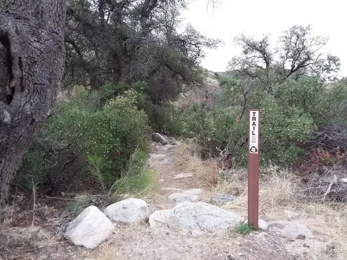
 Bellota Trail #15HikingPhoto: theojones2, Public Domain Dedication (CC0) (via Flickr)0.4 miMolino Basin Trail #11HikingPhoto: theojones2, Public Domain Dedication (CC0) (via Flickr)0.4 mi
 The Watering HoleRock climbingPhoto: Katja Schulz from Washington, D. C., USA, CC BY 2.0 (via Wikimedia Commons)0.4 miAviatorHikingPhoto: theojones2, Public Domain Dedication (CC0) (via Flickr)0.5 mi
Source: Roamze catalog (indexable pages within 10 miles, PostGIS distance)
 Gilbert Ray CampgroundCamping · ~47 min drivePhoto: lamblukas — CC BY 2.0 (via Flickr)
Also worth it near here
Molino Basin Trail #11Hiking · Next doorPhoto: theojones2, Public Domain Dedication (CC0) (via Flickr)The Watering HoleRock climbing · Next doorPhoto: Katja Schulz from Washington, D. C., USA, CC BY 2.0 (via Wikimedia Commons) La MilagrosaMountain biking · ~3 min drivePhoto: Katja Schulz from Washington, D. C., USA, CC BY 2.0 (via Wikimedia Commons)
Best months: October–May. Best months have typical highs of 55–85 °F, lows of 30 °F or warmer (32 °F where the station doesn't record snow), at most one snowy day and no more than 12 wet days.
Jan
56° / 35°
6 wet
Feb
58° / 37°
6 wet
Mar
64° / 42°
6 wet
Apr
71° / 46°
3 wet
May
82° / 56°
2 wet
Jun
92° / 66°
3 wet
Jul
91° / 69°
9 wet
Aug
90° / 67°
11 wet
Sep
86° / 63°
7 wet
Oct
77° / 52°
4 wet
Nov
64° / 42°
4 wet
Dec
55° / 36°
5 wet
Typical high / low (°F) and days with rain or snow, 1991–2020. Measured at Oracle 2 Se, AZ, 18.6 mi away at 4,510 ft. This station doesn't record snowfall. Source: NOAA NCEI U.S. Climate Normals 1991–2020.
