Sierra Hill
At a glance
Sierra Hill is a summit of 1,544 feet in California's Los Padres National Forest, about 13.5 miles from Carmel Valley Village. It sits among a cluster of trails and waterways in the Big Sur country, and its elevation makes it a natural anchor for a day of hiking and paddling in the area. Late summer into early fall is the most comfortable time to visit. Typical averages from a nearby weather station at Big Sur show highs around 77°F in August and September, with almost no wet days. That station sits well below the summit, so temperatures up high run cooler. The closest trail is the Brazil Ranch Trail, about 1.9 miles away, and the Little Sur River offers canoeing at roughly 3.7 miles. Skinner Ridge Trail and Little Sur Camp are both within about 4 miles. For an overnight stay, Pfeiffer Big Sur State Park Campground is about 8.6 miles away.
- summit
- 1,544 ft
- way up
- 1
- best months
- Jan–Dec
Where it is: Los Padres National Forest
Near: Salinas
Best time to visit Sierra Hill
Best months: Year-round. Best months have typical highs of 55–85 °F, lows of 30 °F or warmer (32 °F where the station doesn't record snow), at most one snowy day and no more than 12 wet days.
Jan
61°
42°
11 wet
Feb
61°
43°
11 wet
Mar
64°
43°
10 wet
Apr
67°
44°
6 wet
May
70°
45°
4 wet
Jun
74°
48°
1 wet
Jul
75°
51°
0 wet
Aug
77°
50°
0 wet
Sep
77°
50°
1 wet
Oct
74°
48°
3 wet
Nov
65°
45°
7 wet
Dec
59°
42°
10 wet
Typical high / low (°F) and days with rain or snow, 1991–2020. Measured at Big Sur Stn, CA, 8.8 mi away at 200 ft. The station sits about 1,300 ft lower than this place, so expect it a little cooler here. Source: NOAA NCEI U.S. Climate Normals 1991–2020.
Been here? Tell people how it was.
Map © Mapbox © OpenStreetMap contributors - Devils Peak4,174 ft · California1 route5.7 mi away
- Manuel Peak3,486 ft · California1 route7.9 mi away
- Ventana Double Cone4,853 ft · California1 route9.9 mi away
- Vasquez Knob2,138 ft · California1 route11 mi away
- Loma Alta1,072 ft · California1 route15 mi away
- Marble Peak4,014 ft · California2 routes18 mi away
- Brazil Ranch TrailHiking1.9 mi
- Little SurHiking3.6 mi
- Little Sur RiverCanoeing3.7 mi
- Skinner Ridge TrailHiking3.8 mi
 Little Sur CampHikingPhoto: DeeAshley, CC BY 2.0 (via Flickr)4 mi
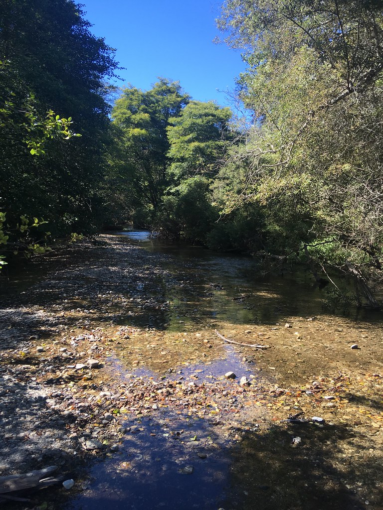 Headlands TrailHikingPhoto: sergei.gussev, CC BY 2.0 (via Flickr)4.4 mi
- Beach TrailHikingPhoto: sergei.gussev, CC BY 2.0 (via Flickr)4.5 mi
 Pfeiffer Big Sur State Park CampgroundCampingPhoto: Slipshod Photog — CC BY 2.0 (via Flickr)8.6 mi
 Junipero Serra PeakSummitPhoto: Thomson200, CC0 (via Wikimedia Commons)~50 min drive
 Cone PeakSummitPhoto: Doug Letterman, CC BY 2.0 (via Wikimedia Commons)~51 min drive
 Fremont PeakSummitPhoto: Thomson200, CC0 (via Wikimedia Commons)~1h drive
 The FingersSummitPhoto: Clyde Charles Brown, CC BY-SA 4.0 (via Wikimedia Commons)~1h 6m drive
 North Chalone PeakSummitPhoto: Miguel Vieira, CC BY 2.0 (via Wikimedia Commons)~1h 7m drive
 Scout PeakSummitPhoto: Clyde Charles Brown, CC BY-SA 4.0 (via Wikimedia Commons)~1h 7m drive
- South Chalone PeakSummitPhoto: Miguel Vieira, CC BY 2.0 (via Wikimedia Commons)~1h 7m drive
 Hawkins PeakSummitPhoto: Clyde Charles Brown, CC BY-SA 4.0 (via Wikimedia Commons)~1h 7m drive
 Mount MadonnaSummitPhoto: Wahn, CC BY-SA 4.0 (via Wikimedia Commons)~1h 21m drive
- Devils PeakSummit~10 min drive
Conditions and forecast
Daily highs and lows, wind and the chance of precipitation at the summit and route start for the next 7 days, from the Open-Meteo model.
Questions about Sierra Hill
How tall is Sierra Hill?
1,544 ft (471 m).
How many routes go to the summit of Sierra Hill?
One: Brazil Ranch Trail.

Ask about this place
Questions about Sierra Hill: conditions, access, timing. Answers say when something isn't known.
