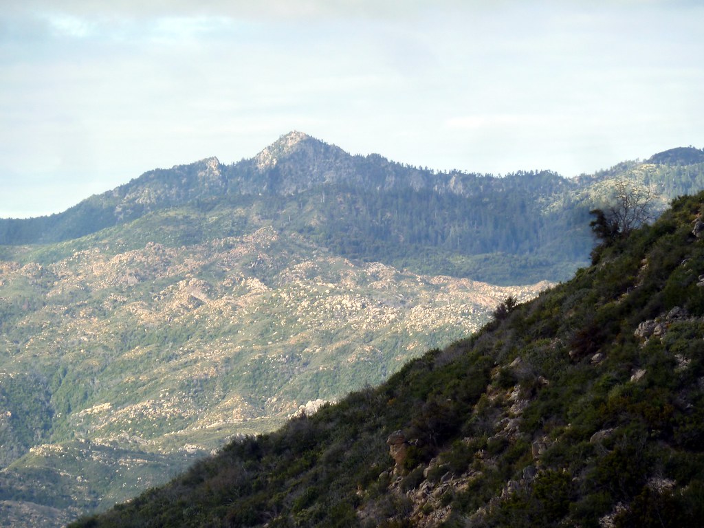
Junipero Serra Peak
 Photo: Thomson200, CC0 (via Wikimedia Commons)
- 5,853 ft
- summit
- 1
- way up
- Forest Service
- managed by
Is Junipero Serra Peak open right now?
Closure in the area
There's a closure order in Monterey Ranger District. It doesn't name Junipero Serra Peak, so check the source for the area it covers (2 listed).
Monterey Ranger District Timber Fire and Plaskett Fire Emergency Closure
Agency closure covering Monterey Ranger District · Order 05-07-51-26-12 · USFS · Monterey Ranger District
Monterey Ranger District Emergency Closure Order with Exceptions
Agency closure covering Monterey Ranger District · Order 05-07-51-26-11 · USFS · Monterey Ranger District
Los Padres Fire Use and Firearm Restrictions
Agency alert covering Los Padres National Forest · Order 05-07-00-26-05 · USFS · Los Padres National Forest
San Carpoforo Beach Prohibition of Overnight Camping and Campfires
Agency alert covering Monterey Ranger District · Order 05-07-51-26-03 · USFS · Monterey Ranger District
Santa Barbara Front Country Fire Use Restrictions
Agency alert covering Los Padres National Forest · Order 05-07-5406-01 · USFS · Los Padres National Forest
As of · Source: USFS · Monterey Ranger District. Agencies don't list every closure — check before you go.
Junipero Serra Peak is a summit of about 5,853 feet in Monterey County, California, inside the Ventana Wilderness. The peak lies within the Monterey Ranger District of Los Padres National Forest, which the Forest Service manages. The nearest town is Fort Hunter Liggett, about 15 miles away. Santa Lucia Peak sits less than a mile away, and the Adobe-Santa Lucia Connector Trail and the Santa Lucia hike are both within about 3 miles. For an overnight base, Memorial Park campground is about 3 miles off.
Conditions and forecast
Daily highs and lows, wind and the chance of precipitation at the summit and route start for the next 7 days, from the Open-Meteo model.
- Summit elevation
- 5,853 ft
- Land manager
- Forest Service
Elevation from USGS 3D Elevation Program terrain data (about 10 m resolution).
Map © Mapbox © OpenStreetMap contributors Questions about Junipero Serra Peak
How tall is Junipero Serra Peak?
5,853 ft (1,784 m).
How many routes go to the summit of Junipero Serra Peak?
One: Santa Lucia Peak.
When is the best time to climb Junipero Serra Peak?
Year-round.
- Twin Peak4,840 ft · California1 route8.1 mi away
- Marble Peak4,014 ft · California2 routes12 mi away
- Twin Peaks3,979 ft · California1 route16 mi away
- Ventana Double Cone4,853 ft · California1 route20 mi away
- Silver Peak3,581 ft · California1 route21 mi away
- Manuel Peak3,486 ft · California1 route22 mi away
 Santa Lucia PeakHikingPhoto: scorpio-tiger, CC BY-SA 2.0 (via Flickr)0.9 mi
 Adobe-Santa Lucia Connector TrailHikingPhoto: Thomson200, CC0 (via Wikimedia Commons)2.9 mi
- Santa LuciaHikingPhoto: Thomson200, CC0 (via Wikimedia Commons)3.1 mi
- Memorial ParkCamping3.3 mi
- EscondidoCamping4.3 mi
 The BeachRock climbingPhoto: Thomson M, CC BY 3.0 (via Wikimedia Commons)4.4 mi
- Arroyo SecoCanoeing4.5 mi
 Wagon CavesRock climbingPhoto: Bob n Renee, CC BY 2.0 (via Flickr)4.5 mi
Source: Roamze catalog (indexable pages within 10 miles, PostGIS distance)
 Cone PeakSummit · ~13 min drivePhoto: Doug Letterman, CC BY 2.0 (via Wikimedia Commons)
 South Chalone PeakSummit · ~41 min drivePhoto: Miguel Vieira, CC BY 2.0 (via Wikimedia Commons)
- North Chalone PeakSummit · ~42 min drivePhoto: Miguel Vieira, CC BY 2.0 (via Wikimedia Commons)
 Scout PeakSummit · ~45 min drivePhoto: Clyde Charles Brown, CC BY-SA 4.0 (via Wikimedia Commons)
 The FingersSummit · ~45 min drivePhoto: Clyde Charles Brown, CC BY-SA 4.0 (via Wikimedia Commons)
 Hawkins PeakSummit · ~46 min drivePhoto: Clyde Charles Brown, CC BY-SA 4.0 (via Wikimedia Commons)
 Fremont PeakSummit · ~1h 13m drivePhoto: Thomson200, CC0 (via Wikimedia Commons)
 San Benito MountainSummit · ~1h 19m drivePhoto: Bureau of Land Management, Public domain (via Wikimedia Commons)
- Twin PeakSummit · ~14 min drive
- Marble PeakSummit · ~20 min drive
