Glacier Trail
- 0.4 mi
- round trip
- 432 ft
- climb
- 11,019 ft
- high point
- Out and back
- route
Is Glacier Trail open right now?
Alert in the area
The Forest Service lists an alert for Shoshone National Forest.
Morrison Jeep Trail
Agency alert covering Shoshone National Forest · USFS · Shoshone National Forest
As of · Source: USFS · Shoshone National Forest. Agencies don't list every closure — check before you go.
Glacier Trail is a short, easy out-and-back hike in Wyoming's Fitzpatrick Wilderness, within the Wind River Ranger District of Shoshone National Forest. The trail is managed by the Forest Service and sits at about 10,793 feet, with a high point of 11,019 feet. The round trip is about 0.74 miles, and the climb is rolling, with a total gain and loss of about 432 feet. The steepest stretch comes at about 0.23 miles, with a grade of about 11 percent. The trail makes a quick addition to a day in the area. It takes about half an hour to complete, and the route is short enough to fit in before or after a longer outing. The nearest neighbor is the Gannett Peak Trail, about 0.4 miles away, and the Gannett Peak and Dinwoody Glacier Area climbing areas lie about 1.4 miles off. Titcomb Basin Area is about 3.9 miles away.
Local outfitters
- Yellowstone Trail RV Park26 mi away
Not on Roamze yet. Their page has how to reach them.
- Gannett Peak TrailHiking0.4 mi
- Gannett PeakRock climbing1.4 mi
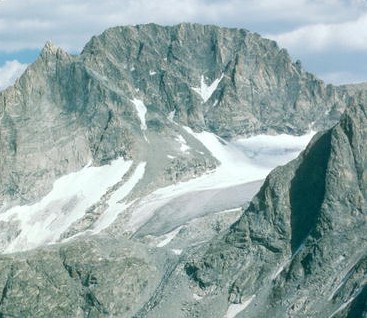
 Dinwoody Glacier Area.Rock climbingPhoto: jfdervin, CC BY-SA 2.0 (via Flickr)1.4 mi
- Titcomb Basin AreaRock climbing3.9 mi
- Ink WellsHiking4.8 mi
- CDT ha- Wyoming AlternatesHiking4.9 mi
- Downs ForkCanoeing6.6 mi
- North Fork Bull Lake CreekCanoeing6.9 mi
Source: Roamze catalog (indexable pages within 10 miles, PostGIS distance)
- Gannett Peak TrailHiking · Next door
- Glacier TrailHiking · ~6 min drive
- Glacier TrailHiking · ~8 min drive
- Titcomb Basin TrailHiking · ~11 min drive
- Indian Pass TrailHiking · ~14 min drive
- Ink WellsHiking · ~8 min drive
- CDT ha- Wyoming AlternatesHiking · ~8 min drive
- Downs ForkHiking · ~12 min drive
- Jackson PeakHiking · ~24 min drive
- Upper Dry CreekHiking · ~10 min drive
Also worth it near here
Map and trail data © OpenStreetMap contributors
