Wyoming · Canoeing · Dubois
Downs Fork
- 4.7 mi
- distance
- 10,683 ft
- high point
Is Downs Fork open right now?
Alert in the area
The Forest Service lists an alert for Shoshone National Forest.
Morrison Jeep Trail
Agency alert covering Shoshone National Forest · USFS · Shoshone National Forest
As of · Source: USFS · Shoshone National Forest. Agencies don't list every closure — check before you go.
Downs Fork is a 4.7-mile paddling stretch near Dubois, Wyoming. It flows year-round. USGS models an average flow of about 31 cfs and a gradient of about 312.4 feet per mile. Land along it is managed by the U.S. Forest Service.
- Ink Wells CutoffHiking1.9 mi
- Dinwoody FallsHiking1.9 mi
- Ink WellsHiking2.3 mi
- Glacier TrailHiking3.4 mi
- Dinwoody CreekCanoeing4.4 mi
- Gannett PeakRock climbing7.2 mi
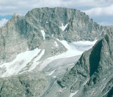
 Dinwoody Glacier Area.Rock climbingPhoto: jfdervin, CC BY-SA 2.0 (via Flickr)8 mi
- Torrey CreekRiver fishing9.4 mi
Source: Roamze catalog (indexable pages within 10 miles, PostGIS distance)
 Wind RiverCanoeing · ~54 min drivePhoto: Original uploader was Billy Hathorn at en.wikipedia, CC BY-SA 3.0 (via Wikimedia Commons)
- Green River Lake Boating SiteBoat launch · ~24 min drive
- North Fork Bull Lake CreekCanoeing · ~18 min drive
- New Fork Lake Boating SiteBoat launch · ~39 min drive
- Dry CreekCanoeing · ~21 min drive
- Upper Fremont Lake Boating SiteBoat launch · ~43 min drive
- Green RiverCanoeing · ~21 min drive
- Green River Access Site 8 Boat LaunchBoat launch · ~47 min drive
- Torrey CreekCanoeing · ~21 min drive
- Green River Access Site 6 Boat LaunchBoat launch · ~49 min drive