Gannett Peak Trail
- 1.8 mi
- round trip
- 2,748 ft
- climb
- 13,710 ft
- high point
- Out and back
- route
Is Gannett Peak Trail open right now?
Alert in the area
The Forest Service lists an alert for Shoshone National Forest.
Morrison Jeep Trail
Agency alert covering Shoshone National Forest · USFS · Shoshone National Forest
As of · Source: USFS · Shoshone National Forest. Agencies don't list every closure — check before you go.
Gannett Peak Trail is a 3.6-mile out-and-back route in Wyoming's Fitzpatrick Wilderness, part of the Wind River Ranger District of Shoshone National Forest. The trail starts at 10,963 feet and climbs to 13,710 feet, a total gain of 2,748 feet, and is rated expert. The climb is front-loaded, with the steepest stretch at about 1.1 miles in, where the grade reaches 53 percent. The route is a serious objective. The high point is Gannett Peak, and the trail is the natural way to approach it. The climb is steep from the start, and the return is the same descent. The Glacier Trail lies just 0.4 miles away, and the Gannett Peak and Dinwoody Glacier Area climbing areas are both within about a mile and a half. Titcomb Basin Area is roughly 3.8 miles off.
Local outfitters
- Yellowstone Trail RV Park25 mi away
Not on Roamze yet. Their page has how to reach them.
Conditions and forecast on Gannett Peak
Daily highs and lows, wind and the chance of precipitation at the summit and route start for the next 7 days, from the Open-Meteo model.
- Glacier TrailHiking0.4 mi
- Gannett PeakRock climbing1.1 mi
 Dinwoody Glacier Area.Rock climbingPhoto: jfdervin, CC BY-SA 2.0 (via Flickr)1.3 mi
- Titcomb Basin AreaRock climbing3.8 mi
- CDT ha- Wyoming AlternatesHiking4.6 mi
- Ink WellsHiking5.1 mi
- Downs ForkCanoeing6.8 mi
- North Fork Bull Lake CreekCanoeing7.2 mi
Source: Roamze catalog (indexable pages within 10 miles, PostGIS distance)
- Glacier TrailHiking · Next door
- Glacier TrailHiking · ~6 min drive
- Titcomb Basin TrailHiking · ~11 min drive
- Indian Pass TrailHiking · ~13 min drive
- CDT ha- Wyoming AlternatesHiking · ~8 min drive
- Ink WellsHiking · ~9 min drive
- Lost LakeHiking · ~12 min drive
- Jackson PeakHiking · ~24 min drive
- Dinwoody FallsHiking · ~14 min drive
- Upper Dry CreekHiking · ~11 min drive
Also worth it near here
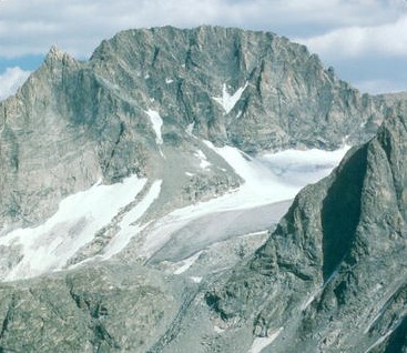 Gannett PeakSummit · ~2 min drivePhoto: U.S. Forest Service, Public domain (via Wikimedia Commons)
- Dinwoody Glacier Area.Rock climbing · ~2 min drivePhoto: jfdervin, CC BY-SA 2.0 (via Flickr)
- Downs ForkCanoeing · ~12 min drive
- Clear Creek Natural BridgeNatural arch · ~20 min drive
- Porcupine Creek FallsWaterfall · ~21 min drive
Route details
- Distance
- 1.8 mi round trip
- Climbing
- About 2,748 ft
- Summit
- 13,800 ft
- Difficulty
- Expert
- Time
- About 2 hours
Other routes up Gannett Peak
Questions about this route
How long is the Gannett Peak Trail on Gannett Peak?
About 1.8 mi round trip.
How much elevation gain is on the Gannett Peak Trail?
About 2,748 ft of climbing round trip.
How hard is the Gannett Peak Trail?
It is rated expert.
How long does the Gannett Peak Trail take?
About 2 hours round trip.
How many routes go up Gannett Peak?
2: Gannett Peak and Gannett Peak Trail.
Map and trail data © OpenStreetMap contributors
