Glacier Trail
- 4.3 mi
- round trip
- 682 ft
- climb
- 11,209 ft
- high point
- Out and back
- route
Is Glacier Trail open right now?
No closures listed
The Forest Service lists no closures for Bridger-Teton National Forest.
As of · Source: USFS · Bridger-Teton National Forest. Agencies don't list every closure — check before you go.
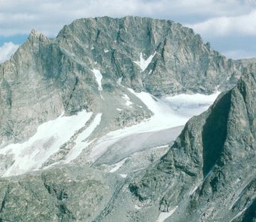
Glacier Trail is a 4.3-mile out-and-back hike in Wyoming's Bridger Wilderness, within the Pinedale Ranger District of the Bridger-Teton National Forest. The Forest Service manages the land, and the route rises from about 10,521 feet to about 11,209 feet, a gain of 682 feet, on a trail rated easy. The trail is open to horses, and bikes are not allowed. That makes it a good fit for a horseback outing or a day on foot. The most comfortable time to go is summer, when typical averages from a nearby weather station run in the low to mid 70s °F. Winter is cold, with typical averages in the teens and 20s. Nearby, the CDT ha-Wyoming Alternates hike lies about 1.3 miles away. Gannett Peak and the Dinwoody Glacier Area climbing areas are both within about 4 miles, and the Gannett Peak Trail is about 4.4 miles off.
Local outfitters
- Yellowstone Trail RV Park22 mi away
Not on Roamze yet. Their page has how to reach them.
Keep exploring — more trails worth the drive
HIKE
CDT ha- Wyoming Alternates
~2 min drive
3.11-mile out-and-back trail in Wyoming with 190 ft elevation gain.
HIKE
Gannett Peak Trail
~8 min drive
3.56-mile out-and-back hike in Wyoming with 2,748 ft elevation gain.
HIKE
Lost Lake
~9 min drive
3.35-mile out-and-back trail to Lost Lake in Wyoming with 777 ft gain.
HIKE
Palmer Lake Trail
~11 min drive
14.23-mile out-and-back trail in Wyoming with 1,186 ft elevation gain.
HIKE
Glacier Trail
~8 min drive
0.74-mile out-and-back trail in Wyoming with 432 ft of elevation gain.
HIKE
Indian Pass Trail
~11 min drive
11.79-mile out-and-back trail in Wyoming with 1,697 ft elevation gain.
HIKE
Seneca Lake Trail
~16 min drive
9.65-mile out-and-back hike in Wyoming with 367 ft elevation gain.
HIKE
Clark Creek
~12 min drive
14.06-mile out-and-back trail in Wyoming with 1,259 ft elevation gain.
HIKE
Lost Camp Trail
~10 min drive
2.56-mile out-and-back trail in Wyoming with 888 ft elevation gain and loss.
HIKE
Jackson Peak
~18 min drive
Route to the summit of Jackson Peak (13,497 ft) from Elkhart Park Trailhead.

Map and trail data © OpenStreetMap contributors
