Tumtum Mountain
 Photo: Seattle Skier, CC BY-SA 4.0 (via Wikimedia Commons)
- 2,001 ft
- summit
- Jun–Sep
- best months
Tumtum Mountain is a summit in Washington, rising to 2,001 feet. The nearest town is Yacolt, about 6 miles away. Summer is the most comfortable time to visit. Typical averages from a nearby weather station show July and August highs around 81 to 82°F with only four or five wet days a month, while winter months bring highs in the mid-40s and rain on 20 or more days. Several other outings sit within a short drive. Chelatchie Creek and Fly Creek, both canoeing spots, are about 3 to 4 miles away. Mt. Mitchell Trail and Huffman Peak are hikes roughly 5 miles off.
Conditions and forecast
Daily highs and lows, wind and the chance of precipitation at the summit for the next 7 days, from the Open-Meteo model.
- Summit elevation
- 2,001 ft
Elevation from USGS 3D Elevation Program terrain data (about 10 m resolution).
We don't know of a mapped trail or route to the summit of Tumtum Mountain. Plan the approach with local maps, a guidebook or a local guide, and check conditions before you go.
Questions about Tumtum Mountain
How tall is Tumtum Mountain?
2,001 ft (610 m).
Is there a trail to the top of Tumtum Mountain?
We don't know of a mapped trail or route to the summit. Plan the approach with local maps, a guidebook or a local guide.
- Mount Mitchell3,965 ft · Washington1 route9.6 mi away
- Siouxon Peak4,169 ft · Washington2 routes11 mi away
- Sturgeon Rock4,164 ft · Washington1 route14 mi away
- Silver Star Mountain4,357 ft · Washington2 routes14 mi away
- Soda Peaks4,534 ft · Washington1 route14 mi away
- Sister Rocks4,264 ft · Washington1 route14 mi away
- Chelatchie CreekCanoeing3.3 mi
- Fly CreekCanoeing3.7 mi
- Mt. Mitchell TrailHiking5 mi
- Huffman PeakHiking5.2 mi
- Big Tree CreekCanoeing5.2 mi
- Lower SiouxonHiking6.2 mi
- Sunset CgCamping9 mi
- Columbia GorgeRock climbing9.8 mi
Source: Roamze catalog (indexable pages within 10 miles, PostGIS distance)
 Mount Saint HelensSummit · ~33 min drivePhoto: U.S. Forest Service- Pacific Northwest Region, Public domain (via Wikimedia Commons)
 Devils PeakSummit · ~33 min drivePhoto: Steven Baltakatei Sandoval, CC BY-SA 4.0 (via Wikimedia Commons)
 Greenleaf PeakSummit · ~40 min drivePhoto: Walter Siegmund (talk), CC BY-SA 3.0 (via Wikimedia Commons)
 Chanticleer PointSummit · ~47 min drivePhoto: Unknown authorUnknown author or not provided, Public domain (via Wikimedia Commons)
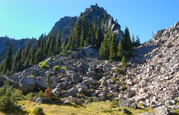 Lemei RockSummit · ~49 min drivePhoto: FizzyUnicorn, CC BY-SA 3.0 (via Wikimedia Commons)
 Rocky ButteSummit · ~50 min drivePhoto: Lyn Topinka of USGS, Public domain (via Wikimedia Commons)
 Powell ButteSummit · ~55 min drivePhoto: Ennetws, Public domain (via Wikimedia Commons)
 Table MountainSummit · ~41 min drivePhoto: Walter Siegmund (talk), CC BY-SA 3.0 (via Wikimedia Commons)
- Mount MitchellSummit · ~16 min drive
- Siouxon PeakSummit · ~18 min drive
Best time to visit Tumtum Mountain
Best months: June–September. Best months have typical highs of 55–85 °F, lows of 30 °F or warmer (32 °F where the station doesn't record snow), at most one snowy day and no more than 12 wet days.
Jan
45° / 34°
21 wet
Feb
49° / 35°
18 wet
Mar
53° / 37°
21 wet
Apr
59° / 40°
19 wet
May
68° / 46°
15 wet
Jun
73° / 50°
11 wet
Jul
81° / 54°
5 wet
Aug
82° / 54°
4 wet
Sep
75° / 51°
9 wet
Oct
62° / 45°
15 wet
Nov
51° / 39°
20 wet
Dec
44° / 34°
21 wet
Typical high / low (°F) and days with rain or snow, 1991–2020. Measured at Cougar 6 E, WA, 10.9 mi away at 659 ft. The station sits about 1,300 ft lower than this place, so expect it a little cooler here. This station doesn't record snowfall. Source: NOAA NCEI U.S. Climate Normals 1991–2020.

