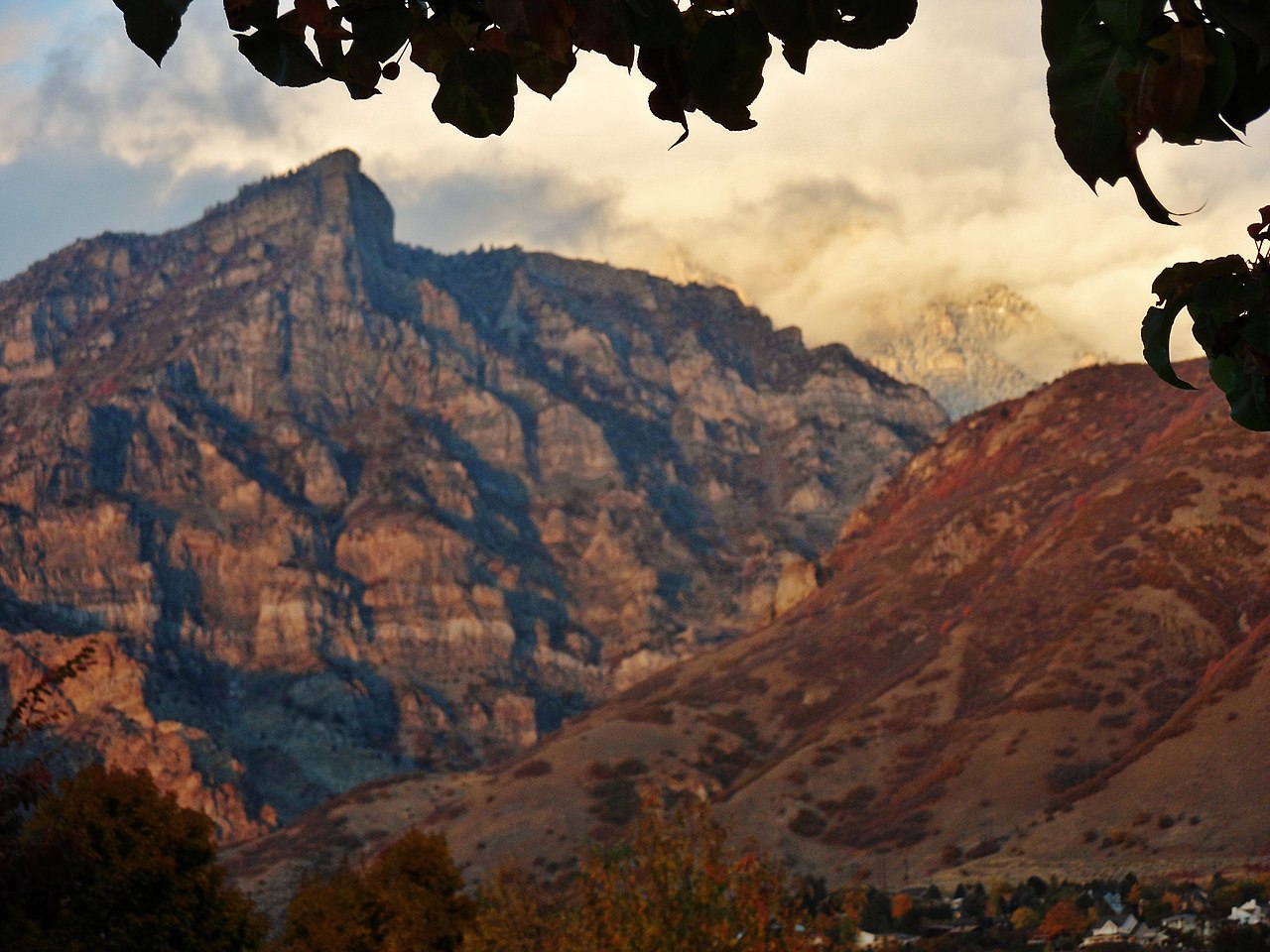
Buckley Mountain
 Photo: An Errant Knight, CC BY-SA 4.0 (via Wikimedia Commons)
- 9,504 ft
- summit
- Forest Service
- managed by
Is Buckley Mountain open right now?
No closures listed
The Forest Service lists no closures for Uinta-Wasatch-Cache National Forest.
As of · Source: USFS · Uinta-Wasatch-Cache National Forest. Agencies don't list every closure — check before you go.
Buckley Mountain is a summit of about 9,504 feet in Utah County, Utah, on the Pleasant Grove Ranger District of the Uinta-Wasatch-Cache National Forest. The Forest Service manages the land, and the nearest town is Provo, about 3.7 miles away. Boardman Spring Trail, a mountain biking route, lies about a mile away, and Slate Canyon Trail is a hike about 1.2 miles off. Climbers can head to Sunset Cliffs, about 2.3 miles away, and Rock Canyon campground sits about 4 miles from the summit.
Conditions and forecast
Daily highs and lows, wind and the chance of precipitation at the summit for the next 7 days, from the Open-Meteo model.
- Summit elevation
- 9,504 ft
- Land manager
- Forest Service
Elevation from USGS 3D Elevation Program terrain data (about 10 m resolution).
We don't know of a mapped trail or route to the summit of Buckley Mountain. Plan the approach with local maps, a guidebook or a local guide, and check conditions before you go.
Questions about Buckley Mountain
How tall is Buckley Mountain?
9,504 ft (2,897 m).
Is there a trail to the top of Buckley Mountain?
We don't know of a mapped trail or route to the summit. Plan the approach with local maps, a guidebook or a local guide.
 Provo Peak11,059 ft · Utah1 route2.7 mi awayPhoto: Epachamo at English Wikipedia, Public domain (via Wikimedia Commons)
- Round Peak5,604 ft · Utah1 route2.7 mi away
 Y Mountain8,556 ft · Utah1 route3.1 mi awayPhoto: Lunkwill at English Wikipedia, Public domain (via Wikimedia Commons)
 Powerhouse Mountain7,988 ft · Utah1 route4.2 mi awayPhoto: Bobjgalindo, CC BY-SA 4.0 (via Wikimedia Commons)
 Kyhv Peak7,874 ft · Utah1 route4.3 mi awayPhoto: Pastelitodepapa, CC0 (via Wikimedia Commons)
 Spanish Fork Peak10,185 ft · Utah1 route9.3 mi awayPhoto: An Errant Knight, CC BY-SA 4.0 (via Wikimedia Commons)
- Boardman Spring TrailMountain biking1.1 mi
- Slate Canyon TrailHiking1.2 mi
- Sunset CliffsRock climbing2.3 mi
- The CoolerRock climbing3.6 mi
 Hobble CreekCanoeingPhoto: An Errant Knight, CC BY-SA 4.0 (via Wikimedia Commons)3.6 mi
- Mill RaceCanoeing3.6 mi
- Rock CanyonCamping4 mi
- WhitingCamping6.5 mi
Source: Roamze catalog (indexable pages within 10 miles, PostGIS distance)
- Provo PeakSummit · ~5 min drivePhoto: Epachamo at English Wikipedia, Public domain (via Wikimedia Commons)
- Y MountainSummit · ~5 min drivePhoto: Lunkwill at English Wikipedia, Public domain (via Wikimedia Commons)
- Powerhouse MountainSummit · ~7 min drivePhoto: Bobjgalindo, CC BY-SA 4.0 (via Wikimedia Commons)
- Kyhv PeakSummit · ~7 min drivePhoto: Pastelitodepapa, CC0 (via Wikimedia Commons)
 Ether PeakSummit · ~10 min drivePhoto: An Errant Knight, CC BY-SA 4.0 (via Wikimedia Commons)
 Cascade MountainSummit · ~11 min drivePhoto: An Errant Knight, CC BY-SA 4.0 (via Wikimedia Commons)
- Spanish Fork PeakSummit · ~16 min drivePhoto: An Errant Knight, CC BY-SA 4.0 (via Wikimedia Commons)
 Mount TimpanogosSummit · ~22 min drivePhoto: Eric Ward from Provo, UT, USA, CC BY-SA 2.0 (via Wikimedia Commons)
 Little MountainSummit · ~25 min drivePhoto: An Errant Knight, CC BY-SA 4.0 (via Wikimedia Commons)
 Mahogany MountainSummit · ~26 min drivePhoto: Don LaVange from Pleasant Grove, UT, USA, CC BY-SA 2.0 (via Wikimedia Commons)
