Mt Timpanogos Cg
Campground
Campground · 2.3 mi from the trail
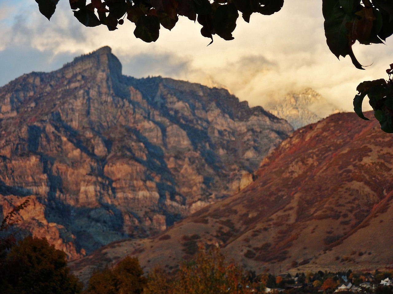
 Photo: Eric Ward from Provo, UT, USA, CC BY-SA 2.0 (via Wikimedia Commons)
No closures listed
The Forest Service lists no closures for Uinta-Wasatch-Cache National Forest.
As of · Source: USFS · Uinta-Wasatch-Cache National Forest. Agencies don't list every closure — check before you go.
Mount Timpanogos is a summit of about 11,744 feet in Utah County, Utah, inside the Mount Timpanogos Wilderness. The peak lies within the Pleasant Grove Ranger District of the Uinta-Wasatch-Cache National Forest, which the Forest Service manages. The nearest town is Sundance, about 3 miles away. Timpanogos Summit, a mountain biking route, is about half a mile away, and Everest Ridge is a hike about 1.4 miles off. For an overnight base, Mt Timpanogos Campground sits about 2.3 miles away, and the Mammoth Wall climbing area is about 3.4 miles away.
Mt Timpanogos Cg
Campground
 If it rainsBen P L from Provo, USA, CC BY-SA 2.0 · Wikimedia Commons
Orem Heritage Museum
Museum
Places © OpenStreetMap contributors, Places © Overture Maps Foundation · Photos: Ben P L from Provo, USA, CC BY-SA 2.0 (commons)
More in HeberDaily highs and lows, wind and the chance of precipitation at the summit and route start for the next 7 days, from the Open-Meteo model.
Elevation from USGS 3D Elevation Program terrain data (about 10 m resolution).
11,744 ft (3,580 m).
One: Timpanogos Summit.
July 1 – October 31.



 Mammoth WallRock climbingPhoto: photophat, CC BY 3.0 (via Wikimedia Commons)3.4 miCretaceous CragRock climbingPhoto: photophat, CC BY 3.0 (via Wikimedia Commons)3.7 mi
Source: Roamze catalog (indexable pages within 10 miles, PostGIS distance)
Mahogany MountainSummit · ~7 min drivePhoto: Don LaVange from Pleasant Grove, UT, USA, CC BY-SA 2.0 (via Wikimedia Commons) Cascade MountainSummit · ~11 min drivePhoto: An Errant Knight, CC BY-SA 4.0 (via Wikimedia Commons)Kyhv PeakSummit · ~14 min drivePhoto: Pastelitodepapa, CC0 (via Wikimedia Commons)Y MountainSummit · ~16 min drivePhoto: Lunkwill at English Wikipedia, Public domain (via Wikimedia Commons)The PfeifferhornSummit · ~18 min drivePhoto: Itineranttrader, Public domain (via Wikimedia Commons)
 Lone PeakSummit · ~19 min drivePhoto: Climbjm at English Wikipedia, Public domain (via Wikimedia Commons)
 Provo PeakSummit · ~19 min drivePhoto: Epachamo at English Wikipedia, Public domain (via Wikimedia Commons)
 Hidden PeakSummit · ~20 min drivePhoto: VeggieGarden, CC BY-SA 4.0 (via Wikimedia Commons)
 Mount BaldySummit · ~21 min drivePhoto: michaelwm25, CC BY 3.0 (via Wikimedia Commons)
 Buckley MountainSummit · ~22 min drivePhoto: An Errant Knight, CC BY-SA 4.0 (via Wikimedia Commons)
Also worth it near here
 TimpoonekeMountain biking · ~2 min drivePhoto: photophat, CC BY 3.0 (via Wikimedia Commons)
 Scout FallsWaterfall · ~3 min drivePhoto: An Errant Knight, CC BY-SA 4.0 (via Wikimedia Commons)
 Stewarts Cascade TrailHiking · ~4 min drivePhoto: Christopher Michel, CC BY 2.0 (via Wikimedia Commons)
