Big Rock Candy Mountain
 Photo: hakkun, CC BY-SA 3.0 (via Wikimedia Commons)
- 7,016 ft
- summit
- Apr–Jun, Sep–Oct
- best months
Is Big Rock Candy Mountain open right now?
Alert in the area
The Forest Service lists 2 alerts for Fishlake National Forest.
PST 66 Rock Canyon Trail Temporarily Closed
Agency alert covering Fishlake National Forest · USFS · Fishlake National Forest
TERMINATION OF STAGE 1 FIRE RESTRICTION ORDER
Agency alert covering Fishlake National Forest · Order 0408-26-10 · USFS · Fishlake National Forest
As of · Source: USFS · Fishlake National Forest. Agencies don't list every closure — check before you go.
Big Rock Candy Mountain is a summit of 7,016 feet in the Beaver Ranger District of Fishlake National Forest in Utah, about 5 miles from the town of Marysvale. The most comfortable months for a visit are typically late spring and early fall. Typical averages from a nearby weather station in Marysvale show May highs around 73°F and September highs around 80°F, while July averages about 90°F and winter lows drop to around 16°F. That station sits roughly 1,200 feet below the summit, so temperatures on top run cooler. The Big Rock Candy Mountain Trail lies about 4 miles away, and the Sargent Mtn. - Bear Hollow and Joe Lott hikes are each within about 5 miles. For an overnight stay, Castle Rock - Rec Site is about 6 miles off.
Conditions and forecast
Daily highs and lows, wind and the chance of precipitation at the summit for the next 7 days, from the Open-Meteo model.
- Summit elevation
- 7,016 ft
Elevation from USGS 3D Elevation Program terrain data (about 10 m resolution).
We don't know of a mapped trail or route to the summit of Big Rock Candy Mountain. Plan the approach with local maps, a guidebook or a local guide, and check conditions before you go.
Questions about Big Rock Candy Mountain
How tall is Big Rock Candy Mountain?
7,016 ft (2,138 m).
Is there a trail to the top of Big Rock Candy Mountain?
We don't know of a mapped trail or route to the summit. Plan the approach with local maps, a guidebook or a local guide.
 Delano Peak12,172 ft · Utah2 routes11 mi awayPhoto: ALK at English Wikipedia, CC BY-SA 3.0 (via Wikimedia Commons)
- Monument Peak11,048 ft · Utah2 routes18 mi away
- Whiskey Knoll11,539 ft · Utah1 route31 mi away
- Coffee Peak10,000 ft · Utah1 route39 mi away
- Adams Head10,428 ft · Utah1 route40 mi away
- Hilgard Mountain11,534 ft · Utah1 route41 mi away
 Big Rock Candy Mountain TrailHikingPhoto: Ken Lund from Reno, NV, USA, CC BY-SA 2.0 (via Wikimedia Commons)4.3 mi
- Sargent Mtn. - Bear HollowHiking4.6 mi
- Joe LottHiking4.8 mi
- Sam HenrieHiking4.9 mi
- Marysvale #02 WestHiking5 mi
- Castle Rock - Rec SiteCamping6 mi
- Clear CreekCanoeing7 mi
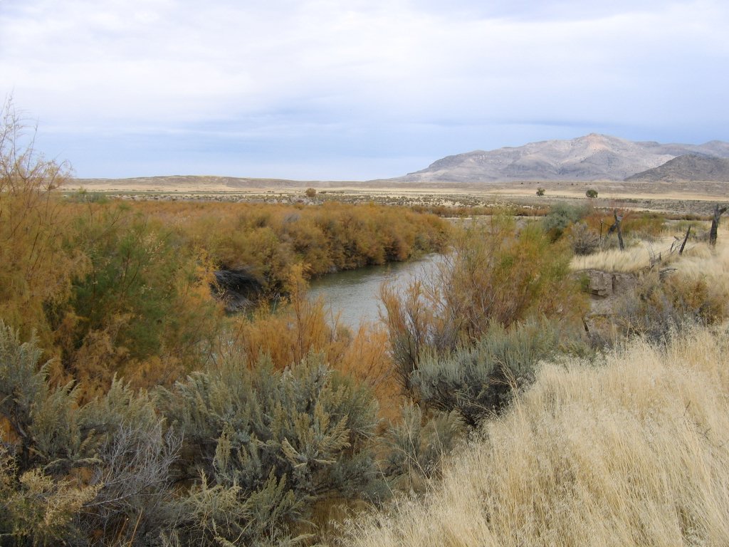 Sevier RiverCanoeingPhoto: w:Flickr user rcstanley, CC BY 2.0 (via Wikimedia Commons)9.4 mi
Source: Roamze catalog (indexable pages within 10 miles, PostGIS distance)
 Mount BelknapSummit · ~17 min drivePhoto: Intermountain Forest Service, USDA Region 4 Photography, Public domain (via Wikimedia Commons)
- Delano PeakSummit · ~19 min drivePhoto: ALK at English Wikipedia, CC BY-SA 3.0 (via Wikimedia Commons)
 Anderson MountainSummit · ~60 min drivePhoto: YubYub41, CC BY-SA 3.0 (via Wikimedia Commons)
 Pahvant ButteSummit · ~1h 18m drivePhoto: Photo by Willie Scott, (Smithsonian Institution)., Public domain (via Wikimedia Commons)
 Cathedral MountainSummit · ~1h 24m drivePhoto: Kevin Neubauer, CC BY 2.0 (via Wikimedia Commons)
- Tip TopSummit · ~13 min drive
- Monument PeakSummit · ~31 min drive
- Whiskey KnollSummit · ~53 min drive
- Cottonwood PeakSummit · ~1h 4m drive
- Coffee PeakSummit · ~1h 7m drive
Also worth it near here
- Candy Mountain Resort RV ParkCamping · ~1 min drive
- Big Rock Candy Mountain TrailHiking · ~7 min drivePhoto: Ken Lund from Reno, NV, USA, CC BY-SA 2.0 (via Wikimedia Commons)
- Sevier RiverCanoeing · ~16 min drivePhoto: w:Flickr user rcstanley, CC BY 2.0 (via Wikimedia Commons)
 The PocketMountain biking · ~17 min drivePhoto: Andrey Zharkikh, CC BY 2.0 (via Wikimedia Commons)
Best time to visit Big Rock Candy Mountain
Best months: April–June and September–October. Best months have typical highs of 55–85 °F, lows of 30 °F or warmer (32 °F where the station doesn't record snow), at most one snowy day and no more than 12 wet days.
Jan
43° / 16°
5 wet
Feb
48° / 20°
6 wet
Mar
56° / 26°
6 wet
Apr
63° / 32°
6 wet
May
73° / 38°
5 wet
Jun
84° / 46°
3 wet
Jul
90° / 52°
5 wet
Aug
87° / 51°
7 wet
Sep
80° / 42°
6 wet
Oct
67° / 32°
5 wet
Nov
54° / 23°
4 wet
Dec
42° / 16°
4 wet
Typical high / low (°F) and days with rain or snow, 1991–2020. Measured at Marysvale, UT, 4.8 mi away at 5,845 ft. The station sits about 1,200 ft lower than this place, so expect it a little cooler here. This station doesn't record snowfall. Source: NOAA NCEI U.S. Climate Normals 1991–2020.
