Delano Peak
 Photo: ALK at English Wikipedia, CC BY-SA 3.0 (via Wikimedia Commons)
- 12,172 ft
- summit
- 2
- ways up
- Forest Service
- managed by
Is Delano Peak open right now?
Alert in the area
The Forest Service lists 2 alerts for Fishlake National Forest.
PST 66 Rock Canyon Trail Temporarily Closed
Agency alert covering Fishlake National Forest · USFS · Fishlake National Forest
TERMINATION OF STAGE 1 FIRE RESTRICTION ORDER
Agency alert covering Fishlake National Forest · Order 0408-26-10 · USFS · Fishlake National Forest
As of · Source: USFS · Fishlake National Forest. Agencies don't list every closure — check before you go.
Delano Peak is a summit of about 12,172 feet in Piute County, Utah, within the Beaver Ranger District of Fishlake National Forest. The Forest Service manages the land, and the nearest town is Marysvale, about 7.5 miles away. The peak sits close to several trails. The Poison Creek - South Fork Bullion Trail passes just 0.1 mile from the summit, and the Delano Peak Trail, a mountain biking route, is about 0.9 mile away. The Pocket, another mountain biking spot, is about 1.2 miles off. For an overnight base, Big John's Dispersed Camping is about 2.3 miles away. The Beaver Ranger District lake fishing area is about 3.1 miles away.
Conditions and forecast
Daily highs and lows, wind and the chance of precipitation at the summit and route start for the next 7 days, from the Open-Meteo model.
- Summit elevation
- 12,172 ft
- Land manager
- Forest Service
Elevation from USGS 3D Elevation Program terrain data (about 10 m resolution).
- Poison Creek - South Fork Bullion TrailHardabout 2,035 ft of climbing7.7 mi round trip
- Poison Creek - So Fk BullionModerateabout 1,601 ft of climbing3.8 mi round trip
Compare the routes Poison Creek - South Fork Bullion Trail Poison Creek - So Fk Bullion Climbing About 2,035 ft About 1,601 ft Round trip 7.7 mi 3.8 mi Difficulty Hard Moderate Terrain Hike Hike Season — July 1 – October 31 Map © Mapbox © OpenStreetMap contributors Questions about Delano Peak
How tall is Delano Peak?
12,172 ft (3,710 m).
How many routes go to the summit of Delano Peak?
2: Poison Creek - South Fork Bullion Trail and Poison Creek - So Fk Bullion.
What is the shortest route up Delano Peak?
Poison Creek - So Fk Bullion, about 3.8 mi round trip.
When is the best time to climb Delano Peak?
July 1 – October 31.
- Poison Creek - South Fork Bullion TrailHiking0.1 mi
 Delano Peak TrailMountain bikingPhoto: Derrellwilliams, CC0 (via Wikimedia Commons)0.9 mi
 The PocketMountain bikingPhoto: Andrey Zharkikh, CC BY 2.0 (via Wikimedia Commons)1.2 mi
- Big John's Dispersed CampingCamping2.3 mi
- Beaver Ranger DistrictLake fishing3.1 mi
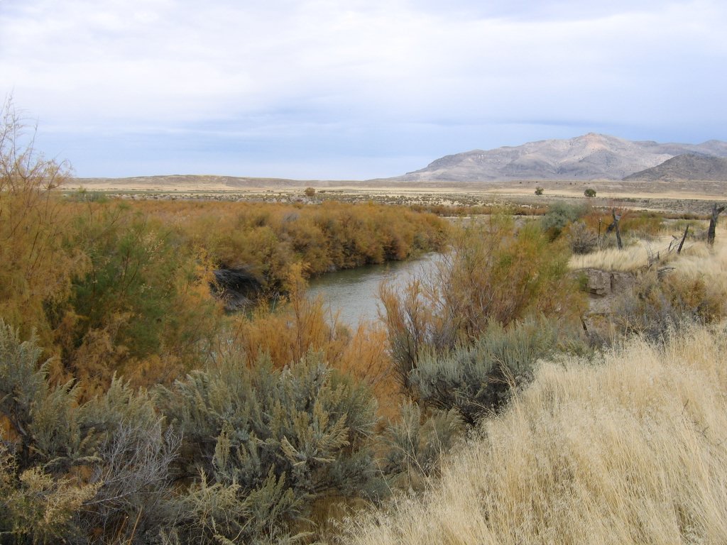 Sevier RiverCanoeingPhoto: w:Flickr user rcstanley, CC BY 2.0 (via Wikimedia Commons)5.9 mi
- Indian Creek Dispersed CampingCamping7.2 mi
- Big Flat Dispersed CampingCamping7.3 mi
Source: Roamze catalog (indexable pages within 10 miles, PostGIS distance)
 Mount BelknapSummit · ~7 min drivePhoto: Intermountain Forest Service, USDA Region 4 Photography, Public domain (via Wikimedia Commons)
 Big Rock Candy MountainSummit · ~19 min drivePhoto: hakkun, CC BY-SA 3.0 (via Wikimedia Commons)
 Anderson MountainSummit · ~41 min drivePhoto: YubYub41, CC BY-SA 3.0 (via Wikimedia Commons)
 Flake MountainSummit · ~1h 15m drivePhoto: An Errant Knight, CC BY-SA 4.0 (via Wikimedia Commons)
 P HillSummit · ~1h 16m drivePhoto: An Errant Knight, CC BY-SA 4.0 (via Wikimedia Commons)
- Tip TopSummit · ~15 min drive
- Monument PeakSummit · ~47 min drive
- Cottonwood PeakSummit · ~49 min drive
- Adams HeadSummit · ~54 min drive
- Whiskey KnollSummit · ~1h 8m drive
Also worth it near here
- Delano Peak TrailMountain biking · ~2 min drivePhoto: Derrellwilliams, CC0 (via Wikimedia Commons)
- Bosman-Big John Flat TrailheadCamping · ~3 min drive
 Skyline National Recreation TrHiking · ~4 min drivePhoto: Andrey Zharkikh, CC BY 2.0 (via Wikimedia Commons)
- Beaver Ranger DistrictLake fishing · ~5 min drive
