Sevier River
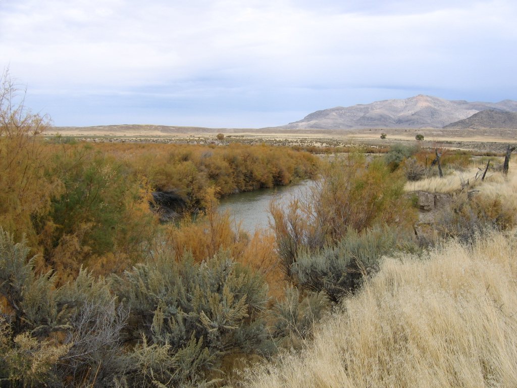 Photo: w:Flickr user rcstanley, CC BY 2.0 (via Wikimedia Commons)
- 163 mi
- distance
- 7,311 ft
- high point
- Jun–Oct
- best months
Is Sevier River open right now?
Alert in the area
The Forest Service lists 2 alerts for Fishlake National Forest.
PST 66 Rock Canyon Trail Temporarily Closed
Agency alert covering Fishlake National Forest · USFS · Fishlake National Forest
TERMINATION OF STAGE 1 FIRE RESTRICTION ORDER
Agency alert covering Fishlake National Forest · Order 0408-26-10 · USFS · Fishlake National Forest
As of · Source: USFS · Fishlake National Forest. Agencies don't list every closure — check before you go.
The Sevier River canoeing route lies within the Beaver Ranger District of Fishlake National Forest in Utah, managed by the Forest Service. It is a paddling stretch of the river rather than a short trail, and its length of about 163 miles makes it a planning choice for a multi-day trip. Summer is the most comfortable season to paddle. Typical averages from a nearby weather station show July highs around 80°F with lows near 52°F, and September still runs to highs of about 71°F. Winters are cold and snowy, with January highs averaging about 37°F and lows near 16°F. Trappers Creek and the Pipeline hike are both within about 2 miles of the river. Indian Creek Dispersed Camping is about 3 miles away, and Beaver Ranger District lake fishing is about 3 miles off.
Local outfitters
- Big Rock Adventure10 mi away
- Big Rock Candy Mountain10 mi away
Not on Roamze yet. Their page has how to reach them.
- Trappers CreekHiking1.5 mi
- PipelineHiking1.7 mi
- Big Meadow - Copper Belt RoadHiking2.2 mi
- Picnic CreekMountain biking2.7 mi
- Beaver Ranger DistrictLake fishing2.9 mi
- Indian Creek Dispersed CampingCamping3.3 mi
- Big John's Dispersed CampingCamping6.9 mi
- Castle Rock - Rec SiteCamping9.8 mi
Source: Roamze catalog (indexable pages within 10 miles, PostGIS distance)
 Otter CreekCanoeing · ~50 min drivePhoto: Murray Foubister, CC BY-SA 2.0 (via Wikimedia Commons)
- Clear CreekCanoeing · ~17 min drive
- Beaver RiverCanoeing · ~43 min drive
- East Fork Sevier RiverCanoeing · ~1h 12m drive
- Koosharem Rec SiteBoat launch · ~57 min drive
- Johnson Reservoir Rec Site Boating SiteBoat launch · ~1h 16m drive
- Forsyth Reservoir Boat Ramp Rec SiteBoat launch · ~1h 25m drive
- Mill Meadow Reservoir Boat Ramp Rec SiteBoat launch · ~1h 21m drive
Also worth it near here
 Mount BelknapSummit · ~3 min drivePhoto: Intermountain Forest Service, USDA Region 4 Photography, Public domain (via Wikimedia Commons)
- Beaver Ranger DistrictLake fishing · ~5 min drive
 South Fork of North CreekHiking · ~5 min drivePhoto: Andrey Zharkikh, CC BY 2.0 (via Wikimedia Commons)
 Blue LakeMountain biking · ~8 min drivePhoto: Andrey Zharkikh, CC BY 2.0 (via Wikimedia Commons)
Best time to visit Sevier River
Best months: June–October. Best months have typical highs of 55–85 °F, lows of 30 °F or warmer (32 °F where the station doesn't record snow), at most one snowy day and no more than 12 wet days.
Jan
37° / 16°
7 wet · 7 snow
Feb
40° / 17°
7 wet · 6 snow
Mar
47° / 23°
7 wet · 6 snow
Apr
53° / 28°
7 wet · 4 snow
May
63° / 36°
6 wet · 2 snow
Jun
75° / 45°
4 wet
Jul
80° / 52°
7 wet
Aug
78° / 51°
9 wet
Sep
71° / 43°
6 wet
Oct
58° / 33°
5 wet · 1 snow
Nov
45° / 24°
5 wet · 3 snow
Dec
36° / 16°
7 wet · 6 snow
Typical high / low (°F) and days with rain or snow, 1991–2020. Measured at Beaver Canyon Pwr House, UT, 12.4 mi away at 7,275 ft. Source: NOAA NCEI U.S. Climate Normals 1991–2020.
