South Creek Road
- 2.1 mi
- round trip
- 339 ft
- climb
- 8,162 ft
- high point
- Out and back
- route
- Jun–Sep
- best months
Is South Creek Road open right now?
Alert in the area
The Forest Service lists 3 alerts for Dixie National Forest.
Duck Creek OHV Trail Closure
Agency alert covering Dixie National Forest · Order 0407-26-11 · USFS · Dixie National Forest
Pine Valley Ranger District Area and Trail and Road Closure
Agency alert covering Dixie National Forest · Order 0407-26-01 · USFS · Dixie National Forest
Cedar City Temporary Road Closure Webster Flat Road (Order 0407-25-02)
Agency alert covering Dixie National Forest · Order 0407-25-02 · USFS · Dixie National Forest
As of · Source: USFS · Dixie National Forest. Agencies don't list every closure — check before you go.
South Creek Road is an easy out-and-back hike in southern Utah, set in the Escalante Ranger District of Dixie National Forest. The route covers about 4 miles, with a total elevation gain of 339 feet from the low point at 7,810 feet to the high at 8,162 feet. Summer is the most comfortable time to go. Typical averages from the Bryce Canyon airport weather station, about 13 miles away, show July highs around 81°F with lows near 45°F. That station sits roughly 576 feet below the hike's high point, so temperatures on the trail run slightly cooler. The Great Western Trail - Sweetwater Section lies just 0.1 mile away, and Mud Spring Draw Road is about 1.8 miles off. Climbers can head to Shangri La, about 3.2 miles away, and Pine Lake Campground is about 4.4 miles away for an overnight stay.
Local outfitters
- Under Canvas4 mi away
- Bryce Canyon Horseback Tours15 mi away
Not on Roamze yet. Their page has how to reach them.
- Great Western Trail - Sweetwater SectionHiking0.1 mi
- Mud Spring Draw RoadHiking1.8 mi
- Shangri LaRock climbing3.2 mi
- The Air StripRock climbing3.5 mi
- The Research StationRock climbing3.8 mi
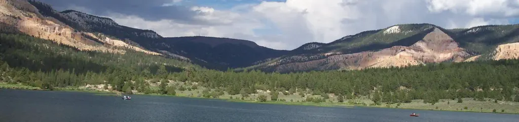 Pine Lake CampgroundCampingPhoto: Recreation.gov (RIDB) / public domain4.4 mi
- Round Willow BottomLake fishing8.8 mi
- Long Willow BottomLake fishing8.8 mi
Source: Roamze catalog (indexable pages within 10 miles, PostGIS distance)
- Great Western Trail - Sweetwater SectionHiking · ~2 min drive
- Mud Spring Draw RoadHiking · ~3 min drive
- John's Valley RoadHiking · ~7 min drive
- Great Western Trail - Griffin Top SectionHiking · ~13 min drive
- Great Western Trail - Sweetwater SectionHiking · ~3 min drive
- Great Western Trail - Horse Creek SectionHiking · ~8 min drive
- Water Canyon TrailHiking · ~15 min drive
- Pine Lake TrailHiking · ~8 min drive
- Great Western Trail - Cameron Wash SectionHiking · ~10 min drive
- White Creek TrailHiking · ~15 min drive
Also worth it near here
- Pine Lake CampgroundCamping · ~8 min drive
 The Dark Continent AreaRock climbing · ~9 min drivePhoto: Wojtek Szkutnik, CC BY 3.0 (via Wikimedia Commons)
- Halls Creek TrailMountain biking · ~12 min drive
 Powell PointSummit · ~15 min drivePhoto: A. E. Crane, U.S. Department of Transportation, Public domain (via Wikimedia Commons)
Best time to visit South Creek Road
Best months: June–September. Best months have typical highs of 55–85 °F, lows of 30 °F or warmer (32 °F where the station doesn't record snow), at most one snowy day and no more than 12 wet days.
Jan
36° / 6°
6 wet
Feb
38° / 10°
7 wet
Mar
45° / 18°
7 wet
Apr
54° / 24°
6 wet
May
64° / 31°
6 wet
Jun
76° / 37°
4 wet
Jul
81° / 45°
9 wet
Aug
79° / 45°
11 wet
Sep
71° / 37°
7 wet
Oct
59° / 26°
5 wet
Nov
46° / 15°
5 wet
Dec
35° / 6°
6 wet
Typical high / low (°F) and days with rain or snow, 1991–2020. Measured at Bryce Canyon Ap, UT, 12.9 mi away at 7,586 ft. The station sits about 600 ft lower than this place, so expect it a little cooler here. This station doesn't record snowfall. Source: NOAA NCEI U.S. Climate Normals 1991–2020.
Map and trail data © OpenStreetMap contributors
