John's Valley Road
- 11.8 mi
- round trip
- 323 ft
- climb
- 7,627 ft
- high point
- Out and back
- route
- Jun–Sep
- best months
John's Valley Road is a hard hike on state trust lands in southern Utah, within the State Trust Lands Johns Valley Block. The route is an out-and-back that covers about 23.5 miles, with a total elevation gain of 323 feet, and it is managed by the State Land Board. The trail starts at a low point of about 7,497 feet and climbs to a high of about 7,627 feet. That makes it a long, low-elevation route rather than a steep climb, but the distance adds up to a full day on foot. Summer is the most comfortable time to go. Typical averages from the nearby Bryce Canyon airport weather station show July highs around 81°F with lows near 45°F, while winter highs stay in the mid-30s. Pine Lake Campground, about 5.8 miles away, is the closest place to camp. The Great Western Trail - Sweetwater Section and Mud Spring Draw Road are both within a few miles, and the East Fork Sevier River offers paddling about 6.8 miles off.
Local outfitters
- Under Canvasunder a mile away
- Bryce Canyon Horseback Tours12 mi away
Not on Roamze yet. Their page has how to reach them.
- Great Western Trail - Sweetwater SectionHiking1.9 mi
- Mud Spring Draw RoadHiking2.3 mi
- South Creek RoadHiking3.8 mi
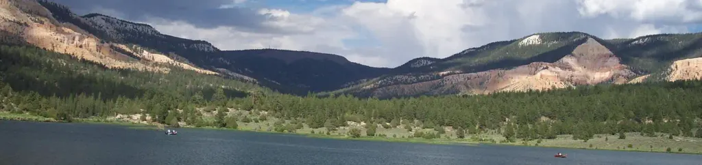 Pine Lake CampgroundCampingPhoto: Recreation.gov (RIDB) / public domain5.8 mi
- Shangri LaRock climbing6.7 mi
- East Fork Sevier RiverCanoeing6.8 mi
- The Air StripRock climbing6.9 mi
- The Research StationRock climbing7.2 mi
Source: Roamze catalog (indexable pages within 10 miles, PostGIS distance)
- Mossy Cave Trailhead WaysideHiking · ~19 min drive
- Water Canyon waysideHiking · ~20 min drive
- Great Western Trail - Sweetwater SectionHiking · ~5 min drive
- Great Western Trail - Cameron Wash SectionHiking · ~12 min drive
- Mossy CaveHiking · ~19 min drive
- Tropic Ditch waysideHiking · ~20 min drive
- North Fork Prospect Creek TraHiking · ~12 min drive
- Burro Canyon TrailHiking · ~12 min drive
 Ruby Rim LoopHiking · ~21 min drivePhoto: Roger Sylvia, CC BY-SA 3.0 (via Wikimedia Commons)
- Mossy Cave Hike the Hoodoos waysideHiking · ~20 min drive
Also worth it near here
Best time to visit John's Valley Road
Best months: June–September. Best months have typical highs of 55–85 °F, lows of 30 °F or warmer (32 °F where the station doesn't record snow), at most one snowy day and no more than 12 wet days.
Jan
36° / 6°
6 wet
Feb
38° / 10°
7 wet
Mar
45° / 18°
7 wet
Apr
54° / 24°
6 wet
May
64° / 31°
6 wet
Jun
76° / 37°
4 wet
Jul
81° / 45°
9 wet
Aug
79° / 45°
11 wet
Sep
71° / 37°
7 wet
Oct
59° / 26°
5 wet
Nov
46° / 15°
5 wet
Dec
35° / 6°
6 wet
Typical high / low (°F) and days with rain or snow, 1991–2020. Measured at Bryce Canyon Ap, UT, 10.1 mi away at 7,586 ft. This station doesn't record snowfall. Source: NOAA NCEI U.S. Climate Normals 1991–2020.


Map and trail data © OpenStreetMap contributors
