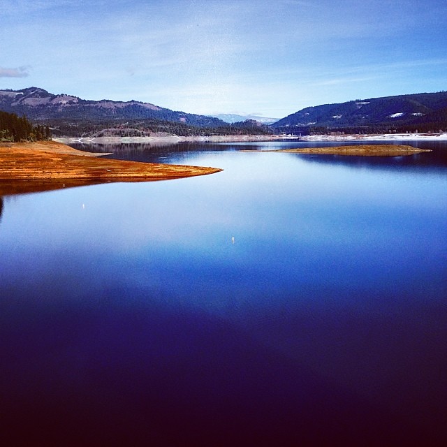
Trail Creek
- 10.8 mi
- distance
- 3,502 ft
- high point
- May–Jun, Sep–Oct
- best months
Trail Creek is a 11-mile paddling stretch in Oregon, about 4.3 miles from the town of Trail. It flows year-round, with an average flow of about 68 cubic feet per second and a gradient of about 191.8 feet per mile, according to USGS models. Summer is the most comfortable time to paddle. Typical averages from a nearby weather station show July and August highs around 89°F with only two or three wet days a month, while winter months bring highs in the 50s and rain on more than half the days. Climbers will find Aurora Buttress and Cloud Buttress about 4.8 miles away. Threehorn Campground and the Yellow Rock Trail are both about 6.8 miles off.
Local outfitters
- The Fishin Hole Fly Shop7 mi away
- Rogue Rafting Company22 mi away
Not on Roamze yet. Their page has how to reach them.
- (1)Aurora ButtressRock climbing4.7 mi
- (2)Cloud ButtressRock climbing4.8 mi
- (3)Long WallRock climbing4.8 mi
- Threehorn CampgroundCamping6.8 mi
- Yellow Rock TrailHiking6.8 mi
- Trail AHiking7.2 mi
- Viewpoint Mike TrailHiking8 mi
- Evans CreekCanoeing8.4 mi
Source: Roamze catalog (indexable pages within 10 miles, PostGIS distance)
 Elk CreekCanoeing · ~20 min drivePhoto: Little Mountain 5, CC BY-SA 3.0 (via Wikimedia Commons)
- Rogue Elk Boat RampBoat launch · ~9 min drive
 Little Butte CreekCanoeing · ~28 min drivePhoto: An employee of the USDA Forest Service, Public domain (via Wikimedia Commons)
- Shady Cove Boat RampBoat launch · ~11 min drive
 South Umpqua RiverCanoeing · ~45 min drivePhoto: McD22, CC BY 2.0 (via Wikimedia Commons)
- Casey Park Boat RampBoat launch · ~13 min drive
 Grave CreekCanoeing · ~46 min drivePhoto: James Norman, Photographer, Public domain (via Wikimedia Commons)
- Cole Rivers Hatchery Boat RampBoat launch · ~14 min drive
 Cow CreekCanoeing · ~47 min drivePhoto: Erik Talyor, National Scenic Byways Program, United States Department of Transportation, Public domain (via Wikimedia Commons)
- Takelma Boat RampBoat launch · ~16 min drive
Best time to visit Trail Creek
Best months: May–June and September–October. Best months have typical highs of 55–85 °F, lows of 30 °F or warmer (32 °F where the station doesn't record snow), at most one snowy day and no more than 12 wet days.
Jan
50° / 30°
16 wet
Feb
54° / 31°
14 wet
Mar
58° / 33°
16 wet
Apr
62° / 35°
15 wet
May
71° / 41°
11 wet
Jun
78° / 45°
5 wet
Jul
89° / 50°
3 wet
Aug
89° / 49°
2 wet
Sep
83° / 44°
4 wet
Oct
70° / 38°
9 wet
Nov
55° / 34°
16 wet
Dec
48° / 30°
17 wet
Typical high / low (°F) and days with rain or snow, 1991–2020. Measured at Prospect 2 Sw, OR, 16.1 mi away at 2,482 ft. The station sits about 1,000 ft lower than this place, so expect it a little cooler here. This station doesn't record snowfall. Source: NOAA NCEI U.S. Climate Normals 1991–2020.