Union Creek
- 8.3 mi
- round trip
- 1,401 ft
- climb
- 3,772 ft
- high point
- Out and back
- route
- May–Jun, Sep–Oct
- best months
Is Union Creek open right now?
Closure in the area
There's a closure order in High Cascades Ranger District. It doesn't name Union Creek, so check the source for the area it covers.
Upper Rogue Cooperative Travel Management Area (Green Dot)
Agency closure covering High Cascades Ranger District · Order 06-10-24-26-04 · USFS · High Cascades Ranger District
Fish Lake Boat Ramp Closure
Agency alert covering High Cascades Ranger District · Order 06-10-24-26-02 · USFS · High Cascades Ranger District
As of · Source: USFS · High Cascades Ranger District. Agencies don't list every closure — check before you go.
Union Creek is an out-and-back hike in Oregon's High Cascades Ranger District, part of the Rogue River-Siskiyou National Forests. The trail is managed by the Forest Service and runs about 8.3 miles round trip, with a total elevation gain of 449 feet from the low point at 3,320 feet to the high point at 3,772 feet. The climb is hardest at the start, where the trail reaches a grade of about 11 percent. The route is rated hard, and the trail surface is natural. Bikes and horses are both allowed, but the trail is not accessible. Summer is the most comfortable time to go. Typical averages from a nearby weather station show July and August highs around 89°F with only two or three wet days a month, while winter months bring highs in the 50s and rain on 16 or 17 days. That station sits well below the trail, so temperatures on the higher ground run cooler. The trail is open from about June 10 through October 31. Union Creek Campground is about 3.3 miles away, and Farewell Bend Campground is about 2.4 miles away. The Rogue Gorge hike is about 2.9 miles off, and the Rogue River offers canoeing about 3.9 miles away.
Local outfitters
- Diamond Lake Resort20 mi away
- The Fishin Hole Fly Shop30 mi away
Not on Roamze yet. Their page has how to reach them.
Best time to go · May–Jun, Sep–Oct
Best time to visit Union Creek
Best months: May–June and September–October. Best months have typical highs of 55–85 °F, lows of 30 °F or warmer (32 °F where the station doesn't record snow), at most one snowy day and no more than 12 wet days.
Jan
50° / 30°
16 wet
Feb
54° / 31°
14 wet
Mar
58° / 33°
16 wet
Apr
62° / 35°
15 wet
May
71° / 41°
11 wet
Jun
78° / 45°
5 wet
Jul
89° / 50°
3 wet
Aug
89° / 49°
2 wet
Sep
83° / 44°
4 wet
Oct
70° / 38°
9 wet
Nov
55° / 34°
16 wet
Dec
48° / 30°
17 wet
Typical high / low (°F) and days with rain or snow, 1991–2020. Measured at Prospect 2 Sw, OR, 14.6 mi away at 2,482 ft. The station sits about 1,300 ft lower than this place, so expect it a little cooler here. This station doesn't record snowfall. Source: NOAA NCEI U.S. Climate Normals 1991–2020.
Closures we've recorded since August 2026
Stage 2 Public Use Fire Restrictions (Forest-wide)
Rogue River-Siskiyou National Forests · Order dated September 4, 2026; seen Sep 3, 2026 → lifted Oct 28, 2026 · Forest Service
Stage 3 Public Use Fire Restrictions (Forest-wide)
Rogue River-Siskiyou National Forests · Order dated July 17, 2026; seen Aug 23, 2026 → lifted Sep 3, 2026 · Forest Service
Keep exploring — more trails worth the drive
 Photo: zappowbang, CC BY-SA 2.0 (via Flickr)
Rogue Gorge
~5 min drive
6.58-mile out-and-back hike in Rogue Gorge, Oregon with 902 ft gain.
 Photo: james shaw, CC BY-SA 3.0 (via Wikimedia Commons)
BERT CREEK SNOMO
~11 min drive
7.94-mile out-and-back trail in Oregon with 1,330 ft elevation gain
Photo: james shaw, CC BY-SA 3.0 (via Wikimedia Commons)Muir Creek
~15 min drive
6.74-mile out-and-back trail in Oregon with 1,561 ft gain.
HIKE
Discovery OHV
~7 min drive
46.39-mile point-to-point trail in Oregon with 4,878 ft gain.
Photo: zappowbang, CC BY-SA 2.0 (via Flickr)Union Creek Trail
~5 min drive
1.1-mile out-and-back trail in Oregon with 218 ft of elevation gain.
HIKE
Golden Stairs Trail
~10 min drive
2.25-mile out-and-back hike in Oregon with 1,570 ft gain
HIKE
PIPELINE SNOMO TRAIL
~5 min drive
12.24-mile out-and-back hike in Oregon with 1,903 ft elevation gain
HIKE
ROCKTOP SNOMO TRAIL
~7 min drive
18.32-mile point-to-point trail in Oregon with 5,170 ft elevation gain.
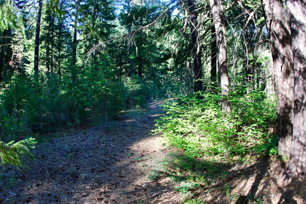 Photo: daveynin, CC BY 2.0 (via Flickr)
UNION CREEK CG NORDIC
~5 min drive
2.11-mile loop trail in Oregon with 462 ft elevation gain and loss.
HIKE
Lightning Spring Trail
~15 min drive
4.19-mile out-and-back hike in Oregon with 1,576 ft elevation gain.


