Oregon Trail
- 0.8 mi
- round trip
- 131 ft
- climb
- 3,551 ft
- high point
- Out and back
- route
- May–Jun, Sep
- best months
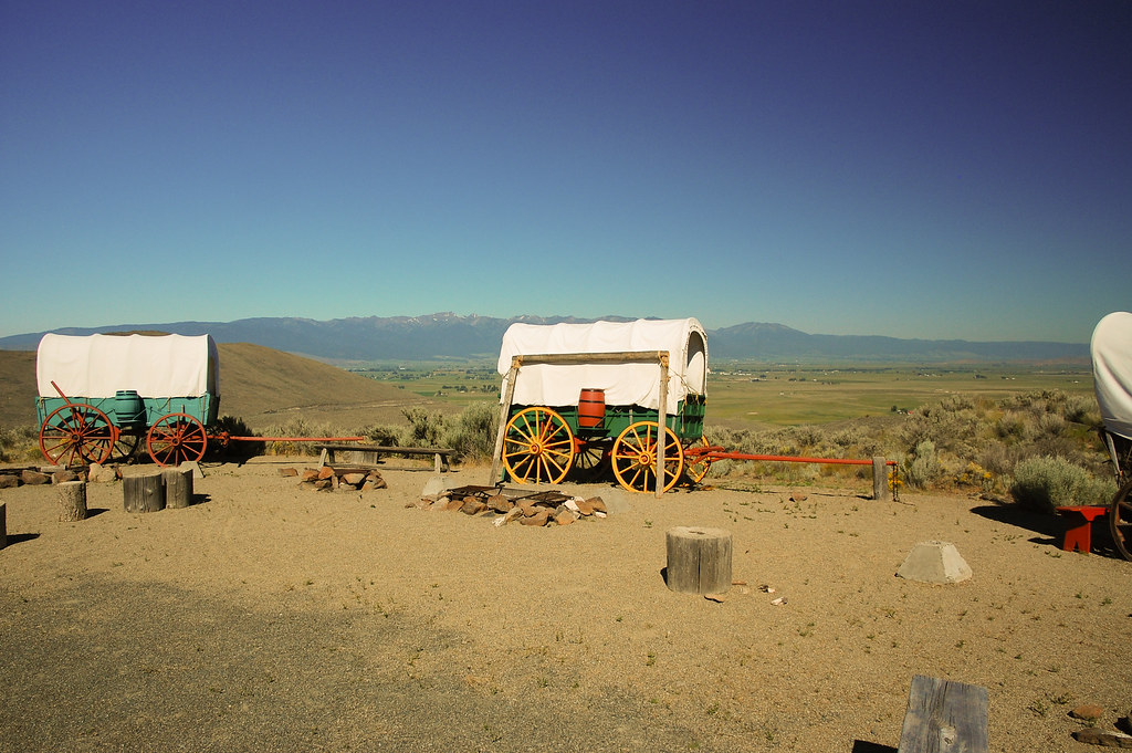
The Oregon Trail is a short, easy hike in eastern Oregon, about 5 miles from the town of Encina. The route is an out-and-back that covers roughly 1.5 miles, with a total climb of about 130 feet. The trail starts at an elevation of about 3,550 feet and reaches a high point of about 3,550 feet, so the climb is minimal and the route is well suited to a quick outing. Summer is the most comfortable time to go. Typical averages from a nearby weather station in Baker City show July and August highs around 88°F with only three or four wet days a month, while winter highs stay in the upper 30s. Several other hikes lie within about 5 miles, including Ascent, NHOTIC Site Trail, Flagstaff Loop and Mountain Ash.
Local outfitters
- Cornucopia Lodge & Packstation28 mi away
- Oregon Backcountry Outfitting46 mi away
Not on Roamze yet. Their page has how to reach them.
- AscentHiking4.5 mi
- NHOTIC Site TrailHiking4.5 mi
 Flagstaff LoopHikingPhoto: ilya_ktsn, CC BY 2.0 (via Flickr)4.6 mi
- Mountain AshHiking5 mi
- Auburn-Burnt RiverHiking5 mi
- Eagle Valley Rr Grade LoopHiking5 mi
- Panorama PointHiking5.1 mi
Source: Roamze catalog (indexable pages within 10 miles, PostGIS distance)
- Flagstaff LoopHiking · ~8 min drivePhoto: ilya_ktsn, CC BY 2.0 (via Flickr)
- Oregon TrailHiking · ~3 min drive
- Elkhorn Crest National Recreation TrailHiking · ~32 min drive
- Rock Creek Lake TrailHiking · ~41 min drive
 Powder River Recreation Area Paved TrailHiking · ~29 min drivePhoto: Robert Ashworth from Bellingham, WA., USA, CC BY 2.0 (via Wikimedia Commons)
- Velvet Creek TrailHiking · ~32 min drive
- West Eagle TrailHiking · ~41 min drive
- Cornucopia Trail #1868Hiking · ~45 min drive
- Phillips Lake North Shoreline TrailHiking · ~30 min drivePhoto: Robert Ashworth from Bellingham, WA., USA, CC BY 2.0 (via Wikimedia Commons)
- Jeep Ride TrailHiking · ~34 min drive
Best time to visit Oregon Trail
Best months: May–June and September. Best months have typical highs of 55–85 °F, lows of 30 °F or warmer (32 °F where the station doesn't record snow), at most one snowy day and no more than 12 wet days.
Jan
38° / 20°
10 wet
Feb
44° / 23°
9 wet
Mar
54° / 28°
10 wet
Apr
61° / 31°
10 wet
May
70° / 39°
10 wet
Jun
77° / 44°
8 wet
Jul
88° / 49°
4 wet
Aug
88° / 47°
3 wet
Sep
79° / 39°
4 wet
Oct
64° / 30°
6 wet
Nov
48° / 25°
9 wet
Dec
37° / 20°
10 wet
Typical high / low (°F) and days with rain or snow, 1991–2020. Measured at Baker City Muni Ap, OR, 8.8 mi away at 3,361 ft. This station doesn't record snowfall. Source: NOAA NCEI U.S. Climate Normals 1991–2020.

Map and trail data © OpenStreetMap contributors
