Nasty Rock Trail (BLM)
- 1.3 mi
- round trip
- 1,295 ft
- climb
- 4,592 ft
- high point
- Out and back
- route
Nasty Rock Trail is a moderate hike on Bureau of Land Management land in northwest Oregon, within the Nw Oregon Cascades Field Office. The trail is about 1.27 miles long, and the round trip adds up to roughly 2.5 miles with a total elevation gain of about 1,295 feet. The route starts at about 4,203 feet and reaches a high point of about 4,592 feet. The steepest stretch comes around the 1.2-mile mark, where the grade reaches about 28%. The trail is an out-and-back, and the climb is rolling rather than a single steep push. Plan for a moderate day on foot, with the most significant climb in the middle of the route. Gold Creek, a canoeing spot, lies about 2 miles away, and Joyce Lake Trail is about 2.9 miles off. Shady Cove Campground is about 4.7 miles away, and Elk Lake Campground is about 8.4 miles away.
Local outfitters
- Horseback Riding Adventures Oregon27 mi away
- Tree Climbing at Silver Falls27 mi away
Not on Roamze yet. Their page has how to reach them.
- Gold CreekCanoeing2 mi
- Joyce Lake TrailHiking2.9 mi
- Henry CreekCanoeing3.1 mi
- Nohorn CreekCanoeing3.1 mi
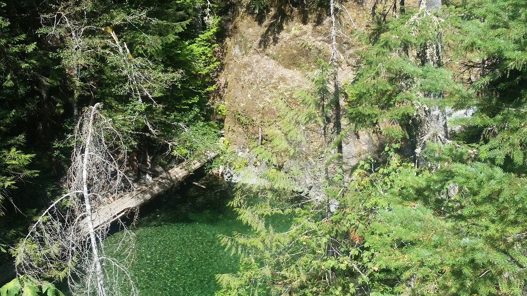 Nasty Rock Trail #3356HikingPhoto: mjfmjfmjf, CC BY 2.0 (via Flickr)3.3 mi
 WhetstoneHikingPhoto: U.S. Forest Service- Pacific Northwest Region, Public domain (via Wikimedia Commons)3.4 mi
- Shady Cove CgCamping4.7 mi
- Elk Lake CampgroundCamping8.4 mi
Source: Roamze catalog (indexable pages within 10 miles, PostGIS distance)
- WhetstoneHiking · ~6 min drivePhoto: U.S. Forest Service- Pacific Northwest Region, Public domain (via Wikimedia Commons)
 Kopetski TrailHiking · ~7 min drivePhoto: U.S. Forest Service- Pacific Northwest Region, Public domain (via Wikimedia Commons)
 Bagby Trail #544Hiking · ~8 min drivePhoto: mjfmjfmjf, CC BY 2.0 (via Flickr)
 Little North SantiamHiking · ~12 min drivePhoto: Forest Service Pacific Northwest Region, Public Domain Mark (via Flickr)
 Opal Creek TrailHiking · ~8 min drivePhoto: mjfmjfmjf, CC BY 2.0 (via Flickr)
 Henline MountainHiking · ~9 min drivePhoto: Forest Service Pacific Northwest Region, Public Domain Mark (via Flickr)
- Battle Ax Creek Trail #3339Hiking · ~9 min drive
- Nasty Rock Trail #3356Hiking · ~6 min drivePhoto: mjfmjfmjf, CC BY 2.0 (via Flickr)
- Battle Axe CreekHiking · ~9 min drivePhoto: U.S. Forest Service- Pacific Northwest Region, Public domain (via Wikimedia Commons)
- Table Rock Wilderness-Rooster Rock TrailHiking · ~7 min drive
Also worth it near here
 Molalla RiverCanoeing · ~6 min drivePhoto: Bureau of Land Management Oregon and Washington from Portland, America, Public domain (via Wikimedia Commons)
- Whetstone MountainSummit · ~6 min drive
- Bagby BathhouseHot spring · ~8 min drive
 Henline FallsWaterfall · ~10 min drivePhoto: Thehike675, CC BY-SA 4.0 (via Wikimedia Commons)
Map and trail data © OpenStreetMap contributors
