Bagby Trail
- 1.2 mi
- round trip
- 524 ft
- climb
- 2,381 ft
- high point
- Out and back
- route
- May–Oct
- best months
Is Bagby Trail open right now?
Closure in the area
There's a closure order in Clackamas River Ranger District. It doesn't name Bagby Trail, so check the source for the area it covers (2 listed).
Austin Fire Closure
Agency closure covering Clackamas River Ranger District · Order 06-06-05-26-20 · USFS · Clackamas River Ranger District
Clackamas River RD Fires
Agency closure covering Clackamas River Ranger District · Order 06-06-05-26-20 · USFS · Clackamas River Ranger District
Tamanawas Falls Trail closed due to instability hazards
Agency alert covering Mt. Hood National Forest · USFS · Mt. Hood National Forest
Emergency fire closure on FR 57
Agency alert covering Clackamas River Ranger District · USFS · Clackamas River Ranger District
Eagle Creek Fire Area Closures
Agency alert covering Mt. Hood National Forest · Order 06-22-01-26-04 · USFS · Mt. Hood National Forest
As of · Source: USFS · Clackamas River Ranger District. Agencies don't list every closure — check before you go.
Bagby Trail is an easy out-and-back hike of about 2.3 miles in the Bull of the Woods Wilderness, part of the Clackamas River Ranger District of Mt. Hood National Forest in Oregon. The Forest Service manages the land, and the nearest town is Ripplebrook, about 11 miles away. The trail starts at roughly 2,198 feet and climbs to about 2,381 feet, with a total gain of 524 feet for the round trip. The steepest stretch comes early, around 0.2 miles in, with an 8% grade. The climb is middle of the route, so the trail stays relatively gentle for most of the way. Summer is the most comfortable time to go. Typical averages from a nearby weather station show July and August highs around 75°F with lows near 50°F, while winter highs sit in the low to mid 40s. Bagby Trail #544 lies about a mile away, and the Hot Springs Fork and Nohorn Creek paddling routes are each about 2 miles off. Kingfisher campground is about 4 miles away.
Local outfitters
- Horseback Riding Adventures Oregon24 mi away
- Tree Climbing at Silver Falls32 mi away
Not on Roamze yet. Their page has how to reach them.
 Bagby Trail #544HikingPhoto: mjfmjfmjf, CC BY 2.0 (via Flickr)1.1 mi
- Hot Springs ForkCanoeing2.2 mi
- Nohorn CreekCanoeing2.2 mi
- Thunder MountainHiking2.6 mi
 KingfisherCampingPhoto: Recreation.gov (RIDB) / public domain4.2 mi
 RaabCampingPhoto: Recreation.gov (RIDB) / public domain7.1 mi
- CoethedralRock climbing9 mi
- Coethedral MainRock climbing9.2 mi
Source: Roamze catalog (indexable pages within 10 miles, PostGIS distance)
- Bagby Trail #544Hiking · ~2 min drivePhoto: mjfmjfmjf, CC BY 2.0 (via Flickr)
 WhetstoneHiking · ~10 min drivePhoto: U.S. Forest Service- Pacific Northwest Region, Public domain (via Wikimedia Commons)
 Kopetski TrailHiking · ~13 min drivePhoto: U.S. Forest Service- Pacific Northwest Region, Public domain (via Wikimedia Commons)
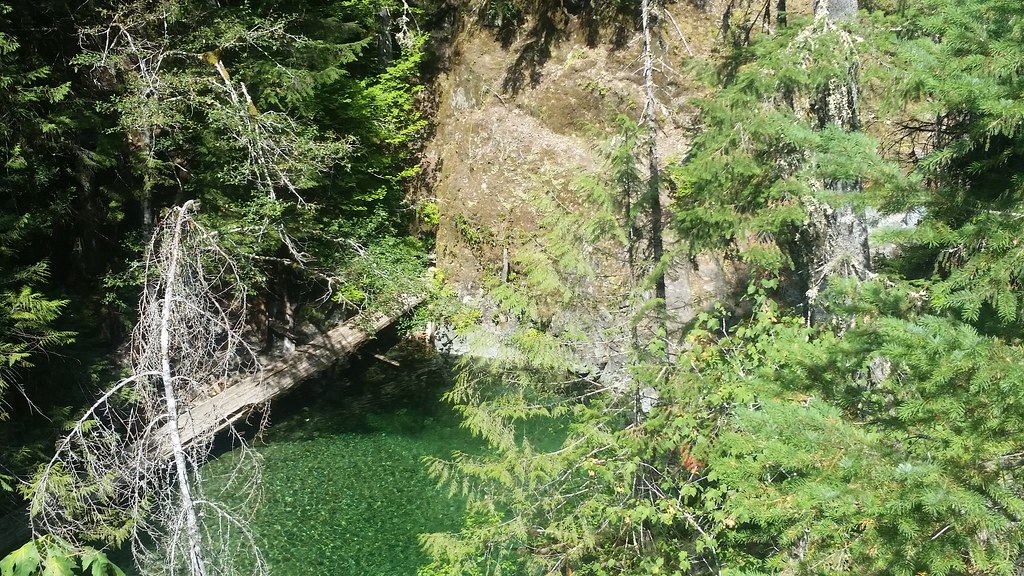 Nasty Rock Trail #3356Hiking · ~14 min drivePhoto: mjfmjfmjf, CC BY 2.0 (via Flickr)
- ELK LAKE CREEKHiking · ~15 min drive
- Battle Axe CreekHiking · ~12 min drivePhoto: U.S. Forest Service- Pacific Northwest Region, Public domain (via Wikimedia Commons)
- Thunder MountainHiking · ~4 min drive
- Skookum LakeHiking · ~4 min drive
- Elk Lake Creek Trail #559Hiking · ~15 min drive
 Opal Creek TrailHiking · ~13 min drivePhoto: mjfmjfmjf, CC BY 2.0 (via Flickr)
Best time to visit Bagby Trail
Best months: May–October. Best months have typical highs of 55–85 °F, lows of 30 °F or warmer (32 °F where the station doesn't record snow), at most one snowy day and no more than 12 wet days.
Jan
44° / 33°
Feb
46° / 33°
Mar
49° / 34°
Apr
54° / 36°
May
61° / 41°
Jun
66° / 45°
Jul
75° / 50°
Aug
75° / 51°
Sep
70° / 49°
Oct
56° / 42°
Nov
48° / 36°
Dec
42° / 33°
Typical high / low (°F) and days with rain or snow, 1991–2020. Measured at Scotts Mills 9 Se, OR, 17.4 mi away at 2,315 ft. This station doesn't record snowfall. Source: NOAA NCEI U.S. Climate Normals 1991–2020.

Map and trail data © OpenStreetMap contributors
