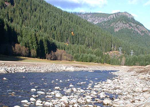
 Photo: Matthew Trump, CC BY-SA 3.0 (via Wikimedia Commons)
Paddling · 12 spots
Featured spots
Photo: Matthew Trump, CC BY-SA 3.0 (via Wikimedia Commons)Canoeing
Breitenbush River
Detroit, Oregon
 Photo: EncMstr, CC BY-SA 3.0 (via Wikimedia Commons)
Canoeing
North Fork Breitenbush River
Detroit, Oregon

Canoeing
Battle Ax Creek
Detroit, Oregon

Canoeing
Cub Creek
Detroit, Oregon

Canoeing
Devils Creek
Detroit, Oregon
All spots · 12 spots

Canoeing
East Fork Collawash River
Detroit, Oregon
Canoeing
East Humbug Creek
Detroit, Oregon
Canoeing
French Creek
Detroit, Oregon
Canoeing
Humbug Creek
Detroit, Oregon
Canoeing
Little North Santiam River
Detroit, Oregon
Canoeing
South Fork Breitenbush River
Detroit, Oregon
Canoeing
South Fork North Fork Breitenbush River
Detroit, Oregon
Keep exploring — more water worth the drive
Photo: Matthew Trump, CC BY-SA 3.0 (via Wikimedia Commons)Breitenbush River
~11 min drive
Breitenbush River is a 0.1-mile paddling stretch near Detroit, Oregon. It flows year-round. USGS models an average flow of about 488 cfs. Land along it is managed by the U.S. Forest Service.
Hoover Boat Ramp
~13 min drive
Hoover Boat Ramp is a boat launch in Oregon.
Detroit Lake
~20 min drive
A worthwhile stop near Oregon.
Raab
~27 min drive
A worthwhile stop near Oregon.
 Photo: U.S. Forest Service- Pacific Northwest Region, Public domain (via Wikimedia Commons)
Clackamas River
~18 min drive
Clackamas River is a 11-mile paddling stretch near Estacada, Oregon. It is intermittent and may run dry in some seasons. USGS models an average flow of about 3,004 cfs and a gradient of about 219.2 feet per mile. Land along it is managed by the U.S. Forest Service.
Southshore Boat Ramp
~17 min drive
Southshore Boat Ramp is a boat launch in Oregon.
 Photo: Unknown author or not provided, Public domain (via Wikimedia Commons)
Collawash River
~20 min drive
Collawash River is a 0.1-mile paddling stretch near Estacada, Oregon. It flows year-round. USGS models an average flow of about 346 cfs. Land along it is managed by the U.S. Forest Service.
Paradise Boating Site
~32 min drive
A worthwhile stop near Oregon.
 Photo: Bureau of Land Management, Public domain (via Wikimedia Commons)
Elkhorn Creek
~26 min drive
Elkhorn Creek is a 7.9-mile paddling stretch near Gates, Oregon. It flows year-round. USGS models an average flow of about 66 cfs and a gradient of about 293.1 feet per mile. Land along it is managed by the U.S. Forest Service.
Sandstone Bridge Boat Access Day Use
~38 min drive
A worthwhile stop near Oregon.
 Photo: Bureau of Land Management Oregon and Washington from Portland, America, Public domain (via Wikimedia Commons)
Molalla River
~29 min drive
Molalla River is a 7.3-mile paddling stretch near Molalla, Oregon. It flows year-round. USGS models an average flow of about 173 cfs and a gradient of about 245.3 feet per mile.
Mongold Boat Ramp
~18 min drive
Mongold Boat Ramp is a boat launch in Oregon.

