Detroit Lake
- May–Oct
- best months
Caution at last check
Agency alerts are in effect for this area; weather is good · USFS, OpenWeather · checked 16 h ago
Is Detroit Lake open right now?
Closure in the area
There's a closure order in Detroit Ranger District. It doesn't name Detroit Lake, so check the source for the area it covers (3 listed).
Beachie Creek and Lionshead Fires Closure
Agency closure covering Detroit Ranger District · Order 06-18-04-26-14 · USFS · Detroit Ranger District
Beachie Creek and Lionshead Fires Closure
Agency closure covering Detroit Ranger District · Order 06-18-04-26-14 · USFS · Detroit Ranger District
Cedar Creek Fire Closure
Agency closure covering Willamette National Forest · Order 06-18-10-26-04 · USFS · Willamette National Forest
FIRE CLOSURES: Current wildfire closures on the Willamette National Forest
Agency alert covering Willamette National Forest · USFS · Willamette National Forest
As of · Source: USFS · Detroit Ranger District. Agencies don't list every closure — check before you go.
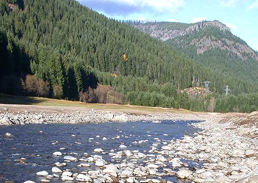
In the summer months, this 3,500-acre, 9-mile long lake in the Cascades below Mt. Jefferson is a popular recreation area for fishing, boating, water skiing, swimming, camping, and picnicking. The U.S. Forest Service and Oregon Department of Parks and Recreation and operate numerous boat ramps, campgrounds and day-use areas around the lake. Two privately owned marinas are located near the town of Detroit.Both Detroit and Big Cliff lakes are located 43 miles southeast of Salem on the North Fork of the Santiam River. They are operated by the Corps of Engineers as part of a system of thirteen multi-purpose dams and reservoirs that make up the Willamette Valley Project. These dams and reservoirs work together for the purposes of flood damage reduction, hydropower generation, irrigation, recreation, fish and wildlife enhancement, and downstream water quality improvement within the Willamette River drainage system.. To learn more about the lake and construction of the dam visit the Army Corps of Engineers website at http://www.nwp.usace.army.mil/In late summer, early fall through spring, the water levels on Detroit and Big Cliff lakes are frequently drawn down to the point where boat launches are no longer available. Reservoir and river level information is available from the US Army Corps of Engineers here. Watch for obstructions near the shoreline such as submerged stumps, logs and rocks. Small craft should stay out of open waters when it is windy since dangerous waves can build up suddenly.Fish Your National Forests: This site can be accessed by Passenger Car; Fish available include: Trout, Native Trout; Types of fishing available include: Shore, Motorized boat, Float tube, Fly, Spin, Bait; ADA Accessible fishing access with fishing pier, boat launch, and fish cleaning stationView more Popular Lakes & Rivers
 Breitenbush RiverCanoeing · ~9 min drivePhoto: Matthew Trump, CC BY-SA 3.0 (via Wikimedia Commons)
- Mongold Boat RampBoat launch · ~2 min drive
 Quartzville CreekCanoeing · ~16 min drivePhoto: anglerp1, CC BY-SA 2.0 (via Wikimedia Commons)
- Hoover Boat RampBoat launch · ~8 min drive
 Molalla RiverCanoeing · ~26 min drivePhoto: Bureau of Land Management Oregon and Washington from Portland, America, Public domain (via Wikimedia Commons)
- Paradise Boating SiteBoat launch · ~23 min drive
 Crabtree CreekCanoeing · ~29 min drivePhoto: Gary Halvorson, Oregon State Archives, CC BY 4.0 (via Wikimedia Commons)
- Southshore Boat RampBoat launch · ~4 min drive
 North Fork Breitenbush RiverCanoeing · ~30 min drivePhoto: EncMstr, CC BY-SA 3.0 (via Wikimedia Commons)
 Elkhorn CreekCanoeing · ~15 min drivePhoto: Bureau of Land Management, Public domain (via Wikimedia Commons)
Also worth it near here
 Tumble RidgeHiking · ~3 min drivePhoto: Robert Ashworth from Bellingham, WA., USA, CC BY 2.0 (via Wikimedia Commons)
- Sardine MountainSummit · ~6 min drive
 Detroit Lake State Recreation AreaCamping · ~7 min drivePhoto: Sapphireblue — CC BY 2.0 (via Flickr)
- Phantom Natural BridgeNatural arch · ~9 min drive
Best time to visit Detroit Lake
Best months: May–October. Best months have typical highs of 55–85 °F, lows of 30 °F or warmer (32 °F where the station doesn't record snow), at most one snowy day and no more than 12 wet days.
Jan
38° / 24°
Feb
41° / 24°
Mar
44° / 26°
Apr
49° / 29°
May
58° / 35°
Jun
65° / 38°
Jul
76° / 42°
Aug
76° / 42°
Sep
69° / 39°
Oct
56° / 33°
Nov
42° / 28°
Dec
36° / 23°
Typical high / low (°F) and days with rain or snow, 1991–2020. Measured at Santiam Junction, OR, 23.4 mi away at 3,750 ft. This station doesn't record snowfall. Source: NOAA NCEI U.S. Climate Normals 1991–2020.
