
Paddling · 10 spots
Featured spots



All spots · 10 spots


Keep exploring — more water worth the drive
 Photo: United States Forest Service, Public domain (via Wikimedia Commons)
Elk River
~33 min drive
Elk River is a 2.8-mile paddling stretch near Sixes, Oregon. It flows year-round. USGS models an average flow of about 216 cfs and a gradient of about 66.8 feet per mile. Land along it is managed by the U.S. Forest Service.
Edson Boat Ramp
~45 min drive
A worthwhile stop near Oregon.
Foster Bar Campground
~32 min drive
A worthwhile stop near Oregon.
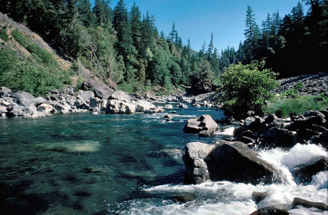 Photo: Lee Webb, Public domain (via Wikimedia Commons)
Chetco River
~46 min drive
Chetco River is a 13-mile paddling stretch near Brookings, Oregon. It flows year-round. USGS models an average flow of about 2,736 cfs and a gradient of about 125.9 feet per mile. Land along it is managed by the U.S. Forest Service.
Boice Cope County Park
~57 min drive
A worthwhile stop near Oregon.
 Photo: Headwes at English Wikipedia, CC BY-SA 3.0 (via Wikimedia Commons)
South Fork Coquille River
~48 min drive
South Fork Coquille River is a 26-mile paddling stretch near Powers, Oregon. It flows year-round. USGS models an average flow of about 723 cfs and a gradient of about 80.0 feet per mile. Land along it is managed by the U.S. Forest Service.
Quosatana Boat Ramp
~10 min drive
Quosatana Boat Ramp is a boat launch in Oregon.
 Photo: United States Forest Service, Public domain (via Wikimedia Commons)
Winchuck River
~52 min drive
Winchuck River is a 6.3-mile paddling stretch near Brookings, Oregon. It flows year-round. USGS models an average flow of about 315 cfs and a gradient of about 18.3 feet per mile. Land along it is managed by the U.S. Forest Service.
Foster Bar Boat Ramp
~32 min drive
Foster Bar Boat Ramp is a boat launch in Oregon.
 Photo: Vertigo Acid at English Wikipedia, CC BY-SA 3.0 (via Wikimedia Commons)
Sixes River
~45 min drive
Sixes River is a 7.8-mile paddling stretch near Sixes, Oregon. It flows year-round. USGS models an average flow of about 465 cfs and a gradient of about 81.0 feet per mile.
Miami Bar Boating Site
~48 min drive
Miami Bar Boating Site is a boat launch in Oregon.
Jim Hunt Creek
~2 min drive
Jim Hunt Creek is a 3.7-mile paddling stretch near Gold Beach, Oregon. It is intermittent and may run dry in some seasons. USGS models an average flow of about 38 cfs and a gradient of about 525.2 feet per mile.

