Little North Santiam River
- 1.1 mi
- distance
- 3,162 ft
- high point
- May–Oct
- best months
Is Little North Santiam River open right now?
Closure in the area
There's a closure order in Detroit Ranger District. It doesn't name Little North Santiam River, so check the source for the area it covers (3 listed).
Beachie Creek and Lionshead Fires Closure
Agency closure covering Detroit Ranger District · Order 06-18-04-26-14 · USFS · Detroit Ranger District
Beachie Creek and Lionshead Fires Closure
Agency closure covering Detroit Ranger District · Order 06-18-04-26-14 · USFS · Detroit Ranger District
Cedar Creek Fire Closure
Agency closure covering Willamette National Forest · Order 06-18-10-26-04 · USFS · Willamette National Forest
FIRE CLOSURES: Current wildfire closures on the Willamette National Forest
Agency alert covering Willamette National Forest · USFS · Willamette National Forest
As of · Source: USFS · Detroit Ranger District. Agencies don't list every closure — check before you go.
The Little North Santiam River is a 1.1-mile paddling stretch near Detroit, Oregon, set within the Detroit Ranger District of the Willamette National Forest. The Forest Service manages the land along the river, and the water flows year-round. USGS models put the average flow at about 101 cubic feet per second and the gradient at about 1,014 feet per mile. Summer is the most comfortable time to paddle. Typical averages from a nearby weather station show July and August highs around 75°F with lows near 50°F, while winter highs sit in the low 40s. The Kopetski and Opal Creek Trail hikes both start within a third of a mile. Battle Ax Creek and Opal Creek offer more paddling within about 2 miles.
Local outfitters
- Anderson's Outdoors36 mi away
- eNRG Kayaking41 mi away
Not on Roamze yet. Their page has how to reach them.
 KopetskiHikingPhoto: U.S. Forest Service- Pacific Northwest Region, Public domain (via Wikimedia Commons)0.2 mi
 Opal Creek TrailHikingPhoto: mjfmjfmjf, CC BY 2.0 (via Flickr)0.3 mi
- Battle Ax CreekCanoeing1.3 mi
 Kopetski TrailHikingPhoto: U.S. Forest Service- Pacific Northwest Region, Public domain (via Wikimedia Commons)1.4 mi
- Opal CreekCanoeing1.8 mi
- Cedar CreekCanoeing3 mi
- Elk Lake CampgroundCamping3.8 mi
- Shady Cove CgCamping5 mi
Source: Roamze catalog (indexable pages within 10 miles, PostGIS distance)
 Molalla RiverCanoeing · ~14 min drivePhoto: Bureau of Land Management Oregon and Washington from Portland, America, Public domain (via Wikimedia Commons)
- Mongold Boat RampBoat launch · ~15 min drive
- Detroit LakeTubing · ~16 min drive
- RaabFloat trip · ~24 min drive
 Collawash RiverCanoeing · ~19 min drivePhoto: Unknown author or not provided, Public domain (via Wikimedia Commons)
- Southshore Boat RampBoat launch · ~16 min drive
 Elkhorn CreekCanoeing · ~11 min drivePhoto: Bureau of Land Management, Public domain (via Wikimedia Commons)
- Hoover Boat RampBoat launch · ~16 min drive
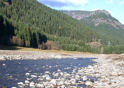 Breitenbush RiverCanoeing · ~12 min drivePhoto: Matthew Trump, CC BY-SA 3.0 (via Wikimedia Commons)
 North Fork Breitenbush RiverCanoeing · ~27 min drivePhoto: EncMstr, CC BY-SA 3.0 (via Wikimedia Commons)
Best time to visit Little North Santiam River
Best months: May–October. Best months have typical highs of 55–85 °F, lows of 30 °F or warmer (32 °F where the station doesn't record snow), at most one snowy day and no more than 12 wet days.
Jan
44° / 33°
Feb
46° / 33°
Mar
49° / 34°
Apr
54° / 36°
May
61° / 41°
Jun
66° / 45°
Jul
75° / 50°
Aug
75° / 51°
Sep
70° / 49°
Oct
56° / 42°
Nov
48° / 36°
Dec
42° / 33°
Typical high / low (°F) and days with rain or snow, 1991–2020. Measured at Scotts Mills 9 Se, OR, 17.5 mi away at 2,315 ft. The station sits about 800 ft lower than this place, so expect it a little cooler here. This station doesn't record snowfall. Source: NOAA NCEI U.S. Climate Normals 1991–2020.
