Southshore Boat Ramp
- Jun–Sep
- best months
Is Southshore Boat Ramp open right now?
Closure in the area
There's a closure order in Detroit Ranger District. It doesn't name Southshore Boat Ramp, so check the source for the area it covers (3 listed).
Beachie Creek and Lionshead Fires Closure
Agency closure covering Detroit Ranger District · Order 06-18-04-26-14 · USFS · Detroit Ranger District
Beachie Creek and Lionshead Fires Closure
Agency closure covering Detroit Ranger District · Order 06-18-04-26-14 · USFS · Detroit Ranger District
Cedar Creek Fire Closure
Agency closure covering Willamette National Forest · Order 06-18-10-26-04 · USFS · Willamette National Forest
FIRE CLOSURES: Current wildfire closures on the Willamette National Forest
Agency alert covering Willamette National Forest · USFS · Willamette National Forest
As of · Source: USFS · Detroit Ranger District. Agencies don't list every closure — check before you go.
Southshore Boat Ramp is a boat launch in the Detroit Ranger District of the Willamette National Forest in Oregon, about 2 miles from the town of Detroit. The land is managed by the Army Corps of Engineers. Summer is the most comfortable time to put in. Typical averages from the nearby Detroit Dam weather station show July and August highs around 80°F, with only four or five wet days a month, while winter months bring highs in the low 40s and rain on most days. Southshore Campground sits just 0.2 miles away, and Cove Creek Campground is under a mile off. Stahlman Point is a hike about 0.6 miles away, and the Breitenbush River, a canoeing route, lies about 3.7 miles away.
- Managed by
- Army Corps of Engineers
- Southshore CgCamping0.2 mi
- Stahlman PointHiking0.6 mi
- Cove Creek CgCamping0.8 mi
 PietyHikingPhoto: Robert Ashworth from Bellingham, WA., USA, CC BY 2.0 (via Wikimedia Commons)1.1 mi
- Piety Island CgCamping1.2 mi
- Tumble RidgeHikingPhoto: Robert Ashworth from Bellingham, WA., USA, CC BY 2.0 (via Wikimedia Commons)1.2 mi
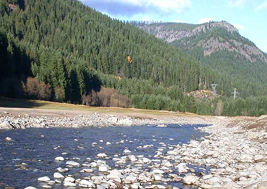 Breitenbush RiverCanoeingPhoto: Matthew Trump, CC BY-SA 3.0 (via Wikimedia Commons)3.7 mi
- French CreekCanoeing4.1 mi
Source: Roamze catalog (indexable pages within 10 miles, PostGIS distance)
 Quartzville CreekCanoeing · ~16 min drivePhoto: anglerp1, CC BY-SA 2.0 (via Wikimedia Commons)
- Mongold Boat RampBoat launch · ~2 min drive
- Detroit LakeTubing · ~4 min drive
 Molalla RiverCanoeing · ~28 min drivePhoto: Bureau of Land Management Oregon and Washington from Portland, America, Public domain (via Wikimedia Commons)
- Hoover Boat RampBoat launch · ~4 min drive
- Breitenbush RiverCanoeing · ~6 min drivePhoto: Matthew Trump, CC BY-SA 3.0 (via Wikimedia Commons)
- Paradise Boating SiteBoat launch · ~22 min drive
 Elkhorn CreekCanoeing · ~17 min drivePhoto: Bureau of Land Management, Public domain (via Wikimedia Commons)
 North Fork Breitenbush RiverCanoeing · ~26 min drivePhoto: EncMstr, CC BY-SA 3.0 (via Wikimedia Commons)
- French CreekCanoeing · ~7 min drive
Also worth it near here
- Stahlman PointSummit · ~3 min drive
 Detroit Lake State Recreation AreaCamping · ~4 min drivePhoto: Sapphireblue — CC BY 2.0 (via Flickr)
 Water Tower Mountain TrailHiking · ~7 min drivePhoto: Robert Ashworth from Bellingham, WA., USA, CC BY 2.0 (via Wikimedia Commons)
- Phantom Natural BridgeNatural arch · ~11 min drive
Best time to visit Southshore Boat Ramp
Best months: June–September. Best months have typical highs of 55–85 °F, lows of 30 °F or warmer (32 °F where the station doesn't record snow), at most one snowy day and no more than 12 wet days.
Jan
43° / 36°
20 wet · 2 snow
Feb
47° / 37°
18 wet · 1 snow
Mar
52° / 38°
21 wet · 1 snow
Apr
57° / 41°
20 wet
May
65° / 46°
16 wet
Jun
71° / 51°
11 wet
Jul
80° / 56°
5 wet
Aug
81° / 56°
4 wet
Sep
74° / 53°
8 wet
Oct
61° / 46°
14 wet
Nov
49° / 40°
19 wet
Dec
43° / 37°
21 wet · 1 snow
Typical high / low (°F) and days with rain or snow, 1991–2020. Measured at Detroit Dam, OR, 4.1 mi away at 1,220 ft. Source: NOAA NCEI U.S. Climate Normals 1991–2020.
Map and trail data © OpenStreetMap contributors
