Red Rock Canyon Campground
Campground
Sites open the weekend of Dec 4 on Recreation.gov
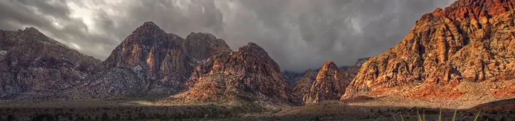
 Photo: Stan Shebs, CC BY-SA 3.0 (via Wikimedia Commons)
Mount Wilson is a summit of about 7,054 feet in Clark County, Nevada, inside the Rainbow Mountain Wilderness. The land is managed by the Bureau of Land Management's Red Rock/Sloan Field Office, and the nearest town is Blue Diamond, about 5 miles away. Summer is the most comfortable time to visit. Typical averages from a nearby weather station at a similar elevation show July highs around 79°F with lows near 52°F, while winter highs sit in the mid-40s. The summit sits right beside a cluster of climbing areas, including Horseshoe Wall about 0.1 mile away and Aeolian Wall about 0.2 mile away. N Oak Creek Canyon and Escarpment Base are both within a mile for hiking. Red Rock Canyon Campground, about 6 miles off, is the closest place to camp.
Red Rock Canyon Campground
Campground
Maria's Taco Shop
Fast food
Places © OpenStreetMap contributors
More in Sandy ValleyDaily highs and lows, wind and the chance of precipitation at the summit for the next 7 days, from the Open-Meteo model.
Elevation from USGS 3D Elevation Program terrain data (about 10 m resolution).
We don't know of a mapped trail or route to the summit of Mount Wilson. Plan the approach with local maps, a guidebook or a local guide, and check conditions before you go.
7,054 ft (2,150 m).
We don't know of a mapped trail or route to the summit. Plan the approach with local maps, a guidebook or a local guide.


 Aeolian WallRock climbingPhoto: Sean Williams 297, CC BY 2.0 (via Flickr)0.2 miLower East SideRock climbingPhoto: Sean Williams 297, CC BY 2.0 (via Flickr)0.3 miN Oak Creek CanyonHikingPhoto: Sean Williams 297, CC BY 2.0 (via Flickr)0.6 miEscarpment BaseHikingPhoto: Sean Williams 297, CC BY 2.0 (via Flickr)0.7 miKnollHikingPhoto: Sean Williams 297, CC BY 2.0 (via Flickr)0.8 mi
 Red Rock Canyon CampgroundCampingPhoto: Recreation.gov (RIDB) / public domain6.2 mi
Source: Roamze catalog (indexable pages within 10 miles, PostGIS distance)
 Rainbow MountainSummit · ~2 min drivePhoto: Stan Shebs, CC BY-SA 3.0 (via Wikimedia Commons)
 Bridge MountainSummit · ~5 min drivePhoto: Sascha Noyes, CC BY-SA 3.0 (via Wikimedia Commons)
 White Rock HillsSummit · ~9 min drivePhoto: BLM Nevada, CC BY 2.0 (via Wikimedia Commons)Turtlehead MountainSummit · ~11 min drivePhoto: Stan Shebs, CC BY-SA 3.0 (via Wikimedia Commons)
 Potosi MountainSummit · ~15 min drivePhoto: Stan Shebs, CC BY-SA 3.0 (via Wikimedia Commons)Charleston PeakSummit · ~29 min drivePhoto: Stan Shebs, CC BY-SA 3.0 (via Wikimedia Commons)Gass PeakSummit · ~47 min drivePhoto: VegasScorpion, CC BY-SA 3.0 (via Wikimedia Commons)
 Frenchman MountainSummit · ~48 min drivePhoto: Stan Shebs, CC BY-SA 3.0 (via Wikimedia Commons)
 Sunrise MountainSummit · ~51 min drivePhoto: Stan Shebs, CC BY-SA 3.0 (via Wikimedia Commons)
 Nopah PeakSummit · ~58 min drivePhoto: Stan Shebs, CC BY-SA 3.0 (via Wikimedia Commons)
Best months: May–October. Best months have typical highs of 55–85 °F, lows of 30 °F or warmer (32 °F where the station doesn't record snow), at most one snowy day and no more than 12 wet days.
Jan
44° / 22°
6 wet
Feb
44° / 22°
6 wet
Mar
49° / 26°
6 wet
Apr
55° / 30°
4 wet
May
63° / 37°
4 wet
Jun
74° / 46°
2 wet
Jul
79° / 52°
5 wet
Aug
78° / 52°
6 wet
Sep
72° / 44°
4 wet
Oct
62° / 35°
3 wet
Nov
51° / 27°
4 wet
Dec
44° / 21°
5 wet
Typical high / low (°F) and days with rain or snow, 1991–2020. Measured at Mt Charleston Fire Stn, NV, 14.6 mi away at 7,460 ft. This station doesn't record snowfall. Source: NOAA NCEI U.S. Climate Normals 1991–2020.

