Corn Creek Dunes
- 2,959 ft
- summit
- 1
- way up
- Oct–May
- best months
Corn Creek Dunes is a summit of 2,959 feet in Nevada's Desert National Wildlife Refuge, about 15 miles from Las Vegas. It sits within the refuge's network of trails, with the Coyote Loop Trail and Birdsong Loop Trail both starting within a quarter mile of the dunes. Spring and fall are the most comfortable times to visit. Typical averages from a nearby weather station show April highs around 76°F and October highs near 79°F, while July averages climb to about 101°F and January lows drop to around 31°F. The Coyote Loop Trail and Birdsong Loop Trail are the closest options, each about 0.2 miles away. The Lucky Strike Trail lies roughly 4 miles off.
Conditions and forecast
Daily highs and lows, wind and the chance of precipitation at the summit and route start for the next 7 days, from the Open-Meteo model.
- Summit elevation
- 2,959 ft
Elevation from USGS 3D Elevation Program terrain data (about 10 m resolution).
Map © Mapbox © OpenStreetMap contributors Questions about Corn Creek Dunes
How tall is Corn Creek Dunes?
2,959 ft (902 m).
How many routes go to the summit of Corn Creek Dunes?
One: Bighorn Loop Trail.
 Gass Peak6,938 ft · Nevada1 route10 mi awayPhoto: VegasScorpion, CC BY-SA 3.0 (via Wikimedia Commons)
- Hayford Peak9,913 ft · Nevada1 route17 mi away
 Turtlehead Mountain6,322 ft · Nevada1 route19 mi awayPhoto: Stan Shebs, CC BY-SA 3.0 (via Wikimedia Commons)
 Charleston Peak11,918 ft · Nevada3 routes22 mi awayPhoto: Stan Shebs, CC BY-SA 3.0 (via Wikimedia Commons)
- Black Mountain5,092 ft · Nevada3 routes39 mi away
- Beehive Rock2,531 ft · Nevada1 route45 mi away
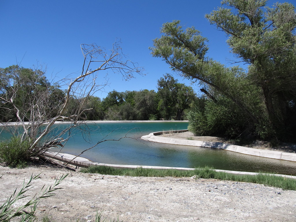 Coyote Loop TrailHikingPhoto: Ken Lund, CC BY-SA 2.0 (via Flickr)0.2 mi
- Birdsong Loop TrailHikingPhoto: Ken Lund, CC BY-SA 2.0 (via Flickr)0.2 mi
- Lucky Strike TrailHiking3.9 mi
Source: Roamze catalog (indexable pages within 10 miles, PostGIS distance)
- Gass PeakSummit · ~17 min drivePhoto: VegasScorpion, CC BY-SA 3.0 (via Wikimedia Commons)
- Turtlehead MountainSummit · ~32 min drivePhoto: Stan Shebs, CC BY-SA 3.0 (via Wikimedia Commons)
 White Rock HillsSummit · ~35 min drivePhoto: BLM Nevada, CC BY 2.0 (via Wikimedia Commons)
 Bridge MountainSummit · ~38 min drivePhoto: Sascha Noyes, CC BY-SA 3.0 (via Wikimedia Commons)
 Rainbow MountainSummit · ~41 min drivePhoto: Stan Shebs, CC BY-SA 3.0 (via Wikimedia Commons)
 Mount WilsonSummit · ~43 min drivePhoto: Stan Shebs, CC BY-SA 3.0 (via Wikimedia Commons)
 Sunrise MountainSummit · ~44 min drivePhoto: Stan Shebs, CC BY-SA 3.0 (via Wikimedia Commons)
 Frenchman MountainSummit · ~46 min drivePhoto: Stan Shebs, CC BY-SA 3.0 (via Wikimedia Commons)
 Potosi MountainSummit · ~58 min drivePhoto: Stan Shebs, CC BY-SA 3.0 (via Wikimedia Commons)
 Muddy PeakSummit · ~1h 6m drivePhoto: LCGS Russ, CC BY 3.0 (via Wikimedia Commons)
Also worth it near here
- Bighorn Loop TrailHiking · Next doorPhoto: Ken Lund, CC BY-SA 2.0 (via Flickr)
- Tule Springs LakeLake fishing · ~16 min drive
 Cheap Beer CragRock climbing · ~24 min drivePhoto: Ken Lund, CC BY-SA 2.0 (via Flickr)
 Original ShowgirlMountain biking · ~28 min drivePhoto: bahniuk, CC BY 3.0 (via Wikimedia Commons)
Best time to visit Corn Creek Dunes
Best months: October–May. Best months have typical highs of 55–85 °F, lows of 30 °F or warmer (32 °F where the station doesn't record snow), at most one snowy day and no more than 12 wet days.
Jan
57° / 31°
3 wet
Feb
60° / 34°
3 wet
Mar
68° / 39°
3 wet
Apr
76° / 45°
2 wet
May
85° / 53°
1 wet
Jun
96° / 61°
1 wet
Jul
101° / 68°
2 wet
Aug
100° / 66°
2 wet
Sep
92° / 58°
1 wet
Oct
79° / 46°
1 wet
Nov
66° / 36°
2 wet
Dec
56° / 30°
2 wet
Typical high / low (°F) and days with rain or snow, 1991–2020. Measured at Desert Nwr, NV, 0.2 mi away at 2,914 ft. Source: NOAA NCEI U.S. Climate Normals 1991–2020.
