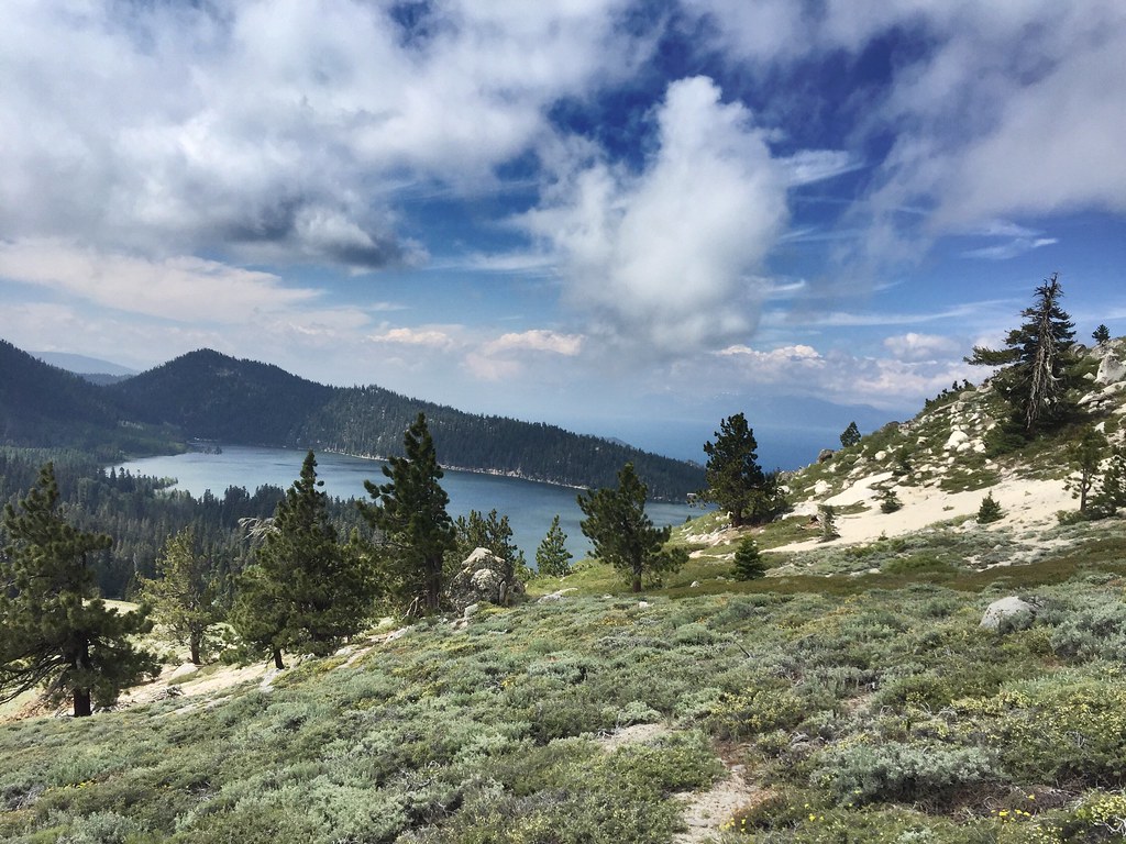
Marlette Peak Campground
Campground
Campground · 1.2 mi from the trail
Sunflower Hill Trail is a mountain biking route in Nevada's Lake Tahoe Nevada State Park, within the Carson Ranger District of the Humboldt-Toiyabe National Forest. The trail is managed by State Park and Recreation and runs about 5.3 miles out and back, with a total elevation gain of 1,201 feet. The climb starts at roughly 7,500 feet and reaches a high point of about 8,324 feet, and the route is rated easy. The trail's steepest stretch comes right at the start, with a grade of about 15 percent. That makes the first few hundred yards the most demanding part of the ride, after which the climb eases into a gentler ascent and descent. Summer is the most comfortable time to ride. Typical averages from a nearby weather station at Dagget Pass show July highs around 75°F with lows near 49°F, and the station sits about 1,000 feet below the trail's high point, so temperatures on the summit run cooler. Red House Rd lies just 0.1 mile away, and Aqueduct Rd is about half a mile off. Sand Harbor, a climbing area, is about 3 miles away, and Washoe Lake State Park Campground is about 5 miles away.
Marlette Peak Campground
Campground
kokanee
Restaurant
Fox Cultural Hall
Museum
Places © OpenStreetMap contributors
More in Sunnyside-Tahoe CityNot on Roamze yet. Their page has how to reach them.
Source: Roamze catalog (indexable pages within 10 miles, PostGIS distance)
 Tahoe Rim TrailMountain biking · ~2 min drivePhoto: AT2663, CC BY-SA 3.0 (via Wikimedia Commons)
 Ophir CreekMountain biking · ~11 min drivePhoto: Ken Lund from Reno, Nevada, USA, CC BY-SA 2.0 (via Wikimedia Commons)Tahoe Rim TrailMountain biking · ~3 min drivePhoto: AT2663, CC BY-SA 3.0 (via Wikimedia Commons)
 Lower Meadow LoopMountain biking · ~12 min drivePhoto: Famartin, CC BY-SA 4.0 (via Wikimedia Commons)Tahoe Rim TrailMountain biking · ~3 min drivePhoto: AT2663, CC BY-SA 3.0 (via Wikimedia Commons)Tahoe Meadows Interpretive TraMountain biking · ~13 min drivePhoto: Famartin, CC BY-SA 4.0 (via Wikimedia Commons)Tahoe Rim TrailMountain biking · ~4 min drivePhoto: AT2663, CC BY-SA 3.0 (via Wikimedia Commons)
Best months: May–October. Best months have typical highs of 55–85 °F, lows of 30 °F or warmer (32 °F where the station doesn't record snow), at most one snowy day and no more than 12 wet days.
Jan
36° / 23°
9 wet
Feb
37° / 23°
8 wet
Mar
42° / 26°
7 wet
Apr
48° / 29°
5 wet
May
56° / 35°
4 wet
Jun
66° / 42°
2 wet
Jul
75° / 49°
2 wet
Aug
74° / 49°
1 wet
Sep
67° / 44°
2 wet
Oct
55° / 36°
3 wet
Nov
43° / 28°
5 wet
Dec
35° / 23°
7 wet
Typical high / low (°F) and days with rain or snow, 1991–2020. Measured at Dagget Pass, NV, 15.3 mi away at 7,334 ft. The station sits about 1,000 ft lower than this place, so expect it a little cooler here. This station doesn't record snowfall. Source: NOAA NCEI U.S. Climate Normals 1991–2020.
Map and trail data © OpenStreetMap contributors