Mt. Rose Campground
Campground
Campground · 1.4 mi from the trail
 Photo: simonov, CC BY-SA 2.0 (via Flickr)
Closure in the area
There's a closure order in Carson Ranger District. It doesn't name Upper Tyrolian Entrance Trail, so check the source for the area it covers (2 listed).
Hawk Fire Closure (Carson Ranger District)
Agency closure covering Carson Ranger District · Order 04-17-26-01-08 · USFS · Carson Ranger District
Elephant Fire Closure
Agency closure covering Humboldt-Toiyabe National Forest · Order 04-17-26-01-04 · USFS · Humboldt-Toiyabe National Forest
Floriston Fire Closure
Agency alert covering Carson Ranger District · Order 17-26-24 · USFS · Carson Ranger District
Power line construction along SR 88, Alpine County, California (Carson Ranger District)
Agency alert covering Carson Ranger District · USFS · Carson Ranger District
Over-Snow Vehicle Closure (Carson Ranger District)
Agency alert covering Carson Ranger District · Order 04-17-25-12 · USFS · Carson Ranger District
As of · Source: USFS · Carson Ranger District. Agencies don't list every closure — check before you go.
Upper Tyrolian Entrance Trail is an easy out-and-back hike in Nevada's Humboldt-Toiyabe National Forest, within the Carson Ranger District. The route is short and gentle, with a total elevation gain of 198 feet over its 1.5-mile length, and the climb is steepest at the start, with a 6% grade at about 0.13 miles. The trail begins at a low point of about 8,525 feet and reaches a high of 8,608 feet. Its elevation gain is modest, making it a quick stop or a way to stretch your legs before or after a longer outing in the area. Several other hikes sit just 0.2 miles away, including Incline Lake, the Tahoe Rim Trail Connector and the Upper Meadow Loop. Mt. Rose Campground is about 1.4 miles off, and climbers can find Main Rock about 2.2 miles away.
Mt. Rose Campground
Campground
Fox Cultural Hall
Museum
Places © OpenStreetMap contributors
More in Sunnyside-Tahoe CityNot on Roamze yet. Their page has how to reach them.
 Photo: simonov, CC BY-SA 2.0 (via Flickr)
Incline Lake
Next door
1.16-mile out-and-back trail to Incline Lake in Nevada with 287 ft of elevation gain.
 Photo: simonov, CC BY-SA 2.0 (via Flickr)
Gray Lake Trail (Mt. Rose)
Next door
3.06-mile out-and-back hike to Gray Lake in Nevada with 871 ft of elevation gain.
 Photo: Ken Lund from Reno, Nevada, USA, CC BY-SA 2.0 (via Wikimedia Commons)
Incline Flume Trail
~3 min drive
Historic 6-mile out-and-back Nevada trail following an old flume system.
 Photo: simonov — CC BY-SA 2.0 (via Flickr)
Tamarack Lake Trail
~2 min drive
4.96-mile out-and-back hike to Tamarack Lake in Nevada.
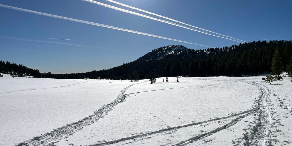 Photo: simonov, CC BY-SA 2.0 (via Flickr)
Tahoe Rim Trail Connector
Next door
0.62-mile out-and-back trail on the Tahoe Rim Trail in Nevada.
 Photo: simonov, CC BY-SA 2.0 (via Flickr)
Tyrolian Downhill
~2 min drive
5.38-mile out-and-back trail in Nevada with 1,575 ft elevation loss.
 Photo: Ken Lund from Reno, Nevada, USA, CC BY-SA 2.0 (via Wikimedia Commons)
Rim to Reno
~8 min drive
24.70-mile out-and-back trail in Nevada with 1,660 ft gain.
HIKE
Tahoe Rim Trail
~3 min drive
62.74-mile out-and-back trail in Nevada with 7,599 ft elevation gain
Photo: simonov, CC BY-SA 2.0 (via Flickr)Upper Meadow Loop
Next door
0.92-mile out-and-back trail in Nevada with 34 ft of elevation gain.
 Photo: inkknife_2000 (7.5 million views +), CC BY-SA 2.0 (via Wikimedia Commons)
Allison Ridge
~4 min drive
2.08-mile out-and-back trail in Nevada with 1,405 ft gain/loss.
Map and trail data © OpenStreetMap contributors


