Centennial Loop
 Photo: Nouhailler, CC BY-SA 2.0 (via Flickr)
- 2.4 mi
- round trip
- 1,481 ft
- climb
- 5,339 ft
- high point
- Out and back
- route
- Mar–Jun, Sep–Oct
- best months
Centennial Loop is a 2.37-mile moderate hike on Bureau of Land Management land in Nevada's Sierra Front Field Office, about 7 miles from Carson City. The route is an out-and-back that climbs steadily from a starting point at about 5,174 feet to a high point of 5,339 feet, with a total elevation gain of 1,481 feet over the round trip. The steepest stretch comes at about 1.7 miles in, where the grade reaches 13%. The most comfortable months for a visit are typically May and September, when typical averages from a nearby weather station in Carson City run around 70°F and 81°F, with lows in the low 40s. July is the warmest month, with highs near 90°F, and winter brings highs in the mid-40s and a few snowy days each month from December through February. The trip takes about 2.5 hours. Rocky Trail Bypass lies just 0.2 miles away, and Rocky Trail, a mountain biking route, is about 1.2 miles off. Climbers can head to Boulder B/Bat Cave, about 3.4 miles away, and Washoe Lake State Park Campground is roughly 5 miles from the trail.
Local outfitters
- Alpenglow Expeditions29 mi away
Not on Roamze yet. Their page has how to reach them.
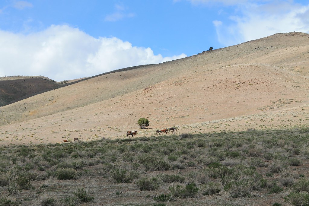 Rocky Trail BypassHikingPhoto: Nouhailler, CC BY-SA 2.0 (via Flickr)0.2 mi
- Rocky TrailMountain biking1.2 mi
- Hwy 50 Frontage TrailMountain biking1.8 mi
- Boulder B/Bat CaveRock climbing3.4 mi
- Tsunami BoulderRock climbing3.4 mi
 Key Hole BouldersRock climbingPhoto: jfdervin, CC BY-SA 2.0 (via Flickr)3.4 mi
- Washoe Lake State Park CampgroundCamping5.2 mi
- Carson Ranger District OfficeLake fishing5.9 mi
Source: Roamze catalog (indexable pages within 10 miles, PostGIS distance)
- Rocky Trail BypassHiking · Next doorPhoto: Nouhailler, CC BY-SA 2.0 (via Flickr)
 Rocky TrailHiking · ~2 min drivePhoto: Nouhailler, CC BY-SA 2.0 (via Flickr)
 Goni RoadHiking · ~5 min drivePhoto: jfdervin, CC BY-SA 2.0 (via Flickr)
 Lower Centennial Loop ConnectorHiking · ~2 min drivePhoto: Nouhailler, CC BY-SA 2.0 (via Flickr)
 Adt - Nevada - S - Seg 9Hiking · ~7 min drivePhoto: Nouhailler, CC BY-SA 2.0 (via Flickr)
 Lincoln BypassHiking · ~11 min drivePhoto: Wheeler Cowperthwaite, CC BY 2.0 (via Flickr)
- Golf Course Outer TrailHiking · ~4 min drivePhoto: Nouhailler, CC BY-SA 2.0 (via Flickr)
- Ophir GradeHiking · ~7 min drivePhoto: Nouhailler, CC BY-SA 2.0 (via Flickr)
 Franktown Creek RoadHiking · ~12 min drivePhoto: jfdervin, CC BY-SA 2.0 (via Flickr)
 Goni - 224Hiking · ~6 min drivePhoto: Seth Tisue, CC BY-SA 2.0 (via Flickr)
Best time to visit Centennial Loop
Best months: March–June and September–October. Best months have typical highs of 55–85 °F, lows of 30 °F or warmer (32 °F where the station doesn't record snow), at most one snowy day and no more than 12 wet days.
Jan
45° / 24°
6 wet · 2 snow
Feb
50° / 27°
6 wet · 1 snow
Mar
56° / 32°
5 wet · 1 snow
Apr
62° / 36°
3 wet
May
70° / 43°
3 wet
Jun
81° / 49°
2 wet
Jul
90° / 55°
1 wet
Aug
88° / 53°
1 wet
Sep
81° / 46°
1 wet
Oct
68° / 36°
2 wet
Nov
55° / 28°
3 wet · 1 snow
Dec
45° / 24°
5 wet · 1 snow
Typical high / low (°F) and days with rain or snow, 1991–2020. Measured at Carson City, NV, 7.3 mi away at 4,761 ft. The station sits about 600 ft lower than this place, so expect it a little cooler here. Source: NOAA NCEI U.S. Climate Normals 1991–2020.
Map and trail data © OpenStreetMap contributors
