Boles Point
- 6,361 ft
- summit
- 1
- way up
Is Boles Point open right now?
Alert in the area
The Forest Service lists an alert for Lolo National Forest.
East Fork Big Creek Road & Trail Closure- Superior Ranger District
Agency alert covering Lolo National Forest · Order 26-003- · USFS · Lolo National Forest
As of · Source: USFS · Lolo National Forest. Agencies don't list every closure — check before you go.
Boles Point is a summit in the Seeley Lake Ranger District of Lolo National Forest in western Montana. The nearest town is Seeley Lake, about 11 miles away, which makes it a practical base for supplies and lodging before heading out. Several trails sit close by. Wolverine and Spook Lake are each about 1.8 miles away, with Grouse Creek about 2.3 miles off. For an overnight stay, the Seeley Lake Campground Complex lies about 9 miles away.
Conditions and forecast
Daily highs and lows, wind and the chance of precipitation at the summit and route start for the next 7 days, from the Open-Meteo model.
- Summit elevation
- 6,361 ft
Elevation from USGS 3D Elevation Program terrain data (about 10 m resolution).
Map © Mapbox © OpenStreetMap contributors Questions about Boles Point
How tall is Boles Point?
6,361 ft (1,939 m).
How many routes go to the summit of Boles Point?
One: Boles Point.
When is the best time to climb Boles Point?
Year-round.
- Triangle Peak7,782 ft · Montana1 route9.5 mi away
- Sheep Mountain7,646 ft · Montana1 route13 mi away
- Crimson Peak8,278 ft · Montana1 route21 mi away
- University Mountain5,813 ft · Montana2 routes22 mi away
- Mount Sentinel5,155 ft · Montana2 routes23 mi away
- Youngs Mountain8,541 ft · Montana1 route23 mi away
- WolverineHiking1.8 mi
- SPOOK LAKEHiking1.8 mi
- Grouse CreekHiking2.3 mi
- Boles CreekHiking4.2 mi
- FINLEY SPOOK CUTOFFHiking4.7 mi
- River Point Campground ComplexCamping9.1 mi
- Seeley Lake Cg ComplexCamping9.2 mi
- Big Larch Cg ComplexCamping9.9 mi
Source: Roamze catalog (indexable pages within 10 miles, PostGIS distance)
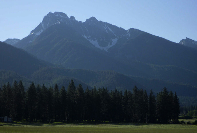 Mount CalowahcanSummit · ~46 min drivePhoto: Run shane run Shane Thomas McMillan, CC BY-SA 3.0 (via Wikimedia Commons)
 Gray Wolf PeakSummit · ~26 min drivePhoto: Thad Lowary, US Forest Service, Public domain (via Wikimedia Commons)
- Triangle PeakSummit · ~16 min drive
- Sheep MountainSummit · ~22 min drive
- Richmond PeakSummit · ~29 min drive
- Crimson PeakSummit · ~36 min drive
- University MountainSummit · ~37 min drive
- Mount SentinelSummit · ~39 min drive
- Cardinal PeakSummit · ~40 min drive
- Hemlock PointSummit · ~43 min drive

