Richmond Peak
- 7,144 ft
- summit
Is Richmond Peak open right now?
Alert in the area
The Forest Service lists an alert for Lolo National Forest.
East Fork Big Creek Road & Trail Closure- Superior Ranger District
Agency alert covering Lolo National Forest · Order 26-003- · USFS · Lolo National Forest
As of · Source: USFS · Lolo National Forest. Agencies don't list every closure — check before you go.
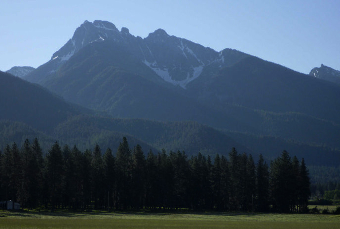
Richmond Peak is a summit in Montana's Lolo National Forest, within the Seeley Lake Ranger District. The town of Seeley Lake sits about 10 miles away and is the nearest community for supplies and a base for planning a trip into this part of the forest. The peak anchors a cluster of routes for both hikers and riders. That makes it a natural focal point for a day spent on foot or on a bike in the Seeley Lake area, and campgrounds within a few miles allow for longer stays. Within a mile of the summit, Swan Divide and Inez Ridge offer mountain biking, and the Richmond-Sunday Mountain hike lies just 0.6 miles away. For an overnight, Lake Inez Campground Complex is about 3.8 miles off.
Conditions and forecast
Daily highs and lows, wind and the chance of precipitation at the summit for the next 7 days, from the Open-Meteo model.
- Summit elevation
- 7,144 ft
Elevation from USGS 3D Elevation Program terrain data (about 10 m resolution).
We don't know of a mapped trail or route to the summit of Richmond Peak. Plan the approach with local maps, a guidebook or a local guide, and check conditions before you go.
Questions about Richmond Peak
How tall is Richmond Peak?
7,144 ft (2,177 m).
Is there a trail to the top of Richmond Peak?
We don't know of a mapped trail or route to the summit. Plan the approach with local maps, a guidebook or a local guide.
- Swan DivideMountain biking0.5 mi
- Richmond-Sunday MountainHiking0.6 mi
- Inez RidgeMountain biking0.9 mi
 Clearwater RiverCanoeingPhoto: Bswc blackfootchallenge, CC BY-SA 4.0 (via Wikimedia Commons)3.5 mi
- Lakeside Cg (Old Alva)Camping3.8 mi
- Lake Inez Campground ComplexCamping3.8 mi
- Lake Alva Cg ComplexCamping3.9 mi
- Holland Lake Boating SiteLake fishing9.8 mi
Source: Roamze catalog (indexable pages within 10 miles, PostGIS distance)
 Mount CalowahcanSummit · ~39 min drivePhoto: Run shane run Shane Thomas McMillan, CC BY-SA 3.0 (via Wikimedia Commons)
 Turtlehead MountainSummit · ~45 min drivePhoto: Stan Shebs, CC BY-SA 3.0 (via Wikimedia Commons)
 Gray Wolf PeakSummit · ~30 min drivePhoto: Thad Lowary, US Forest Service, Public domain (via Wikimedia Commons)
- Cardinal PeakSummit · ~13 min drive
- Crimson PeakSummit · ~14 min drive
- Shaw MountainSummit · ~15 min drive
- Kid MountainSummit · ~20 min drive
- Youngs MountainSummit · ~21 min drive
- Lena PeakSummit · ~21 min drive
- Gordon MountainSummit · ~24 min drive
