Northwest Region
- 50 routes
- 5.4 – 5.13c
- Trad · Sport · Bouldering
- May, Jul–Sep
- best months
Is Northwest Region open right now?
Alert in the area
The Forest Service lists an alert for Lolo National Forest.
East Fork Big Creek Road & Trail Closure- Superior Ranger District
Agency alert covering Lolo National Forest · Order 26-003- · USFS · Lolo National Forest
As of · Source: USFS · Lolo National Forest. Agencies don't list every closure — check before you go.
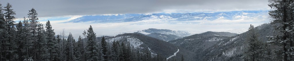
The Northwest Region climbing area sits in the Rattlesnake Wilderness, within the Missoula Ranger District of Lolo National Forest in western Montana. The Forest Service manages the surrounding land. The area holds about 50 climbing routes, ranging from traditional and sport climbs to bouldering and alpine routes. Grades run from 5.4 up to 5.13c, with sport routes like Mescalito Edge at 5.10b and Pigeon Killer at 5.13c. Alpine routes, such as SE Ridge at 5.4, add a different style to the mix. Summer is the most comfortable time to visit. At a nearby weather station, typical July and August highs reach about 83°F with lows in the low 40s, and these months see the fewest wet days of the year. That station sits well below the wilderness, so temperatures up high run cooler. Nearby, the Rattlesnake Trail and Wrangle Creek offer mountain biking within about a mile and a half. Rattlesnake Creek and Carter Lake are hiking options at similar distances.
 Rattlesnake TrailMountain bikingPhoto: nklette, CC BY 3.0 (via Wikimedia Commons)1 mi
 Wrangle CreekMountain bikingPhoto: nklette, CC BY 3.0 (via Wikimedia Commons)1.5 mi
- Rattlesnake CreekHiking1.6 mi
- Carter LakeHiking1.7 mi
- Triangle PeakHiking1.8 mi
- Wrangel Creek TrailMountain bikingPhoto: nklette, CC BY 3.0 (via Wikimedia Commons)1.9 mi
 Porcupine CreekMountain bikingPhoto: nklette, CC BY 3.0 (via Wikimedia Commons)2.2 mi
- Boulder PointMountain biking2.5 mi
Source: Roamze catalog (indexable pages within 10 miles, PostGIS distance)
 The HeapRock climbing · ~1h 6m drivePhoto: djembayz, CC0 (via Wikimedia Commons)
- Alberton Rest StopRock climbing · ~56 min drive
- Palace WallRock climbing · ~1h drive
- Bass CreekRock climbing · ~1h 2m drive
- Mulkey GulchRock climbing · ~1h 2m drive
- Sick BayRock climbing · ~1h 6m drive
- Kootenai CanyonRock climbing · ~1h 6m drive
- First ButtressRock climbing · ~1h 6m drive
- Second ButtressRock climbing · ~1h 7m drive
- Outermost LimitsRock climbing · ~1h 7m drive
Best time to visit Northwest Region
Best months: May and July–September. Best months have typical highs of 55–85 °F, lows of 30 °F or warmer (32 °F where the station doesn't record snow), at most one snowy day and no more than 12 wet days.
Jan
32° / 12°
15 wet
Feb
37° / 13°
12 wet
Mar
45° / 20°
12 wet
Apr
54° / 27°
11 wet
May
65° / 34°
12 wet
Jun
72° / 41°
13 wet
Jul
83° / 44°
8 wet
Aug
83° / 43°
7 wet
Sep
73° / 36°
9 wet
Oct
56° / 29°
11 wet
Nov
40° / 21°
14 wet
Dec
31° / 13°
16 wet
Typical high / low (°F) and days with rain or snow, 1991–2020. Measured at Seeley Lake Rs, MT, 20.1 mi away at 4,100 ft. The station sits about 1,600 ft lower than this place, so expect it a little cooler here. This station doesn't record snowfall. Source: NOAA NCEI U.S. Climate Normals 1991–2020.