Mount Sentinel
- 5,155 ft
- summit
- 2
- ways up
- May–Sep
- best months
Mount Sentinel is a summit in Montana, about 2 miles from East Missoula. It sits at 5,155 feet, and several trails pass within a short distance of it, making it an easy anchor for a day of hiking or mountain biking in the area. Summer is the most comfortable time to go. Typical averages from a nearby weather station at Potomac, which sits well below the summit, show July and August highs around 82°F with lows in the low 40s. Winters there are cold, with January highs near 30°F and regular snow days. The closest trail is Hellgate Ridgeline, about 0.1 mile away, and the Sentinel Climb mountain biking route is about 0.2 mile off. University Mountain Tie is about 0.4 mile away, and Pattee Canyon Picnic Area, about 4 miles away, offers a place to camp.
Conditions and forecast
Daily highs and lows, wind and the chance of precipitation at the summit and route start for the next 7 days, from the Open-Meteo model.
- Summit elevation
- 5,155 ft
Elevation from USGS 3D Elevation Program terrain data (about 10 m resolution).
- Hellgate RidgelineModerateabout 1,134 ft of climbing1.5 mi round trip
- Hellgate CanyonHardabout 1,896 ft of climbing6.1 mi round trip
Compare the routes Hellgate Ridgeline Hellgate Canyon Climbing About 1,134 ft About 1,896 ft Round trip 1.5 mi 6.1 mi Difficulty Moderate Hard Terrain Hike Hike Season — Year-round Map © Mapbox © OpenStreetMap contributors Questions about Mount Sentinel
How tall is Mount Sentinel?
5,155 ft (1,571 m).
How many routes go to the summit of Mount Sentinel?
2: Hellgate Ridgeline and Hellgate Canyon.
What is the shortest route up Mount Sentinel?
Hellgate Ridgeline, about 1.5 mi round trip.
When is the best time to climb Mount Sentinel?
Year-round.
- Ginny Mountain4,701 ft · Montana1 route1.5 mi away
- University Mountain5,813 ft · Montana2 routes1.6 mi away
- Sheep Mountain7,646 ft · Montana1 route9.9 mi away
- Triangle Peak7,782 ft · Montana1 route17 mi away
- Albert Point6,001 ft · Montana1 route20 mi away
- Petty Mountain7,275 ft · Montana1 route21 mi away
- Hellgate RidgelineHiking0.1 mi
 Sentinel ClimbMountain bikingPhoto: A-Reck, CC BY-SA 3.0 (via Wikimedia Commons)0.2 mi
 University Mountain TieHikingPhoto: diaper, CC BY 2.0 (via Flickr)0.4 mi
- Hellgate CanyonMountain bikingPhoto: A-Reck, CC BY-SA 3.0 (via Wikimedia Commons)0.5 mi
- CROOKED TRAIL CUTOFFHiking0.6 mi
- Crooked CutoffHiking1 mi
- Woodworth TrailHiking1 mi
 Pattee Canyon Picnic AreaCampingPhoto: Recreation.gov (RIDB) / public domain3.9 mi
Source: Roamze catalog (indexable pages within 10 miles, PostGIS distance)
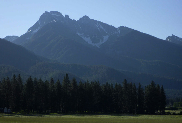 Mount CalowahcanSummit · ~1h 12m drivePhoto: Run shane run Shane Thomas McMillan, CC BY-SA 3.0 (via Wikimedia Commons)
 Gray Wolf PeakSummit · ~52 min drivePhoto: Thad Lowary, US Forest Service, Public domain (via Wikimedia Commons)
- University MountainSummit · ~3 min drive
- Sheep MountainSummit · ~17 min drive
- Triangle PeakSummit · ~29 min drive
- Petty MountainSummit · ~37 min drive
- Boles PointSummit · ~39 min drive
- West Fork ButteSummit · ~39 min drive
- Spink PointSummit · ~46 min drive
- Saint Mary PeakSummit · ~46 min drive
Also worth it near here
- Sentinel ClimbMountain biking · Next doorPhoto: A-Reck, CC BY-SA 3.0 (via Wikimedia Commons)
 US West trailHiking · ~2 min drivePhoto: Charles Nadeau from San Mateo, CA, CC BY 2.0 (via Wikimedia Commons)
- Pattee South -- Main LoopCross-country skiing · ~4 min drive
- Pattee Canyon Picnic AreaCamping · ~7 min drive
Best time to visit Mount Sentinel
Best months: May–September. Best months have typical highs of 55–85 °F, lows of 30 °F or warmer (32 °F where the station doesn't record snow), at most one snowy day and no more than 12 wet days.
Jan
30° / 8°
8 wet · 6 snow
Feb
35° / 9°
6 wet · 5 snow
Mar
45° / 17°
6 wet · 3 snow
Apr
54° / 24°
6 wet · 1 snow
May
64° / 30°
8 wet
Jun
71° / 38°
9 wet
Jul
82° / 41°
6 wet
Aug
82° / 39°
4 wet
Sep
71° / 32°
5 wet
Oct
55° / 23°
7 wet · 1 snow
Nov
39° / 16°
8 wet · 3 snow
Dec
29° / 9°
8 wet · 6 snow
Typical high / low (°F) and days with rain or snow, 1991–2020. Measured at Potomac, MT, 19.1 mi away at 3,690 ft. The station sits about 1,500 ft lower than this place, so expect it a little cooler here. Source: NOAA NCEI U.S. Climate Normals 1991–2020.
