Rattlebone Lake
- 0.6 mi
- round trip
- 62 ft
- climb
- 3,434 ft
- high point
- Out and back
- route
- May–Sep
- best months
Is Rattlebone Lake open right now?
Closure in the area
There's a closure order in Kootenai National Forest. It doesn't name Rattlebone Lake, so check the source for the area it covers.
Kootenai Flood Event & Inaccessible Areas
Agency closure covering Kootenai National Forest · USFS · Kootenai National Forest
Updated Skillet Fire Area, Road, Trail Closure
Agency alert covering Kootenai National Forest · Order 01-10- · USFS · Kootenai National Forest
As of · Source: USFS · Kootenai National Forest. Agencies don't list every closure — check before you go.
Rattlebone Lake is an easy, short hike in the Fortine Ranger District of Montana's Kootenai National Forest, managed by the Forest Service. The trail is about 0.6 miles long, with a total elevation gain of about 62 feet, and it makes a natural out-and-back from the low point at about 3,331 feet up to the high point at about 3,434 feet. The route is short enough to fit easily into a longer day of exploring the surrounding area. Bikes are allowed, so the trail works for a ride as well as a walk. Summer and early fall are the most comfortable times to go. Typical averages from a nearby weather station in Fortine show July highs around 84°F and September highs near 72°F, with lows in the low 40s. That station sits several hundred feet lower than the lake, so temperatures on the trail run a bit cooler. The hike is open from about June 1 to October 31. South Dickey Lake campground is about 1.3 miles away, and North Dickey Lake campground is about 2.5 miles off. Patrick Ridge offers another hike at the same distance, and the Stillwater River is about 3.8 miles away.
Local outfitters
- Indian Springs Montana20 mi away
- North American RV Park & Yurt Village39 mi away
Not on Roamze yet. Their page has how to reach them.
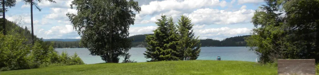 South Dickey LakeCampingPhoto: Recreation.gov (RIDB) / public domain1.3 mi
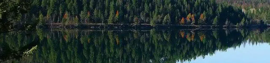 North Dickey LakeCampingPhoto: Recreation.gov (RIDB) / public domain2.5 mi
- Dickey Lake OverlookMountain biking2.5 mi
- Patrick RidgeHiking2.5 mi
 Stillwater RiverCanoeingPhoto: Joe Mabel (on Flickr as Joe Mabel from Seattle, US), CC BY-SA 3.0 (via Wikimedia Commons)3.8 mi
- Point of RocksRock climbing4.5 mi
- Fortine CreekCanoeing5.2 mi
- Mouse HouseRock climbing6.2 mi
Source: Roamze catalog (indexable pages within 10 miles, PostGIS distance)
 Link LakeHiking · ~20 min drivePhoto: Forest Service Northern Region from Missoula, MT, USA, Public domain (via Wikimedia Commons)
 Chain LakeHiking · ~23 min drivePhoto: Forest Service Northern Region from Missoula, MT, USA, Public domain (via Wikimedia Commons)
- Laughing WaterHiking · ~10 min drive
- Dickey Lake OverlookHiking · ~4 min drive
- Nasukoin Mtn.Hiking · ~20 min drivePhoto: Forest Service Northern Region from Missoula, MT, USA, Public domain (via Wikimedia Commons)
- KrinklehornHiking · ~16 min drive
- Patrick's RidgeHiking · ~5 min drive
- DEEP CREEK X-C SKIHiking · ~11 min drive
- Huntsberger LakeHiking · ~20 min drive
- Hagadore LakeHiking · ~7 min drive
Best time to visit Rattlebone Lake
Best months: May–September. Best months have typical highs of 55–85 °F, lows of 30 °F or warmer (32 °F where the station doesn't record snow), at most one snowy day and no more than 12 wet days.
Jan
30° / 18°
9 wet
Feb
35° / 19°
7 wet
Mar
46° / 25°
7 wet
Apr
56° / 31°
7 wet
May
68° / 38°
9 wet
Jun
73° / 45°
10 wet
Jul
84° / 50°
6 wet
Aug
83° / 47°
5 wet
Sep
72° / 40°
6 wet
Oct
55° / 31°
7 wet
Nov
39° / 25°
10 wet
Dec
29° / 17°
10 wet
Typical high / low (°F) and days with rain or snow, 1991–2020. Measured at Fortine 1 N, MT, 7.5 mi away at 3,000 ft. This station doesn't record snowfall. Source: NOAA NCEI U.S. Climate Normals 1991–2020.
