Elkhorn Creek
- 6.6 mi
- distance
- 6,972 ft
- high point
- Jun–Sep
- best months
Is Elkhorn Creek open right now?
Alert in the area
The Forest Service lists an alert for Salmon-Challis National Forest.
Stoddard Bridge Construction Closure
Agency alert covering Salmon-Challis National Forest · Order 0413-07-17 · USFS · Salmon-Challis National Forest
As of · Source: USFS · Salmon-Challis National Forest. Agencies don't list every closure — check before you go.
Elkhorn Creek is a 6.6-mile paddling stretch near Cascade, Idaho, within the Frank Church-River of No Return Wilderness. The land is managed by the U.S. Forest Service as part of the Middle Fork Ranger District of the Salmon-Challis National Forest. The creek flows year-round, with typical averages from a nearby weather station at Deadwood Lodge showing an average flow of about 57 cubic feet per second and a gradient of about 253 feet per mile. Summer is the most comfortable time to paddle. July typically brings highs around 82°F and lows near 40°F, while winter highs stay in the low to mid 30s. Nearby, the Middle Fork Salmon River is about 4.6 miles away, and Boundary Creek Campground is about 5.7 miles off. Hikers can head to Morehead Mtn, about 3.8 miles away, or Big Soldier Trail, about 4.1 miles away.
Local outfitters
- Arrowhead RV Park37 mi away
- Black Bear RV Park43 mi away
Not on Roamze yet. Their page has how to reach them.
- Morehead MtnHiking3.8 mi
- Big Soldier TrailHiking4.1 mi
 Middle Fork Salmon RiverCanoeingPhoto: Rex Parker, CC BY 2.0 (via Wikimedia Commons)4.6 mi
- Muskeg CreekHiking4.6 mi
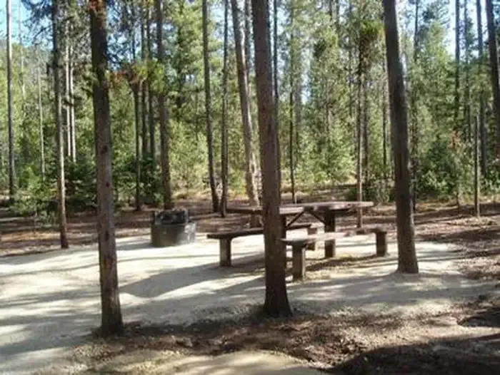 Boundary Creek CampgroundCampingPhoto: Recreation.gov (RIDB) / public domain5.7 mi
- Boundary Creek Campground ComplexCamping5.8 mi
- Pistol CreekCanoeing5.9 mi
- Dagger Falls CampgroundCamping5.9 mi
Source: Roamze catalog (indexable pages within 10 miles, PostGIS distance)
- Middle Fork Salmon RiverCanoeing · ~8 min drivePhoto: Rex Parker, CC BY 2.0 (via Wikimedia Commons)
- Shoreline Boating SiteBoat launch · ~30 min drive
- Park CreekFloat trip · ~1h 3m drive
 South Fork Salmon RiverCanoeing · ~32 min drivePhoto: Zachary Collier, CC BY 2.0 (via Wikimedia Commons)
- Salmon River Bridge AccessBoat launch · ~56 min drive
- HelendeFloat trip · ~1h 3m drive
- Pistol CreekCanoeing · ~10 min drive
- Elk Creek Boat LaunchBoat launch · ~1h 4m drive
- Mountain ViewFloat trip · ~1h 8m drive
- Beaver CreekCanoeing · ~28 min drive
Best time to visit Elkhorn Creek
Best months: June–September. Best months have typical highs of 55–85 °F, lows of 30 °F or warmer (32 °F where the station doesn't record snow), at most one snowy day and no more than 12 wet days.
Jan
35° / 8°
Feb
36° / 12°
Mar
42° / 16°
Apr
49° / 22°
May
61° / 30°
Jun
70° / 35°
Jul
82° / 40°
Aug
81° / 38°
Sep
73° / 32°
Oct
57° / 26°
Nov
40° / 16°
Dec
31° / 9°
Typical high / low (°F) and days with rain or snow, 1991–2020. Measured at Deadwood Lodge, ID, 17 mi away at 5,948 ft. The station sits about 1,000 ft lower than this place, so expect it a little cooler here. This station doesn't record snowfall. Source: NOAA NCEI U.S. Climate Normals 1991–2020.
