Marble Creek
- 21.7 mi
- distance
- 6,721 ft
- high point
- Jun–Sep
- best months
Caution at last check
Agency alerts are in effect for this area; weather is good · USFS, OpenWeather · checked 13 h ago
Is Marble Creek open right now?
Alert in the area
The Forest Service lists an alert for Salmon-Challis National Forest.
Stoddard Bridge Construction Closure
Agency alert covering Salmon-Challis National Forest · Order 0413-07-17 · USFS · Salmon-Challis National Forest
As of · Source: USFS · Salmon-Challis National Forest. Agencies don't list every closure — check before you go.
Marble Creek is a 22-mile paddling stretch near Cascade, Idaho, flowing year-round through the Frank Church-River of No Return Wilderness. The Middle Fork Ranger District of the Salmon-Challis National Forest manages the land along it, and the U.S. Forest Service oversees the surrounding area. The creek moves steadily, with a typical average flow of about 169 cubic feet per second and a gradient of about 104.7 feet per mile. Summer is the most comfortable time to paddle. Typical averages from a nearby weather station at Deadwood Lodge show July highs around 82°F with lows near 40°F, while winter highs stay in the low to mid 30s. Several hikes lie within about 10 miles, including Canyon Creek at 4.2 miles, the Middle Fork Trail at 7.6 miles, Lookout Mountain Trail at 8.7 miles and Norton Lake at 9.3 miles.
- Canyon CreekHiking4.2 mi
- Middle Fork TrailHiking7.6 mi
- Lookout Mountain TrailHiking8.7 mi
- Pack TrailHiking9.1 mi
- West Fork Thomas Creek TrailHiking9.1 mi
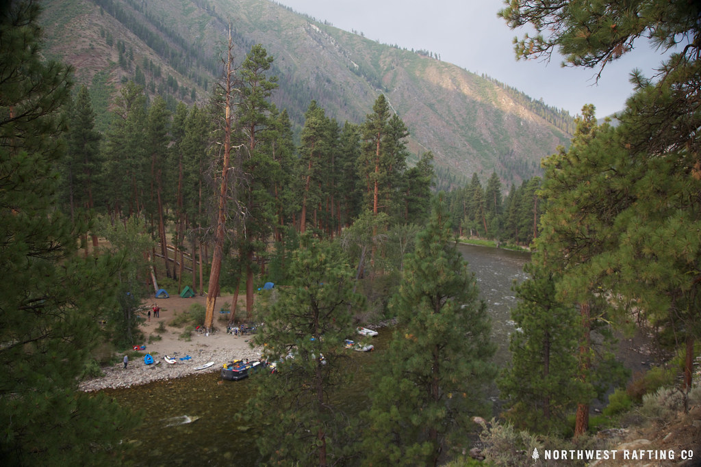 Middle Fork EastHikingPhoto: Northwest Rafting Company, CC BY 2.0 (via Flickr)9.2 mi
- Norton LakeHikingPhoto: Northwest Rafting Company, CC BY 2.0 (via Flickr)9.3 mi
- Garden WayHiking9.6 mi
Source: Roamze catalog (indexable pages within 10 miles, PostGIS distance)
 Middle Fork Salmon RiverCanoeing · ~42 min drivePhoto: Rex Parker, CC BY 2.0 (via Wikimedia Commons)
- Shoreline Boating SiteBoat launch · ~58 min drive
- Cache Bar Boat RampFloat trip · ~1h 4m drive
 South Fork Salmon RiverCanoeing · ~57 min drivePhoto: Zachary Collier, CC BY 2.0 (via Wikimedia Commons)
- Confluence TakeoutBoat launch · ~1h 4m drive
- Little Loon CreekCanoeing · ~24 min drive
- Elk Creek Boat LaunchBoat launch · ~1h 14m drive
- Rush CreekCanoeing · ~24 min drive
- Salmon River Bridge AccessBoat launch · ~1h 15m drive
- Monumental CreekCanoeing · ~24 min drive
Best time to visit Marble Creek
Best months: June–September. Best months have typical highs of 55–85 °F, lows of 30 °F or warmer (32 °F where the station doesn't record snow), at most one snowy day and no more than 12 wet days.
Jan
35° / 8°
Feb
36° / 12°
Mar
42° / 16°
Apr
49° / 22°
May
61° / 30°
Jun
70° / 35°
Jul
82° / 40°
Aug
81° / 38°
Sep
73° / 32°
Oct
57° / 26°
Nov
40° / 16°
Dec
31° / 9°
Typical high / low (°F) and days with rain or snow, 1991–2020. Measured at Deadwood Lodge, ID, 38.2 mi away at 5,948 ft. The station sits about 800 ft lower than this place, so expect it a little cooler here. This station doesn't record snowfall. Source: NOAA NCEI U.S. Climate Normals 1991–2020.
