Cache Bar Boat Ramp
- Apr–Jun, Sep–Oct
- best months
Caution at last check
Agency alerts are in effect for this area; weather is marginal · USFS, OpenWeather · checked 22 h ago
Is Cache Bar Boat Ramp open right now?
Alert in the area
The Forest Service lists an alert for Salmon-Challis National Forest.
Stoddard Bridge Construction Closure
Agency alert covering Salmon-Challis National Forest · Order 0413-07-17 · USFS · Salmon-Challis National Forest
As of · Source: USFS · Salmon-Challis National Forest. Agencies don't list every closure — check before you go.
Cache Bar Boat Ramp is a Forest Service boat launch in the North Fork Ranger District of Idaho's Salmon-Challis National Forest, about 18 miles from the town of Shoup. It serves as a put-in for boaters heading onto the water in this corner of the forest. Summer is the most comfortable time to visit. Typical averages from a nearby weather station in Shoup show July highs around 90°F with lows near 54°F, while September cools to highs in the upper 70s. Winters are cold, with January highs around 31°F. The ramp sits close to several hiking routes. Cramer Basin is about half a mile away, and Stoddard and Nolan Pt. are each within about 2.5 miles. For an overnight stay, Corn Creek Campground Complex is roughly 4 miles off.
- Managed by
- Forest Service
- Cramer BasinHiking0.5 mi
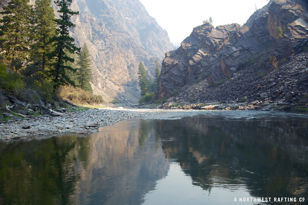 StoddardHikingPhoto: Northwest Rafting Company, CC BY 2.0 (via Flickr)2.2 mi
- Stoddard AccessHiking2.4 mi
- Nolan Pt.Hiking2.5 mi
- Butts PointHiking4 mi
- Bear BasinHiking4 mi
- Corn Creek Campground ComplexCamping4.3 mi
- Ebenezer CampgroundCamping6 mi
Source: Roamze catalog (indexable pages within 10 miles, PostGIS distance)
 Selway RiverCanoeing · ~37 min drivePhoto: U.S. Forest Service, Public domain (via Wikimedia Commons)
- Confluence TakeoutBoat launch · ~4 min drive
- Cache Bar Boat RampFloat trip · Next door
- Horse CreekCanoeing · ~18 min drive
- Duncans Outpost Boat RampBoat launch · ~19 min drive
- RomboFloat trip · ~1h 1m drive
- Yellowjacket CreekCanoeing · ~41 min drive
- Spring Creek Boat RampBoat launch · ~33 min drive
- West Fork Bitterroot RiverCanoeing · ~41 min drive
- Slate Creek Bay Boating SiteBoat launch · ~54 min drive
Best time to visit Cache Bar Boat Ramp
Best months: April–June and September–October. Best months have typical highs of 55–85 °F, lows of 30 °F or warmer (32 °F where the station doesn't record snow), at most one snowy day and no more than 12 wet days.
Jan
31° / 17°
Feb
37° / 20°
Mar
52° / 30°
Apr
61° / 36°
May
71° / 42°
Jun
79° / 48°
Jul
90° / 54°
Aug
89° / 52°
Sep
77° / 45°
Oct
60° / 35°
Nov
42° / 27°
Dec
31° / 19°
Typical high / low (°F) and days with rain or snow, 1991–2020. Measured at Shoup, ID, 17.9 mi away at 3,400 ft. This station doesn't record snowfall. Source: NOAA NCEI U.S. Climate Normals 1991–2020.
Map and trail data © OpenStreetMap contributors
